Situation Summary
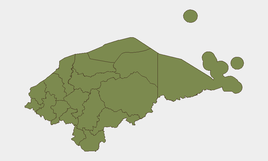
Honduras remains a challenging operating environment, with a composite threat score of 21 and eight tracked events in the current monitoring cycle. Olancho department presents substantially elevated risk (31.3) compared to all other regions, suggesting concentrated instability or criminal activity in that area. Recent signal activity includes military force deployment, presidential statements, and armed confrontation involving Montreal actors, indicating active security pressures. The security picture is fluid but not yet characterized by nationwide systemic breakdown.
Key Developments
GeoBit's event signals from the past 72 hours point to active security dynamics, though detailed incident verification from Honduras-specific open sources remains incomplete:
- 2026-06-17 · Conventional Military Force deployment — location and operational scope unconfirmed; suggests armed state response to a security challenge.
- 2026-06-17 · Public Statement — source and content unconfirmed; may relate to security posture or crisis communication.
- 2026-06-18 · Presidential Statement vs. Honduras — indicates political tension or public disagreement between executive and state actors; exact subject unconfirmed.
- 2026-06-18 · Demand issued — scope and issuing actor unconfirmed; may signal criminal, political, or armed-group pressure.
- 2026-06-17 · Small Arms Combat (Montreal vs. Honduran actors) — location, casualty count, and organizational affiliation unconfirmed; transnational dimension noted.
Assessment: Signal density and event diversity suggest multiple concurrent pressure points rather than a single dominant crisis. However, absence of verified Honduras-specific incident detail from mainstream and official sources in the past 24–48 hours means that tactical situational awareness relies on incomplete data. Real-time local media, government alerts (Policía Nacional, COPECO), and official travel advisories should be consulted for operational decision-making.
Highest-Risk Areas
Olancho (31.3) is the clear risk outlier and warrants focused attention; it carries approximately 7× the composite risk of Cortés and Francisco Morazán (both 4.3), which rank second. The remaining ten departments cluster at low risk (1.3 each). Olancho's elevated profile likely reflects organized crime activity, trafficking routes, or localized conflict dynamics; security teams with personnel or logistics in that department face materially different threat exposure than those in central or western Honduras. Cortés and Francisco Morazán (which includes Tegucigalpa) retain moderate risk despite lower scores, reflecting urban crime, gang presence, or political activity.
How GeoBit Would Assist
Security and duty-of-care teams operating in Honduras should employ AOI Monitoring & Early Warning to maintain persistent watch on Olancho and secondary risk zones, with automated alerting on new incident signals, military/police activity, and criminal events. OSINT fusion (X/Twitter geo-filters, Telegram, Honduran police feeds, local media) enables real-time incident verification and timeline corroboration—critical when open-source detail is incomplete. Conflict & Military tracking and Network & Actor Analysis support identification of armed-group movements, state force posture, and transnational criminal networks active in the country. For operational safety, Routing & Network Analysis can recommend alternative travel corridors and supply-chain pathways to avoid hotspots.
7-Day Outlook
The convergence of military deployment, political statements, and armed contact suggests heightened operational tempo over the coming week. Olancho and urban centers (Cortés, Francisco Morazán) should be monitored for escalation or stabilization. Organizations with critical operations or personnel in Honduras should confirm local situational awareness through official channels and reinforce contingency communication protocols.
Highest-Risk Areas — Ranked
| # | State / Region | Risk |
|---|---|---|
| 1 | Olancho | 31.3 |
| 2 | Cortés | 4.3 |
| 3 | Francisco Morazán | 4.3 |
| 4 | El Paraíso | 1.3 |
| 5 | Copán | 1.3 |
| 6 | Ocotepeque | 1.3 |
| 7 | Yoro | 1.3 |
| 8 | Santa Bárbara | 1.3 |
| 9 | Lempira | 1.3 |
| 10 | Intibucá | 1.3 |
| 11 | Comayagua | 1.3 |
| 12 | La Paz | 1.3 |
Sources
Previous Daily Briefs
A new Honduras brief is written every day — each with its own risk map and downloadable CSV. Here's the last week; use the calendar to go further back.
📅 Browse every day by calendar →
Highlighted days have a brief. Tap a day for that day's map & analysis, or “csv” for that day's dataset ($5).