Situation Summary
Ireland remains a low-threat jurisdiction (rank #134 globally, composite score 6.0) with no credible reports of active security incidents, civil unrest, or infrastructure disruption in the last 24–48 hours. Risk is heavily concentrated in County Dublin (score 32), which accounts for the majority of tracked threat events nationally. The overall security environment is stable, though corporate teams with operations in Dublin should maintain standard duty-of-care protocols given the capital's concentration of financial, diplomatic, and transport infrastructure.
Key Developments
No verified security incidents have been reported in Ireland in the last 24–48 hours. Available web and social sources do not contain time-stamped, incident-level reporting for recent civil unrest, crime events, infrastructure failures, or travel disruptions specific to Ireland. Recent GeoBit event signals reference airline-related disputes and public statements (23–22 June), but these are not geographically specific to Ireland and do not represent active on-ground security developments.
Corporate security teams should rely on near-real-time feeds from Garda Síochána (national police), local Irish news outlets (RTE, Irish Times, regional papers for Dublin, Cork, Limerick, and Galway), and official government advisories for current incident reporting. GeoBit's event feed will be updated immediately upon detection of credible, corroborated incidents.
Highest-Risk Areas
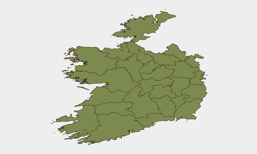
County Dublin dominates the national risk profile (score 32, representing roughly 80% of tracked threat activity), reflecting the capital's role as the centre of government, finance, diplomatic missions, and major transport hubs (Dublin Airport, Port of Dublin). Secondary concern exists in County Tipperary (score 20.7), though the drivers of this score are not immediately apparent from current reporting and warrant direct inquiry with GeoBit's research team. All other counties register scores below 7.0, indicating dispersed, low-level activity.
For organizations with personnel or assets in Dublin, standard security protocols—staff awareness, secure comms, incident reporting chains, and liaison with local authorities—should remain in place; escalation is not indicated by current threat data.
How GeoBit Would Assist
Teams operating in Ireland should use AOI Monitoring & Early Warning to set persistent watches on Dublin's key nodes (airports, ports, financial districts) and flag emerging incidents in real time. Multi-language OSINT, X/Twitter & Telegram monitoring, and local-news search provide continuous coverage of civil unrest, crime, and infrastructure alerts without reliance on manual daily briefings. Conflict & risk assessment and network & actor analysis enable rapid correlation of dispersed events (e.g., organized crime, protest movements, or cyber activity) that may affect duty-of-care obligations.
7-Day Outlook
No acute threats are forecast for Ireland in the next seven days. The security environment is expected to remain stable at or below current risk levels. Continuous monitoring of Dublin's transport and financial infrastructure is recommended as routine practice; corporate teams should confirm incident-reporting protocols with local Garda contacts and verify staff emergency procedures ahead of summer travel season.
Highest-Risk Areas — Ranked
| # | State / Region | Risk |
|---|---|---|
| 1 | County Dublin | 32 |
| 2 | County Tipperary | 20.7 |
| 3 | County Kildare | 6.6 |
| 4 | County Meath | 4.3 |
| 5 | County Cork | 4.3 |
| 6 | County Galway | 2.7 |
| 7 | County Clare | 2.7 |
| 8 | County Kilkenny | 2.7 |
| 9 | County Mayo | 2 |
| 10 | County Sligo | 2 |
| 11 | County Limerick | 2 |
| 12 | County Donegal | 2 |
Sources
Previous Daily Briefs
A new Ireland brief is written every day — each with its own risk map and downloadable CSV. Here's the last week; use the calendar to go further back.
📅 Browse every day by calendar →
Highlighted days have a brief. Tap a day for that day's map & analysis, or “csv” for that day's dataset ($5).