Situation Summary
Kenya remains at moderate composite threat level (rank #67 globally, score 16) but faces a complex overlay of security pressures: active police mobilization in response to planned protests, elevated terrorism threat advisories from bilateral allies, political allegations of unlawful detention, and emerging health-security concerns related to regional Ebola spread. The security environment is characterized less by acute conflict than by institutional friction—between government and civil society, between security agencies and the public, and between Kenya's import-dependent economy and external supply-chain volatility. Current trajectory suggests sustained friction rather than rapid escalation, but capacity for localized disruption remains high.
Key Developments
- Nairobi (Parliament precinct & central roads) – 7 July 2026: Police executed large-scale checkpoint deployment and barbed-wire barriers around Parliament and major city approach routes in anticipation of planned protests over government policy. Risk of confrontation between demonstrators and security forces remains elevated in these zones.
- Nationwide (US Embassy alert) – early July 2026: US Embassy issued terrorism alert advising American citizens of potential attacks on embassies, schools, hotels, restaurants, malls, markets, and places of worship "with little or no warning." Alert reflects generalized rather than specific threat but signals elevated bilateral concern over jihadist activity.
- Kenya (public health) – last 24 hours: Ministry of Health reported multiple Ebola-related alerts, all tested negative; simultaneously confirmed preparedness measures in 25 high-risk counties against cross-border Bundibugyo Ebola Virus Disease spread from the region.
- Kenya (political allegations) – recent statement: Former Speaker Justin Muturi publicly accused security agencies, particularly the Directorate of Criminal Investigations (DCI), of systematic enforced disappearances and unlawful detention, describing the trend as evidence of "sliding into authoritarianism." Such allegations heighten distrust of security forces and risk triggering civil-society protests.
- Kenya (cyber/information security) – early July 2026: Parliamentary lawmakers advanced amendments to information-security law requiring government officials to use secure *.go.ke* email addresses and classifying records under Top Secret through Restricted categories. Reflects government concern over data leaks and cyber-vulnerability in state systems.
- Kenya (food security) – early July 2026: Authorities acknowledged rising fertilizer and input costs driven by Gulf-region tensions affecting supply via Strait of Hormuz; diversification of import sources under discussion. Indirect but material risk to rural livelihoods and potential socio-economic stress in agricultural zones.
- Kenya–Italy (bilateral security) – recent agreement: Kenya and Italy signed cooperation accord on crime-fighting and security collaboration, signaling external institutional support for law-enforcement capacity.
Highest-Risk Areas
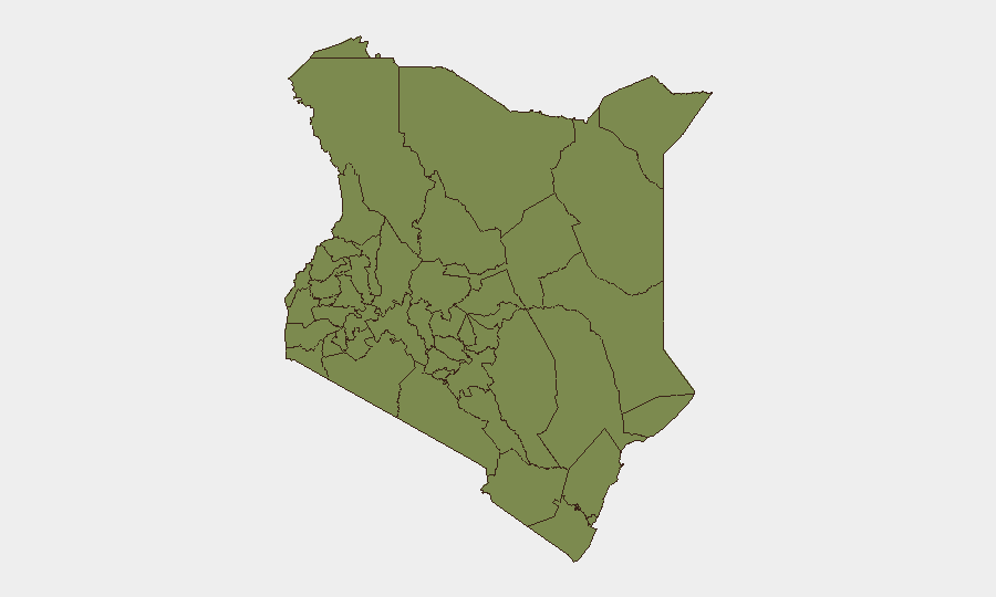
Samburu County (risk 32.4) and Kitui County (risk 22.4) dominate the sub-national ranking and are likely driven by pastoral-conflict dynamics, resource scarcity, and cross-border raiding patterns typical of northern and eastern semi-arid zones. Nairobi County (5.2), despite lower absolute score, merits sustained attention due to population density, institutional concentration (Parliament, embassies, commercial hubs), and current police mobilization signaling protest-response readiness. All other ranked counties remain below risk 3.0, indicating that threat concentration is heavily skewed toward the pastoral north-east and the capital.
How GeoBit Would Assist
Security teams should employ AOI Monitoring & Early Warning on Parliament precinct and major Nairobi thoroughfares to track protest activity and police posture in real-time; OSINT Fusion (X/Telegram, news feeds) to monitor claims of unlawful detention and civil-society backlash; and Intel Sweep across health and cross-border channels to track Ebola surveillance status and any spillover into Kenya's 25 designated high-risk counties. Routing & Network Analysis can identify alternative journey paths around active checkpoint zones.
7-Day Outlook
Planned protests are likely to occur, with police presence already established; localized disruption to central Nairobi traffic and commerce expected but not indicative of broader instability. Terrorism threat remains generalized and persistent rather than acute; no credible specific threat timeline has emerged. Political allegations of detention abuses may prompt civil-society statements and localized gatherings but are unlikely to trigger nationwide mobilization within the next week.
Highest-Risk Areas — Ranked
| # | State / Region | Risk |
|---|---|---|
| 1 | Samburu | 32.4 |
| 2 | Kitui County | 22.4 |
| 3 | Nairobi County | 5.2 |
| 4 | Kisumu County | 3.8 |
| 5 | Busia County | 2.4 |
| 6 | Kakamega County | 2.4 |
| 7 | Vihiga County | 2.4 |
| 8 | Nandi County | 2.4 |
| 9 | Elgeyo-Marakwet County | 2.4 |
| 10 | Uasin Gishu County | 2.4 |
| 11 | Baringo | 2.4 |
| 12 | Laikipia County | 2.4 |
Sources
Previous Daily Briefs
A new Kenya brief is written every day — each with its own risk map and downloadable CSV. Here's the last week; use the calendar to go further back.
📅 Browse every day by calendar →
Highlighted days have a brief. Tap a day for that day's map & analysis, or “csv” for that day's dataset ($5).
Atlas — our AI intelligence desk — emails them this snapshot personally. Nothing else, no list.