Situation Summary
Lithuania faces an elevated but contained security posture following Russian rhetoric about potential infrastructure sabotage and a series of false bomb threats in major urban centers. President Nausėda has ordered heightened security at critical energy and transport sites nationwide, and authorities have reinforced drone-alert procedures in response to regional unmanned-aircraft incidents. The overall threat ranking remains low globally (#164), but sub-national concentration in Vilnius and Kaunas counties reflects both urban density and proximity to hybrid-threat vectors; the trajectory is one of heightened vigilance rather than imminent operational danger.
Key Developments
- Vilnius & Kaunas, 17–18 July 2026 – Emailed bomb threats targeting Teltonika offices, office buildings, and emergency medical services prompted evacuations and police searches; authorities confirmed threats were false and opened pretrial investigations for making false public-danger reports.
- Lithuania (countrywide), 18–19 July 2026 – President Nausėda ordered heightened security at critical energy and transport infrastructure sites after intelligence services reported indicators of potential Russian sabotage planning; authorities have implemented tighter physical security and surveillance at facilities linked to the European electricity grid.
- Vilnius, 18–19 July 2026 – Regional drone security concerns prompted Lithuanian authorities to reinforce shelter procedures and alerting protocols; officials warned of a "high possibility" of further unmanned aerial incidents.
- Lithuania–Latvia border, 18–19 July 2026 – Prime Minister Sinkevičius discussed potential temporary reintroduction of checkpoints at the Latvia–Lithuania border in response to secondary migration and border-security concerns.
- Marijampolė, 18–19 July 2026 – A violent assault involving minors drew national attention and prompted the prime minister to call for discussions on youth violence prevention, highlighting localized public-safety concerns.
- Russia–Lithuania rhetoric, 19–20 July 2026 – Moscow publicly rejected Lithuanian sabotage allegations as "scare stories," while Russian officials issued public statements directed at Lithuanian government; Lithuania responded with administrative sanctions against Belarus in parallel.
Highest-Risk Areas
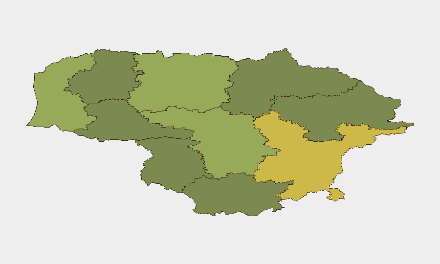
Vilnius County (risk 68) and Kaunas County (risk 58) drive national threat concentration, reflecting their status as the capital and second-largest city, respectively, plus proximity to major energy, transport, and communications infrastructure. The false bomb threats and drone-alert procedures have been concentrated in these counties, and both are within plausible range of hybrid-attack vectors originating from Belarus or Russia. Klaipeda County (risk 52)—the primary Baltic port and energy hub—represents a third critical node; Siauliai, Panevezys, and other interior counties carry lower scores aligned with reduced critical infrastructure density and distance from border zones.
How GeoBit Would Assist
Security teams should deploy AOI Monitoring & Early Warning to track Lithuania's critical energy and transport sites (Vilnius, Kaunas, Klaipeda) for indicators of hostile reconnaissance or escalation; Intel Sweep and multi-language OSINT (X/Twitter, Telegram, Russian media) to detect emerging Russian or Belarusian messaging about hybrid operations; and Routing & Network Analysis to model alternative supply-chain and personnel-movement routes in case of infrastructure disruption. Satellite & Imagery analysis and GIS & Spatial Analysis would support assessment of protective measures around key facilities and early identification of physical anomalies.
7-Day Outlook
Lithuania will likely maintain elevated alert postures at critical infrastructure through the coming week, with no immediate deescalation expected in Russian rhetoric. False-threat incidents may recur; police capacity will be tested by hoax investigations. The EU and NATO presence should limit operational escalation, but drone incidents and rhetorical pressure from Moscow remain probable.
Highest-Risk Areas — Ranked
| # | State / Region | Risk |
|---|---|---|
| 1 | Vilnius County | 68 |
| 2 | Kaunas County | 58 |
| 3 | Klaipeda County | 52 |
| 4 | Siauliai County | 42 |
| 5 | Panevezys County | 38 |
| 6 | Taurage County | 35 |
| 7 | Utena County | 33 |
| 8 | Alytus County | 32 |
| 9 | Telsiai County | 28 |
| 10 | Marijampole County | 25 |
Sources
Previous Daily Briefs
A new Lithuania brief is written every day — each with its own risk map and downloadable CSV. Here's the last week; use the calendar to go further back.
📅 Browse every day by calendar →
Highlighted days have a brief. Tap a day for that day's map & analysis, or “csv” for that day's dataset ($5).
Atlas — our AI intelligence desk — emails them this snapshot personally. Nothing else, no list.