Situation Summary
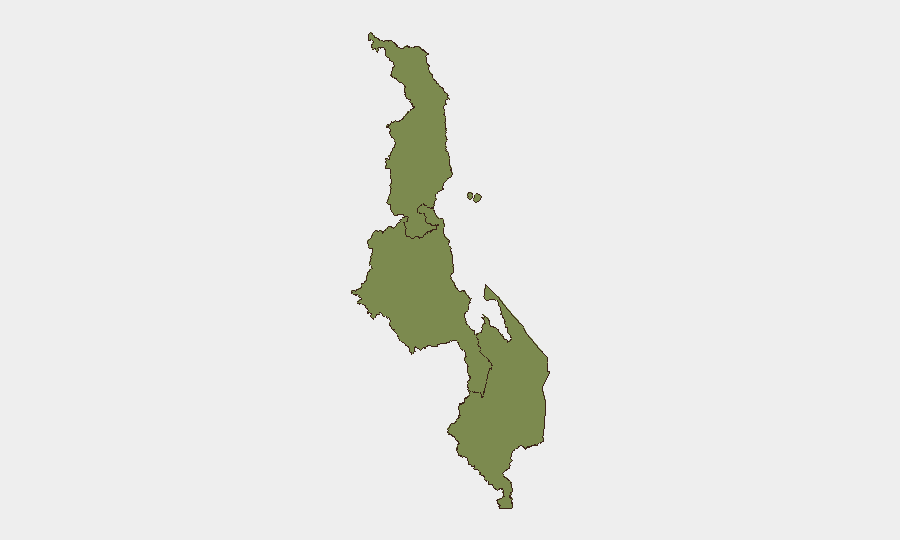
Malawi remains a low-threat environment globally (rank #157, composite score 5), with no verified security incidents reported in the last 24–48 hours. Sub-national risk is concentrated in the Southern Region (composite score 31.4), driven by localized civil-society tensions and health-sector friction documented in early July. Political and administrative statements dominate recent signal activity; no armed conflict, organized crime spike, or major infrastructure failure is evident in current reporting.
Key Developments
No verified security incidents in Malawi have been reliably time-stamped and corroborated within the last 24–48 hours. Preliminary social-media references to a violent incident at Nandumbo Health Centre (Balaka District, Southern Region) lack precise dating and secondary confirmation and cannot be included as current developments under standard verification criteria. Recent event signals (July 3–4) primarily reflect administrative statements and civil-society disapproval actions in Lilongwe and Blantyre; specific operational context for these signals is not yet available in open sources. Security teams should monitor local Malawi outlets and official channels (Malawi Police Service, Ministry of Health) for any confirmation of health-facility violence or other civil unrest in the coming 24 hours.
Highest-Risk Areas
The Southern Region (risk 31.4) is the primary driver of national threat elevation, with tension centered on health-service delivery and community relations—notably friction between villagers and facility staff in rural districts such as Balaka. The Central Region (risk 21.4), anchored by Lilongwe, shows secondary administrative and civil-society friction but lower immediate operational risk. The Northern Region (risk 1.4) presents negligible concern. Risk in the South appears episodic rather than systemic; localized health-sector incidents and civil-society disapproval actions are not indicative of state instability or widespread violence. However, rural-area tensions warrant sustained monitoring, as scattered incidents can escalate if unaddressed or if broader service-delivery grievances accumulate.
How GeoBit Would Assist
AOI Monitoring & Early Warning on Balaka District and other Southern Region health facilities would provide real-time alerting if violence recurs or civil unrest spreads. Intel Sweep (including multi-language social-media OSINT, local news feeds, and Telegram channels) combined with sentiment & temporal analysis would disambiguate undated or vague reports and establish precise incident timelines. Network & Actor Analysis would map civil-society organizations, health-worker unions, and community leaders involved in recent tensions, enabling predictive assessment of escalation vectors and identification of negotiation or de-escalation contacts for corporate stakeholders.
7-Day Outlook
No imminent, widespread threat is forecast. Malawi's overall stability and low global threat ranking are unlikely to shift materially in the near term absent a major political shock or health-sector crisis. Southern Region localized tensions should remain monitored; isolated incidents are possible but are not expected to trigger broader unrest or disrupt national operations for international business or NGO presence. Duty-of-care teams should maintain standard protocols and await further verification of the Balaka incident before adjusting travel or site-security postures.
Highest-Risk Areas — Ranked
| # | State / Region | Risk |
|---|---|---|
| 1 | Southern Region, Malawi | 31.4 |
| 2 | Central Region, Malawi | 21.4 |
| 3 | Northern Region, Malawi | 1.4 |
Sources
Previous Daily Briefs
A new Malawi brief is written every day — each with its own risk map and downloadable CSV. Here's the last week; use the calendar to go further back.
📅 Browse every day by calendar →
Highlighted days have a brief. Tap a day for that day's map & analysis, or “csv” for that day's dataset ($5).
Atlas — our AI intelligence desk — emails them this snapshot personally. Nothing else, no list.