Situation Summary
Malta remains in a low–threat security posture overall (composite score 4), with no major civil unrest, political instability, or systemic security incidents confirmed in the last 24–48 hours. Localized property crime (vehicle vandalism in Bormla) and elevated fire risk amid summer temperatures represent the most significant documented concerns. A Malta-flagged tanker strike in the Strait of Hormuz, while operationally relevant to maritime stakeholders, falls outside Malta's territorial jurisdiction and does not alter the domestic security picture.
Key Developments
- 2026-07-19 · Bormla (Cospicua) – vehicle vandalism arrest. Police arrested a 41-year-old resident in connection with a series of smashed car windows affecting multiple residents; timing described as "recent days" but exact date unconfirmed. Represents low-level property crime with no indication of organized criminal activity or escalation.
- 2026-07-20 (approx.) · Multiple fire incidents across Malta. Social media report indicates four separate fires reported within the last 48 hours, attributed to elevated summer temperatures. Specific locations and causes (accidental vs. arson) remain unspecified; timing is plausible but not independently verified.
- 2026-07-19 (approx.) · Strait of Hormuz – Malta-flagged tanker strike. The oil products tanker *Kavomaleas* (Malta-flagged) struck by unknown projectile approximately 8 nm northeast of Limah, Oman; fire reported, crew evacuated safely with no casualties or major spill. UKMTO issued maritime security advisory. Geographically external to Malta but operationally relevant to Malta-linked maritime sector.
- 2026-07-19 · Event signal: Physical Assault (Malta vs. Police). Tracked event indicating police engagement; no corroborating open-source details available at this time.
- 2026-07-20 · Event signal: Reject (Malta). Tracked signal with insufficient contextual data to assess specificity or threat level.
Highest-Risk Areas
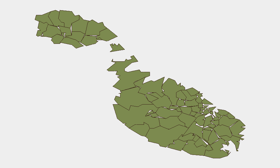
Mosta stands substantially isolated as the highest-risk locality (score 31.3), a 24-fold elevation above all other ranked regions, which cluster at 1.3. The driver of Mosta's elevated profile is not explained by current open-source reporting and warrants investigation via deeper intelligence collection. All other 11 tracked areas (Santa Venera, Birkirkara, Għarb, Saint Lawrence, Kerċem, Għasri, Fontana, Żebbuġ, Victoria, Xagħra, Xewkija) register uniform low risk, suggesting either homogeneous baseline security conditions or data clustering effects. The disparity suggests either localized incident concentration, event-signal accumulation, or data anomaly in Mosta; duty-of-care teams with operations there should apply heightened attention.
How GeoBit Would Assist
Security teams operating in Malta should employ Intel Sweep and multi-language OSINT to monitor fragmentary local reporting (Malta's media ecosystem produces limited English-language coverage), combined with X/Twitter and Telegram OSINT for real-time civil unrest, protest, or incident signals. AOI Monitoring & Early Warning pinned to Mosta, Bormla, and other high-asset zones would enable persistent watch and automated alerting on fire, crime, or protest activity. Routing & Network Analysis supports contingency planning and alternative journey logistics should localized incidents spike.
7-Day Outlook
No major security deterioration is forecast over the next 7 days. Elevated summer fire risk will likely persist; vehicle crime in Bormla may continue at low levels absent police intervention. Mosta's anomalously high risk score warrants targeted monitoring to clarify drivers and assess whether it reflects emerging localized instability or data artifact; confirmation is critical for accurate forward planning.
Highest-Risk Areas — Ranked
| # | State / Region | Risk |
|---|---|---|
| 1 | Mosta | 31.3 |
| 2 | Santa Venera | 1.3 |
| 3 | Birkirkara | 1.3 |
| 4 | Għarb | 1.3 |
| 5 | Saint Lawrence | 1.3 |
| 6 | Kerċem | 1.3 |
| 7 | Għasri | 1.3 |
| 8 | Fontana | 1.3 |
| 9 | Żebbuġ | 1.3 |
| 10 | Victoria | 1.3 |
| 11 | Xagħra | 1.3 |
| 12 | Xewkija | 1.3 |
Sources
Previous Daily Briefs
A new Malta brief is written every day — each with its own risk map and downloadable CSV. Here's the last week; use the calendar to go further back.
📅 Browse every day by calendar →
Highlighted days have a brief. Tap a day for that day's map & analysis, or “csv” for that day's dataset ($5).
Atlas — our AI intelligence desk — emails them this snapshot personally. Nothing else, no list.