Situation Summary
Myanmar remains in acute civil conflict with a composite threat score of 100 (ranked #10 globally), driven by competing armed factions, civil-military clashes, and destabilizing cross-border dynamics. Recent event signals indicate active conventional military operations, civilian targeting, and abduction activity as of 9 June 2026. The conflict shows no signs of deescalation, with military consolidation efforts underway alongside ongoing resistance from multiple opposition groups.
Key Developments
- 9 June 2026 · Conventional Military Operations (Multiple Actors): Multiple reports of active clashes involving the Myanmar military, civilian forces, and militant groups. Specific operational locations under GeoBit tracking; civilians reported targeted in violence.
- 9 June 2026 · Abduction/Hostage Activity: Kidnapping or hostage-taking incident(s) recorded in Myanmar; details on perpetrator and location pending full corroboration.
- 9 June 2026 · Physical Assault on Civilians: Documented instance of military-on-civilian violence; geographic specificity and casualty toll to be clarified through ongoing OSINT fusion.
- 7–9 June 2026 · Indonesian-Myanmar Diplomatic Tension: Public statements from Indonesian officials regarding Myanmar reflect diplomatic friction; nature of dispute (likely border, refugee, or regional stability concern) under analysis.
- 8 June 2026 · Myanmar Military vs. Criminal Element: Threat statement issued by Myanmar military against criminal actors; indicates ongoing security operations beyond political-military conflict.
Highest-Risk Areas
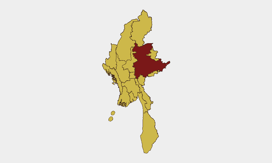
Shan State (risk 100) remains the epicenter of conflict, reflecting sustained fighting between the military and multiple armed groups in its border territories. Tanintharyi, Chin, Sagaing, Kachin, and Mandalay regions (all risk 70) show sustained sub-national threat scores, indicating distributed rather than concentrated violence. Notably, even urban and administrative centers—Yangon, Naypyitaw, and Mandalay—are assigned equivalent risk levels to frontier zones, suggesting pervasive instability across all governance structures. The uniform elevation of 10 of 14 regions to risk 70 or above indicates civil conflict is countrywide; no region offers genuine sanctuary for sustained operations.
How GeoBit Would Assist
Intel Sweep & OSINT Fusion would corroborate the 24 tracked events, disambiguate actor identities (military, civilian, militant, criminal), and flag emerging cross-border spillover (Indonesian and South Asian signals). AOI Monitoring & Early Warning with persistent surveillance of Shan State, Mandalay, and Yangon would provide real-time alerting on clashes, checkpoints, and mass-casualty events affecting duty-of-care obligations. Conflict & Military Battle Mapping and Network & Actor Analysis would track force disposition, command lines, and territorial control by faction, enabling alternative routing and asset relocation planning.
7-Day Outlook
Conventional military operations are likely to persist across the Shan-Mandalay corridor and secondary fronts in Sagaing and Kachin. Abduction and civilian targeting will remain a threat vector for foreign nationals and high-value personnel. Indonesian and regional diplomatic friction may escalate pressure on Myanmar's borders, increasing refugee flows and cross-border militia activity over the next 7–10 days.
Highest-Risk Areas — Ranked
| # | State / Region | Risk |
|---|---|---|
| 1 | Shan State | 100 |
| 2 | Tanintharyi Region | 70 |
| 3 | Chin | 70 |
| 4 | Sagaing Region | 70 |
| 5 | Kachin State | 70 |
| 6 | Wa State (Northern Region) | 70 |
| 7 | Magway | 70 |
| 8 | Mandalay | 70 |
| 9 | Rakhine | 70 |
| 10 | Ayeyarwady | 70 |
| 11 | Yangon | 70 |
| 12 | Naypyitaw Union Territory | 70 |
Previous Daily Briefs
A new Myanmar brief is written every day — each with its own risk map and downloadable CSV. Here's the last week; use the calendar to go further back.
📅 Browse every day by calendar →
Highlighted days have a brief. Tap a day for that day's map & analysis, or “csv” for that day's dataset ($5).