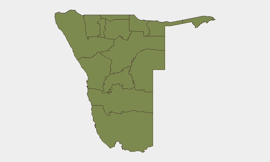
Situation Summary
Namibia remains a low-threat environment overall (composite score 3; global ranking #null), with no verified major security, civil unrest, or infrastructure incidents reported in the last 24–48 hours. The country faces elevated cyber risk, with Q2 2026 reporting a 56.7% increase in cyber events and a 39.8% increase in vulnerabilities according to NAM-CSIRT/CRAN. Wildfire activity has been tracked as a secondary environmental hazard. The security posture is stable but requires continued monitoring of digital threats and regional variations in risk.
Key Developments
- Cybersecurity (Countrywide, Q2 2026) — NAM-CSIRT/CRAN reported a 56.7% increase in cyber events and 39.8% increase in vulnerabilities during the second quarter, signaling elevated digital-threat activity across government and commercial networks.
- Wildfire Monitoring (Recent, Location TBD) — Two wildfire events (GeoBit event IDs 1029682, 1029734) have been flagged in recent reporting; extent, containment status, and impact on infrastructure or populated areas require clarification via satellite and GIS analysis.
- No Acute Civil or Conflict Incidents (Last 24–48 hours) — Open-source reporting and verified incident feeds show no major security events, unrest, or infrastructure disruptions meeting the immediate-window threshold across the country.
Note: A public statement was issued on 2026-07-29; specifics are not detailed in current reporting and merit follow-up corroboration.
Highest-Risk Areas
Khomas Region (composite risk 31.3) is the clear outlier and driver of national risk, likely reflecting Windhoek's concentration of government, commercial, and diplomatic activity, as well as urban crime and cybersecurity exposure. The remaining eleven regions cluster at risk score 1.3, indicating a broadly even and low baseline threat distribution outside Khomas. Security teams with personnel or assets in the capital should prioritize Khomas for threat monitoring, incident response, and duty-of-care protocols; operations in peripheral regions face significantly lower classical security risk but remain subject to environmental hazards (wildfire) and isolated incidents.
How GeoBit Would Assist
Corporate security and risk teams in Namibia would benefit from AOI Monitoring & Early Warning on Khomas Region to detect emerging civil, crime, or protest activity in real time; Cyber Threat & Vulnerability Search to correlate NAM-CSIRT alerts with organizational exposure and remediation priorities; and Satellite & GIS Analysis to track wildfire progression, assess impact on supply chains or facilities, and inform evacuation or rerouting decisions. Multi-language OSINT and Telegram/X monitoring would provide early signals of local unrest, strikes, or infrastructure incidents before they escalate.
7-Day Outlook
Namibia is expected to remain at low to moderate threat over the next seven days, with cyber activity likely persisting at elevated Q2 2026 levels. Wildfire activity should be monitored for seasonal escalation and proximity to populated or economically sensitive areas. Any shift in civil stability or regional border activity would trigger rapid alert; current open-source reporting suggests no imminent catalyst.
Highest-Risk Areas — Ranked
| # | State / Region | Risk |
|---|---|---|
| 1 | Khomas | 31.3 |
| 2 | Kunene Region | 1.3 |
| 3 | Omusati | 1.3 |
| 4 | Ohangwena | 1.3 |
| 5 | Oshana | 1.3 |
| 6 | Oshikoto | 1.3 |
| 7 | Kavango West | 1.3 |
| 8 | Otjozondjupa | 1.3 |
| 9 | Omaheke | 1.3 |
| 10 | Kavango East | 1.3 |
| 11 | Erongo Region | 1.3 |
| 12 | Zambezi | 1.3 |
Sources
Previous Daily Briefs
A new Namibia brief is written every day — each with its own risk map and downloadable CSV. Here's the last week; use the calendar to go further back.
📅 Browse every day by calendar →
Highlighted days have a brief. Tap a day for that day's map & analysis, or “csv” for that day's dataset ($5).
Atlas — our AI intelligence desk — emails them this snapshot personally. Nothing else, no list.