Situation Summary
Oman remains a low-threat environment for domestic civil security (composite threat score 3; rank #179 globally), with no reported civil unrest, crime spikes, or internal political instability in the past 24–48 hours. However, escalating U.S.–Iran tensions have directly affected maritime security in the Strait of Hormuz adjacent to Omani waters, including a confirmed attack on a cargo vessel on June 25 and subsequent U.S. military strikes on June 26. Risk to commercial shipping, energy infrastructure, and personnel transiting or operating in the strait has risen sharply, and Oman's own maritime governance role in the shared waterway has become a focal point of geopolitical contestation.
Key Developments
- Strait of Hormuz (Omani side), June 25, 2026: A cargo/container vessel was struck by a projectile or drone while transiting the waterway, triggering immediate disruption to maritime traffic and heightened alert among shipping operators in Omani-proximate waters.[3][4][5]
- Strait of Hormuz (near Omani waters), June 25–26, 2026: At least four tankers executed emergency U-turns while attempting to exit the strait; overall traffic volume dropped significantly as operators rerouted or delayed transits for security reasons, reflecting "near wartime" activity levels.[3]
- Strait of Hormuz / Gulf region, June 26, 2026: The U.S. military conducted retaliatory strikes against Iranian targets in response to the June 25 attack, directly escalating the confrontation and increasing regional conflict risk for vessels and critical infrastructure using waters off Oman's coast.[4][6]
- U.S.–GCC joint statement, June 26, 2026: The United States and Gulf Cooperation Council states, including Oman, issued a coordinated call for "free, unconditional, and unrestricted navigation" through the Strait of Hormuz, rejecting unilateral control or toll schemes and signaling diplomatic backing for open passage but also acknowledging underlying political fragility.[4]
- Iranian statement on maritime sovereignty, June 26, 2026: Iranian officials reaffirmed that the Strait of Hormuz lies within territorial waters shared by Iran and Oman, asserting Iran's authority over maritime operations—a claim that heightens legal ambiguity and governance risk for navigation in the area.[4]
- Oman evacuation corridor, June 24–25, 2026: Oman announced a temporary shipping transit corridor to assist evacuation of stranded sailors and vessels through the Strait of Hormuz, framed as a humanitarian and risk-mitigation measure in response to ongoing incidents.[1][3]
Highest-Risk Areas
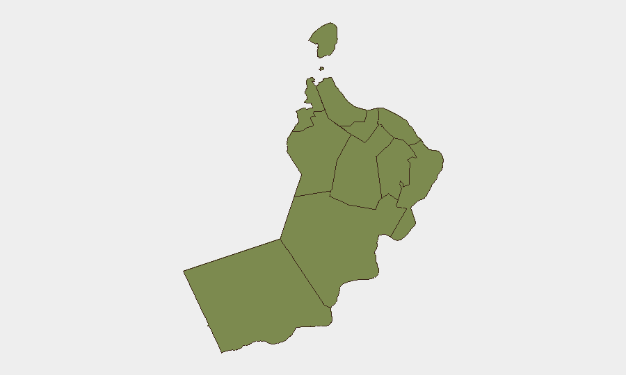
Al Wusta Governorate (risk 31.4) dominates Oman's sub-national threat profile; this remote southern region hosts critical maritime chokepoint infrastructure and coastline adjacent to the Strait of Hormuz, making it directly exposed to the current geopolitical escalation. Musandam Governorate (risk 9) and Muscat Governorate (risk 7.2) follow, with Musandam's proximity to the strait and Muscat's role as the capital and diplomatic hub adding layered exposure to maritime and political risk. All other governorates score 1.4 or below, reflecting concentrated risk in maritime and trade-linked zones rather than widespread domestic instability.
How GeoBit Would Assist
Security teams should deploy Maritime & Aviation Tracking and GIS & Spatial Analysis to monitor vessel movements, insurance implications, and route diversions in real time. AOI Monitoring & Early Warning on the Strait of Hormuz, Muscat, and key ports will provide persistent surveillance of shipping traffic, military activity, and escalatory signals. Intel Sweep, OSINT fusion, and Sentiment & Temporal Analysis across shipping news, Iranian and U.S. state media, and maritime forums will enable rapid detection of further attacks or diplomatic shifts affecting duty-of-care obligations.
7-Day Outlook
Immediate risk remains concentrated on maritime transit and energy infrastructure in the Strait of Hormuz rather than Oman's land territory. Shipping operators should expect continued elevated insurance costs, route uncertainty, and potential further tit-for-tat incidents in the strait over the next 7 days, while Oman's diplomatic role as a de-escalation mediator may stabilize the broader environment within two weeks if back-channel negotiations activate.
Highest-Risk Areas — Ranked
| # | State / Region | Risk |
|---|---|---|
| 1 | Al Wusta Governorate | 31.4 |
| 2 | Musandam Governorate | 9 |
| 3 | Muscat Governorate | 7.2 |
| 4 | Al Buraymi Governorate | 1.4 |
| 5 | Ad Dhahirah Governorate | 1.4 |
| 6 | Al Batinah North Governorate | 1.4 |
| 7 | Al Batinah South Governorate | 1.4 |
| 8 | Ad Dakhiliyah Governorate | 1.4 |
| 9 | Ash Sharqiyah North Governorate | 1.4 |
| 10 | Ash Sharqiyah South Governorate | 1.4 |
| 11 | Dhofar Governorate | 1.4 |
Sources
Previous Daily Briefs
A new Oman brief is written every day — each with its own risk map and downloadable CSV. Here's the last week; use the calendar to go further back.
📅 Browse every day by calendar →
Highlighted days have a brief. Tap a day for that day's map & analysis, or “csv” for that day's dataset ($5).