Situation Summary
Palau remains a low-threat environment with no credible security incidents, civil unrest, crime spikes, infrastructure disruptions, or travel-risk events reported in the last 24–48 hours. The country ranks 179th globally in composite threat score (4/100) and shows no tracked events in the current monitoring window. Security conditions remain stable across the archipelago, though sub-national risk variation warrants differentiated attention to specific states.
Key Developments
No discrete security, conflict, crime, civil unrest, or infrastructure incidents have been reported in Palau during 2–3 July 2026. Open-source news, social media, and web content contain no credible incident reports, alerts, or breaking developments for this period. Absence of reporting reflects the baseline low-incident profile of the country rather than information gaps.
Highest-Risk Areas
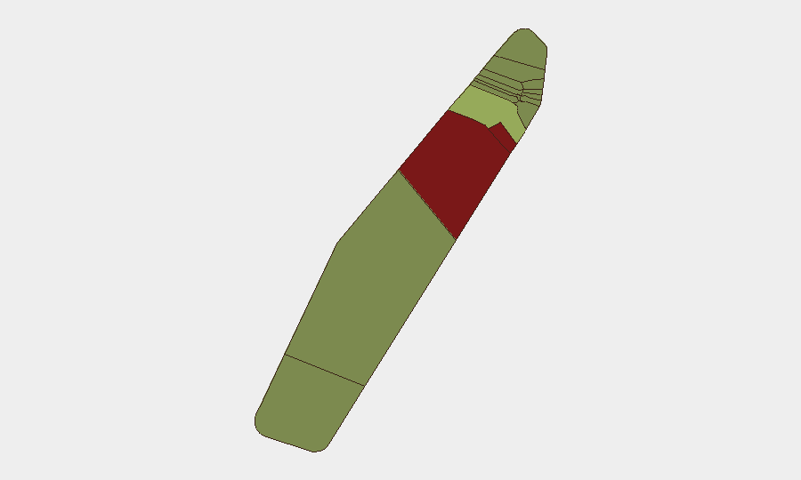
Peleliu and Angaur substantially exceed risk levels in all other states, with composite scores of 92 and 88 respectively—nearly double that of Koror (45), the third-ranked state. This divergence likely reflects historical WWII-era infrastructure, unexploded ordnance (UXO) contamination, limited government presence, and sparse population density in these outer islands, creating operational hazards for any personnel conducting fieldwork, infrastructure development, or salvage activities. Koror, as the commercial and population center, carries moderate risk driven by routine urban crime and maritime activity rather than instability. Remaining states present minimal risk and require standard duty-of-care protocols only.
How GeoBit Would Assist
For organizations with personnel or assets in Palau, GeoBit's AOI Monitoring & Early Warning capability provides persistent watch on Peleliu and Angaur for any emerging incidents, with automated alerting to duty-of-care teams. Satellite & Imagery analysis can assess infrastructure condition and UXO hazard zones in high-risk outer islands, supporting field-operation planning. OSINT fusion across news, social media, and local sources—despite current information scarcity—ensures real-time detection of any developments in this low-volume information environment, preventing blind spots as conditions change.
7-Day Outlook
No material change to the current low-threat baseline is anticipated in the next seven days. Seasonal weather patterns and routine maritime activity present standard operational considerations; political, security, and civil-stability conditions show no indicators of deterioration. Organizations should maintain standard risk-management protocols for outer-island operations, particularly in UXO-affected zones.
Report Date: 4 July 2026 | Confidence: High (baseline stability); Medium (early-warning threshold for low-incident environment) | Next Update: 5 July 2026
Highest-Risk Areas — Ranked
| # | State / Region | Risk |
|---|---|---|
| 1 | Peleliu | 92 |
| 2 | Angaur | 88 |
| 3 | Koror | 45 |
| 4 | Melekeok | 35 |
| 5 | Airai | 32 |
| 6 | Ngatpang | 28 |
| 7 | Ngeremlengui | 26 |
| 8 | Ngaraard | 25 |
| 9 | Ngardmau | 24 |
| 10 | Aimeliik | 23 |
| 11 | Ngiwal | 22 |
| 12 | Ngchesar | 21 |
Previous Daily Briefs
A new Palau brief is written every day — each with its own risk map and downloadable CSV. Here's the last week; use the calendar to go further back.
📅 Browse every day by calendar →
Highlighted days have a brief. Tap a day for that day's map & analysis, or “csv” for that day's dataset ($5).
Atlas — our AI intelligence desk — emails them this snapshot personally. Nothing else, no list.