Situation Summary
Panama remains at composite threat level 14 (rank #88 globally) with no acute security incidents, civil unrest, or infrastructure disruptions reported within Panama's territory in the past 24–48 hours. However, Panama-flagged commercial vessels operating in high-risk international waters—particularly the Strait of Hormuz—have come under attack, elevating maritime risk exposure for Panama-linked shipping and signaling broader geopolitical pressure on key trade routes. Domestic security posture remains stable, though Colón province continues to carry substantially elevated composite risk (31.4) relative to all other sub-national areas.
Key Developments
- Strait of Hormuz (Iran/Oman waters) – 27–28 June 2026:
A Panama-flagged crude oil tanker sustained damage from an Iranian one-way attack drone while in transit. This marks a direct threat to Panama-registered commercial assets outside territorial waters, with implications for shipping insurance, crew safety, and maritime route viability.
- Strait of Hormuz – 28–29 June 2026:
U.S. Central Command conducted airstrikes on Iranian military infrastructure linked to drone and naval mine operations in response to continued commercial shipping threats, including the earlier attack on the Panama-flagged vessel.
- Strait of Hormuz – late 28–early 29 June 2026:
U.S. forces intercepted and shot down two Iranian attack drones near the Strait of Hormuz, reinforcing active military engagement in waters transited by Panama-flagged and other commercial tonnage.
- Panama Canal – late 27–28 June 2026:
U.S. and Panamanian authorities publicly reaffirmed bilateral cooperation to secure the Panama Canal as a strategic maritime asset. This reflects elevated geopolitical focus but does not indicate a specific incident or disruption to Canal operations.
Highest-Risk Areas
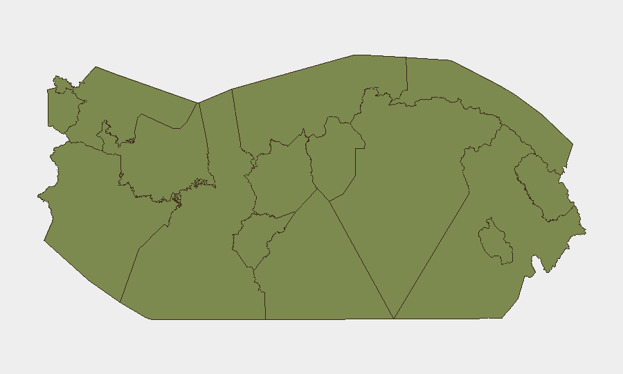
Colón province dominates Panama's internal risk profile with a composite score of 31.4—more than 22 times the national average and substantially above all other sub-national areas, which cluster at 1.4–2.2. This disparity reflects Colón's historical concentration of port-related crime, migrant-trafficking networks, and gang activity tied to Caribbean and Central American narcotics routes. All other provinces and indigenous territories show materially lower composite risk, indicating that threat concentration is highly localized to Colón and, to a lesser degree, Chiriquí (2.2). Organizations with assets in Colón (ports, logistics, warehousing, or personnel) face asymmetric risk compared to those operating elsewhere in Panama.
How GeoBit Would Assist
Corporate security teams should leverage AOI Monitoring & Early Warning to establish persistent watch on Colón province and key ports (Colón Free Zone, Balboa) with automated alerting on crime, labor disputes, or port disruptions. Maritime & Aviation Tracking combined with Economic & Trade intelligence can monitor Panama-flagged vessel movements, insurance claims, and route diversions away from high-risk international waters such as the Strait of Hormuz. Network & Actor Analysis and OSINT fusion (including X/Twitter, Telegram, and multi-language search) enable rapid detection of emerging labor strikes, gang activity escalation, or government policy shifts affecting operational continuity.
7-Day Outlook
No imminent domestic security escalation is forecast within Panama proper over the next seven days. However, the sustained Iranian threat to shipping in the Hormuz Strait will likely persist, creating ongoing risk to Panama-flagged and Panama-routed commercial cargo. Colón's risk profile should be treated as a persistent operational constraint rather than an acute crisis; routine vigilance and contingency planning remain standard duty-of-care requirements.
Highest-Risk Areas — Ranked
| # | State / Region | Risk |
|---|---|---|
| 1 | Colón | 31.4 |
| 2 | Chiriquí | 2.2 |
| 3 | Panamá Province | 1.4 |
| 4 | Guna Yala | 1.4 |
| 5 | Darién | 1.4 |
| 6 | Emberá-Wounaan | 1.4 |
| 7 | Naso Tjër Di | 1.4 |
| 8 | Bocas del Toro | 1.4 |
| 9 | Ngäbe-Buglé | 1.4 |
| 10 | Coclé | 1.4 |
| 11 | Panamá Oeste | 1.4 |
| 12 | Veraguas | 1.4 |
Sources
Previous Daily Briefs
A new Panama brief is written every day — each with its own risk map and downloadable CSV. Here's the last week; use the calendar to go further back.
📅 Browse every day by calendar →
Highlighted days have a brief. Tap a day for that day's map & analysis, or “csv” for that day's dataset ($5).