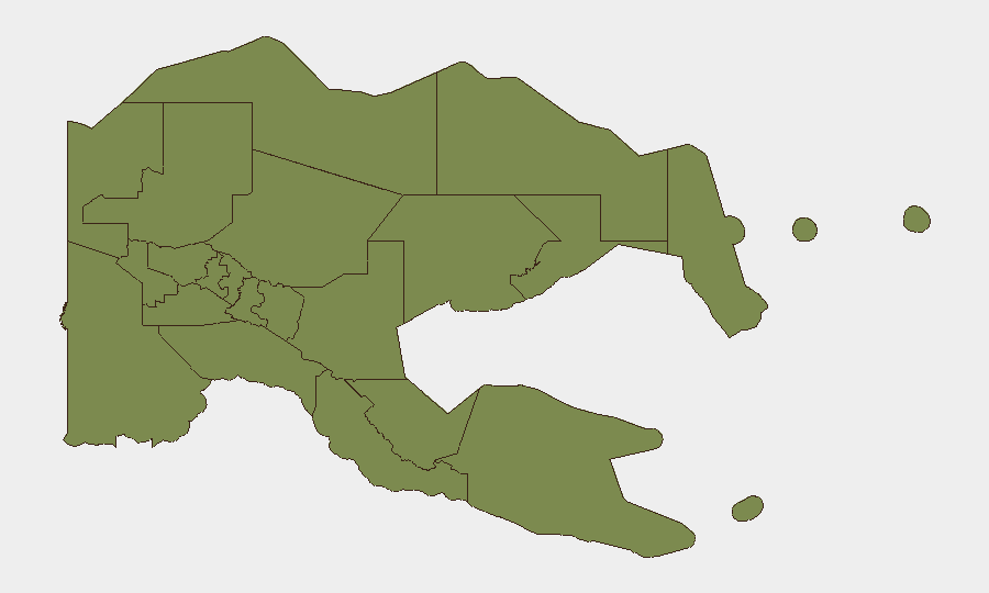
Situation Summary
Papua New Guinea remains classified as a composite threat level 7 (globally #null ranking), with eight tracked events currently under monitoring. The security environment is characterized by dispersed low-to-moderate risk across most provinces, with Morobe Province significantly elevated due to ongoing incidents. A submarine volcanic eruption in Manus Province is actively disrupting coastal communities and supply chains as of 19 June, and unverified reports of territorial occupation and diplomatic tensions with Samoa require continued monitoring.
Key Developments
- Manus Province, 2026-06-19: Floating volcanic pumice from the Titan Ridge submarine eruption is disrupting boat travel and fishing access in coastal communities. PNG's Disaster Minister has flagged food-security and supply concerns as immediate operational risks for the region.
- Unspecified location, 2026-06-19: A threat event was recorded but remains unverified in available reporting. Concurrent diplomatic tension with Samoa (Apia) was noted as rejected/contested, suggesting possible maritime or resource-related friction.
- Territorial occupation reported, 2026-06-18: A territorial occupation event was logged in Papua New Guinea without detailed geographic specificity in current reporting. Verification and location clarification are pending.
- Seismic activity, recent: A magnitude 4.6 earthquake occurred 78 km west of Panguna (Bougainville region), consistent with the area's volcanic and tectonic profile. No casualties or infrastructure damage have been reported in available sources.
- Health event, circulating: Circulating vaccine-derived poliovirus type 2 (cVDPV2) has been identified. Scope, affected provinces, and containment status require clarification through health ministry channels.
Highest-Risk Areas
Morobe Province dominates the sub-national threat picture with a composite risk score of 31.3—approximately 10 times the baseline for all other provinces. This elevation reflects an accumulation of criminality, intercommunal violence, and logistical disruption rather than a single incident. Manus Province (2.9) ranks second and is currently experiencing volcanic-disruption impacts that, while non-violent, carry acute supply-chain and food-security consequences. All remaining provinces cluster at 1.3, indicating baseline security conditions with no acute focal risks; National Capital District (Port Moresby) is included in this lower-risk band, though urban crime patterns warrant standard corporate due diligence.
How GeoBit Would Assist
AOI Monitoring & Early Warning would establish persistent watch over Morobe, Manus, and Eastern Highlands provinces to detect escalation in violent incidents, supply-chain disruptions, or displacement. Satellite & Imagery Analysis combined with GIS & Spatial Analysis would track the Titan Ridge volcanic disruption, estimate pumice drift patterns, and map operational impact zones for maritime and coastal assets. Intel Sweep and multi-language OSINT would clarify the unverified territorial occupation and Samoa tensions, providing duty-of-care teams actionable confirmation before exposure decisions are made.
7-Day Outlook
The volcanic disruption in Manus is likely to persist for 7–14 days as pumice dispersal continues; supply normalization should be monitored against seasonal weather patterns. Morobe Province remains the principal security variable—no de-escalation indicators are present, and intercommunal tensions historically spike in the dry season. Diplomatic friction with Samoa and any associated territorial claims require diplomatic and legal review before new regional operations or personnel movement are authorized.
Highest-Risk Areas — Ranked
| # | State / Region | Risk |
|---|---|---|
| 1 | Morobe | 31.3 |
| 2 | Manus | 2.9 |
| 3 | Eastern Highlands | 1.3 |
| 4 | Gulf | 1.3 |
| 5 | Madang | 1.3 |
| 6 | West New Britain | 1.3 |
| 7 | New Ireland | 1.3 |
| 8 | East New Britain | 1.3 |
| 9 | National Capital District | 1.3 |
| 10 | Central | 1.3 |
| 11 | Oro | 1.3 |
| 12 | Milne Bay | 1.3 |
Sources
Previous Daily Briefs
A new Papua New Guinea brief is written every day — each with its own risk map and downloadable CSV. Here's the last week; use the calendar to go further back.
📅 Browse every day by calendar →
Highlighted days have a brief. Tap a day for that day's map & analysis, or “csv” for that day's dataset ($5).