Situation Summary
Paraguay remains a low-threat environment regionally (rank #78 globally, composite score 14) with dispersed, low-intensity risk across most departments. However, a sharp concentration of threat signals—including diplomatic friction with France, Japanese law-enforcement action, and unconfirmed financial/ministerial investigations—emerged on 2026-07-08, requiring immediate clarification. Flooding reported in recent days adds infrastructure and mobility risk. Overall trajectory is stable but volatile pending resolution of today's international incidents.
Key Developments
- 2026-07-08 · France–Paraguay diplomatic friction. France has issued a formal rejection and deployed conventional military force messaging toward Paraguay; Paraguay has reciprocated rejection. Nature and location of dispute not yet clarified in available reporting.
- 2026-07-08 · Japanese enforcement action. Japan has initiated three separate arrest/detention procedures involving Paraguay; specific allegations, individuals, and locations remain unconfirmed.
- 2026-07-08 · Ministerial and banking investigations. Paraguayan Ministry and an unnamed domestic bank have launched investigations; scope and subjects undisclosed.
- 2026-07-07 · Domestic political friction. Senator Celeste Amarilla faced French prosecutorial scrutiny and domestic government condemnation following racist social-media remarks about French athlete Kylian Mbappé; unlikely to affect corporate security directly but signals internal political volatility.
- Recent · Infrastructure impact. Flooding reported across Paraguay (reference 1103999); impacts to transportation, utilities, and supply chains in flood-affected regions require monitoring.
- 2026-07-08 · Government public statement. Ministry issued public statement; content unknown. Likely response to international developments above.
Highest-Risk Areas
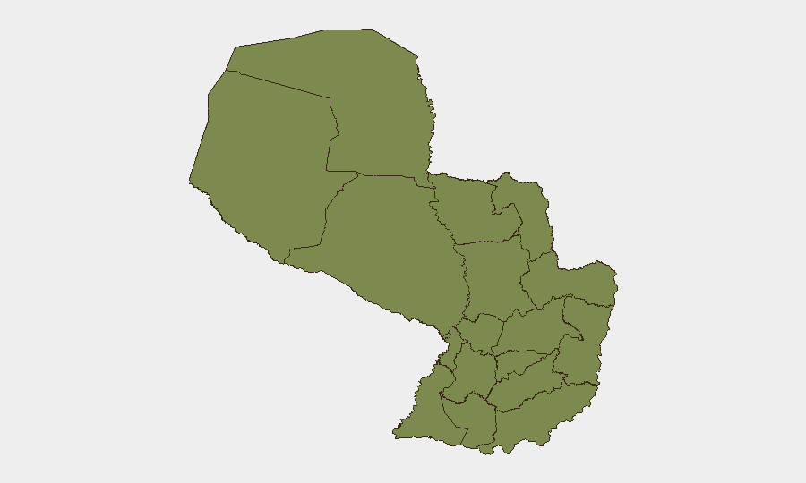
Presidente Hayes Department dominates the risk ranking at 31.4, a 20-fold differential above all other regions, which cluster at 1.4 each. This concentration suggests either a localized incident (organized crime, resource conflict, or civil unrest) or a persistent border/remote-area threat unresolved since prior reporting. All other departments—including urban centers Asunción-adjacent Alto Paraná and major transit corridors (Itapúa, Caaguazá)—show uniform baseline risk. Personnel and assets in Presidente Hayes should be treated as elevated-priority for duty-of-care monitoring and contingency planning.
How GeoBit Would Assist
Intel Sweep & OSINT Fusion would rapidly corroborate today's France–Paraguay and Japan–Paraguay incidents, extracting allegation details, named parties, and official statements from multi-language government, media, and diplomatic feeds. AOI Monitoring & Early Warning on Presidente Hayes, border crossings (especially Chaco region), and transport nodes would provide persistent alerting on cascading unrest or law-enforcement activity. Routing & Network Analysis would identify safe alternative transit routes if primary corridors are disrupted by flooding or political checkpoints.
7-Day Outlook
Resolution of diplomatic incidents with France and Japan over the next 48–72 hours will significantly de-risk the environment; escalation or arrest of named individuals could trigger secondary protests or supply-chain disruption. Flooding impact will persist for 5–7 days depending on drainage and rainfall; monitor transportation and utility advisories. Baseline threat trajectory remains low unless incidents compound.
Next Brief: 2026-07-09 (or on-demand if substantive new incident reporting emerges).
Highest-Risk Areas — Ranked
| # | State / Region | Risk |
|---|---|---|
| 1 | Presidente Hayes Department | 31.4 |
| 2 | Concepción Department | 1.4 |
| 3 | San Pedro Department | 1.4 |
| 4 | Guairá Department | 1.4 |
| 5 | Amambay Department | 1.4 |
| 6 | Canindeyú Department | 1.4 |
| 7 | Caaguazú Department | 1.4 |
| 8 | Alto Paraná Department | 1.4 |
| 9 | Caazapá Department | 1.4 |
| 10 | Itapúa Department | 1.4 |
| 11 | Boquerón | 1.4 |
| 12 | Alto Paraguay Department | 1.4 |
Sources
Previous Daily Briefs
A new Paraguay brief is written every day — each with its own risk map and downloadable CSV. Here's the last week; use the calendar to go further back.
📅 Browse every day by calendar →
Highlighted days have a brief. Tap a day for that day's map & analysis, or “csv” for that day's dataset ($5).
Atlas — our AI intelligence desk — emails them this snapshot personally. Nothing else, no list.