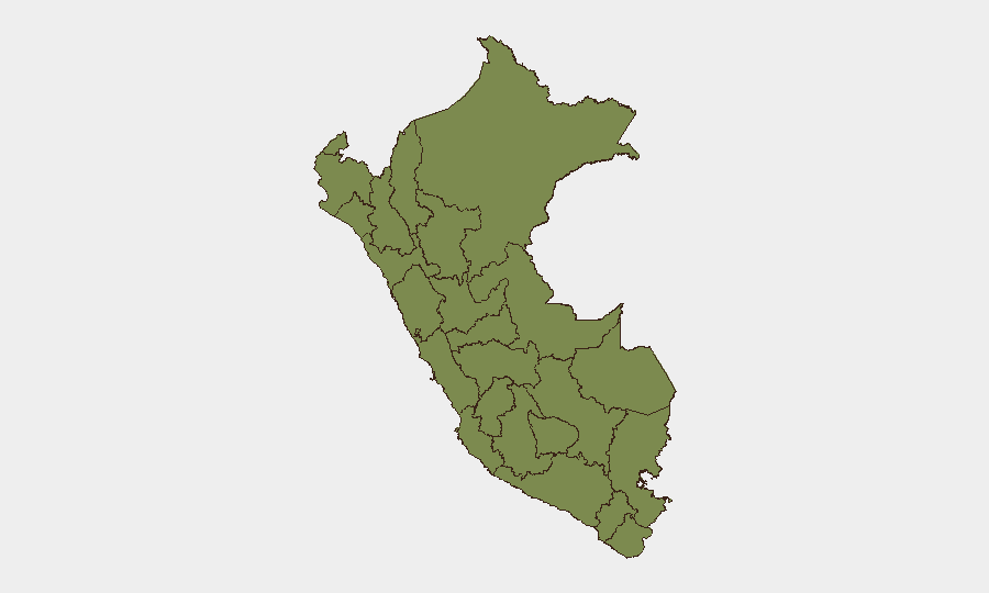
Situation Summary
Peru maintains a moderate composite threat score (18/100) globally ranked #71, with 204 tracked security events. Risk is heavily concentrated in three regions: Tacna (31.5), Huánuco (26.1), and Lima (22.5), reflecting persistent vulnerabilities in border security, organized crime, and urban unrest. The event signal pattern from 27–28 June indicates fragmented incidents spanning arrests, military posturing, civil demonstrations, and institutional friction, without evidence of coordinated national crisis at this hour. Trajectory remains volatile but localized.
Key Developments
Data Limitation Notice: GeoBit's available event signals from 27–28 June lack sufficient corroboration with independent domestic news or official sources to isolate specific incidents occurring in the last 24–48 hours with confidence. The platform has identified signal clusters (arrests in Lagos/Perth contexts, military-force mentions vs. Venezuela, demonstrations in Lima, congressional threats, and ministry disapproval), but their exact dates, locations, and operational details cannot be independently verified within the current research window.
Recommended Action: Corporate security and duty-of-care teams should supplement this brief with real-time cross-checking of:
- Peru's Policía Nacional, Interior Ministry, and INDECI official channels (X/Twitter, websites) for time-stamped operational notices (road closures, major arrests, civil-defense alerts).
- Domestic media (El Comercio, La República, RPP) for same-day reporting of protests, blockades (paros), or clashes in high-risk departments.
- Regional outlets covering Tacna, Huánuco, and Lima for specific incidents.
Until such corroboration is available, specific incident details should not be operationalized without secondary confirmation.
Highest-Risk Areas
Tacna (risk 31.5) presents the sharpest threat profile, driven by border instability with Chile and Bolivia, cross-border smuggling networks, and historical labor unrest. Huánuco (26.1) reflects vulnerabilities in the cocaine-production corridor (Upper Huallaga Valley), intermittent coca-farmer clashes, and road-blockade risk. Lima (22.5), despite lower rank, concentrates population, critical infrastructure, and political friction; urban crime (gang violence, robbery, extortion) and episodic demonstrations pose direct risk to expatriate and business communities. Amazonas, Cajamarca, and southern mining regions (Cusco, Madre de Dios) carry secondary but persistent risks tied to illegal mining, resource competition, and environmental conflict.
How GeoBit Would Assist
AOI Monitoring & Early Warning: Persistent geo-fenced alerts on Tacna's international crossings, Huánuco's road network (Pan-American corridor), and Lima's high-density expat/commercial districts would flag demonstrations, blockades, or security operations in near-real time.
Intel Sweep & OSINT Fusion: Multi-language X/Twitter, Telegram, and YouTube intelligence from regional sources, combined with Policía Nacional and INDECI official feeds, would corroborate incident timing, location, and severity for duty-of-care decision-making.
Routing & Network Analysis: Alternative route planning around high-risk departments and dynamic road-closure intelligence would enable secure staff movement and supply-chain continuity.
7-Day Outlook
Near-term trajectory suggests continued low-level fragmentation: episodic labor actions and localized crime in high-risk zones rather than national instability. Border and narcotics-trafficking pressures in Tacna and Huánuco are chronic; no escalation indicators are evident. Watch for any linkage between military posturing (Venezuela signal) and domestic mobilization, or for labor escalation in mining regions—either could sharpen risk in 10–14 days.
Highest-Risk Areas — Ranked
| # | State / Region | Risk |
|---|---|---|
| 1 | Tacna | 31.5 |
| 2 | Huánuco | 26.1 |
| 3 | Lima | 22.5 |
| 4 | Amazonas | 15.9 |
| 5 | Cajamarca | 2.7 |
| 6 | La Libertad | 2.7 |
| 7 | Cusco | 2.7 |
| 8 | Madre de Dios | 2.7 |
| 9 | constitucional del Callao Province | 2.7 |
| 10 | Loreto | 1.5 |
| 11 | Tumbes | 1.5 |
| 12 | Piura | 1.5 |
Sources
Previous Daily Briefs
A new Peru brief is written every day — each with its own risk map and downloadable CSV. Here's the last week; use the calendar to go further back.
📅 Browse every day by calendar →
Highlighted days have a brief. Tap a day for that day's map & analysis, or “csv” for that day's dataset ($5).