Situation Summary
Romania faces a composite threat score of 9 (globally ranked #117) with 56 tracked events, reflecting a fragmented security landscape dominated by natural hazards and localized civil tensions rather than systemic instability. A severe weather event on 2026-07-01 to 2026-07-02 has created the most urgent operational concern: one fatality, flooding across 20 counties, 2,200+ emergency calls, and widespread infrastructure disruption in the Bucharest-Ilfov metro area. Sub-national risk concentration remains extreme, with Satu Mare county scoring 31.5—more than four times the risk of Bucharest (6.5)—indicating that threat vectors are highly localized rather than national. The country's trajectory is stabilizing post-storm, but secondary flood and weather risks persist through early July.
Key Developments
- Bucharest & Ilfov County (2026-07-01 overnight to 2026-07-02): A powerful storm killed 1 person (tree-fall fatality) and triggered 2,200+ emergency service requests. Urban flooding affected 350+ houses and 100+ streets; 988 trees down, 495 vehicles damaged, roads blocked across the metro area.
- Bucharest municipality (2026-07-02): Emergency crews deployed water pumps and rescue teams to drain flooded residential blocks and clear debris-choked streets, indicating sustained infrastructure strain and potential service delays.
- Ilfov County & surrounding regions (2026-07-02): Multi-county mutual aid activated; rescue units from western and southern Romania deployed chainsaws, trucks, and specialized equipment, reflecting broader civil-protection mobilization.
- Western & Southern Romania (2026-07-02): National Meteorological Administration issued warnings of torrential rain and thunderstorms from atmospheric instability, signaling elevated flood and travel risk through the near term.
- Romania nationwide (2026-06-29 to 2026-07-02): Event signals show multiple investigative, public-statement, and disapproval actions by armed groups, rights groups, prosecutors, and journalists; concurrent with natural-disaster response, civil-order tensions remain tracked but have not escalated to violent incidents.
Highest-Risk Areas
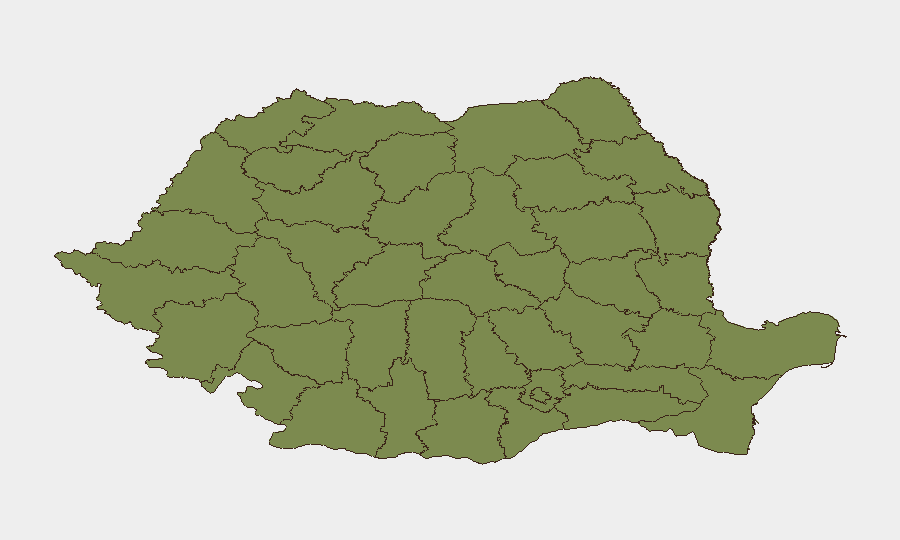
Satu Mare county dominates the sub-national risk ranking with a composite score of 31.5—an outlier that warrants focused monitoring. Bucharest (6.5) and Brașov (6.1) rank second and third; both are major economic and transport hubs, making localized incidents there more consequential for corporate operations. The concentration of risk in three areas suggests that threat vectors are specific (armed-group activity, protest dynamics, or investigative actions in Satu Mare; institutional or civil tensions in Bucharest and Brașov) rather than diffuse. Lower-risk counties (Cluj, Bihor, Timiș) reflect more stable governance and lower event frequency.
How GeoBit Would Assist
Security teams should deploy AOI (Area-of-Interest) Monitoring & Early Warning on Bucharest, Brașov, and Satu Mare to capture civil unrest, armed-group signaling, and investigative actions in near-real time. Multi-language OSINT and X/Twitter & Telegram intelligence would flag emerging protest or institutional tensions ahead of escalation. Routing & Network Analysis can identify alternative transport and supply-chain paths around the current flood-affected zones (Ilfov, surrounding counties) to minimize operational disruption.
7-Day Outlook
Immediate risk remains elevated due to secondary flooding, continued atmospheric instability, and road/infrastructure disruption in the Bucharest metro area through 2026-07-04. Institutional and civil-order signals (armed-group activity, investigative actions, public statements) persist but have not coalesced into large-scale violence; however, sustained monitoring of Satu Mare and Bucharest is warranted. By 2026-07-07, weather stabilization and emergency-response completion should restore normal operational conditions, pending local flooding impacts.
Highest-Risk Areas — Ranked
| # | State / Region | Risk |
|---|---|---|
| 1 | Satu Mare | 31.5 |
| 2 | Bucharest | 6.5 |
| 3 | Brașov | 6.1 |
| 4 | Brăila | 4.9 |
| 5 | Gorj | 3.2 |
| 6 | Cluj | 2.4 |
| 7 | Vaslui | 2.4 |
| 8 | Buzău | 2.4 |
| 9 | Mehedinți | 2.4 |
| 10 | Vâlcea | 1.5 |
| 11 | Bihor | 1.5 |
| 12 | Timiș | 1.5 |
Sources
Previous Daily Briefs
A new Romania brief is written every day — each with its own risk map and downloadable CSV. Here's the last week; use the calendar to go further back.
📅 Browse every day by calendar →
Highlighted days have a brief. Tap a day for that day's map & analysis, or “csv” for that day's dataset ($5).