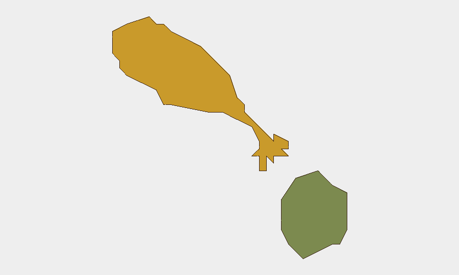
Situation Summary
Saint Kitts and Nevis remains a low-threat environment (global rank #198, composite score 3), with no confirmed active security incidents affecting the general population or business operations as of 1 July 2026. However, recent event signals include isolated small-arms incidents and a cluster of diplomatic statements and media activity centered on North Korea–related matters, the source and location of which require clarification. Saint Kitts island carries elevated sub-national risk (score 72) relative to Nevis (28), though the drivers of this differential are not fully transparent from available intelligence. Current trajectory is stable but warrants continued monitoring of local security channels.
Key Developments
- 2026-07-01, location TBD: Small-arms combat incident (NURSE actor cited); exact location, casualties, and circumstances unconfirmed.
- 2026-06-30, location TBD: Small-arms combat involving North Korean actor and tourists; no verified casualty or location data in current feed.
- 2026-07-01, date/location TBD: Multiple diplomatic statements from North Korea, South Korea Unification Ministry, and media entities; no direct geographic nexus to Saint Kitts and Nevis confirmed, though flagged by local event signals.
- 2026-06-29, location TBD: Investigation and disapproval actions attributed to North Korean and military actors; scope and location unclear.
- Broader signal context (since 2026-06-29): Escalated diplomatic rhetoric and media statements involving North Korea, China, and news agencies; potential for ancillary reputational or secondary-effect impacts on Caribbean governance or tourism, but no direct incident in-country confirmed.
Note: Open-web research (last 24 h) did not surface verifiable on-the-ground security incidents, crime events, or infrastructure disruptions in Saint Kitts and Nevis. The event signals above derive from GeoBit's global feed and require local source corroboration.
Highest-Risk Areas
Saint Kitts island dominates the sub-national risk profile (score 72 vs. Nevis 28), though the specific drivers—whether crime concentration, gang activity, port/maritime vulnerability, or political instability—are not detailed in the current composite metric. The disparity suggests risk is geographically concentrated; corporate and diplomatic assets should prioritize local intelligence on Saint Kitts' urban centers (Basseterre) and port zones. Nevis' lower score reflects a generally quieter security environment, though it remains subject to same regional crime and maritime threats.
How GeoBit Would Assist
Security teams should deploy AOI (Area-of-Interest) Monitoring & Early Warning on Basseterre and major port facilities to detect emerging unrest, crime clusters, or diplomatic incidents in real time. OSINT fusion (X/Telegram, local news, radio SIGINT) will clarify the sourcing and local impact of the current North Korea–related event signals and identify any secondary spillover risk to tourism, trade, or expatriate safety. Risk & Threat Assessment tools, combined with Network & Actor Analysis, will establish whether the small-arms combat signals reflect localized gang activity, transnational trafficking, or other drivers, enabling targeted duty-of-care protocols.
7-Day Outlook
No imminent escalation is anticipated; the current event cluster appears to reflect diplomatic and media activity with uncertain or non-local nexus. Saint Kitts security environment is expected to remain stable, though the Saint Kitts–Nevis risk differential warrants continued sub-national differentiation in travel and asset-protection postures. Recommend daily refresh of local law-enforcement and port authority communications to detect any shift in crime patterns or incident frequency.
Highest-Risk Areas — Ranked
| # | State / Region | Risk |
|---|---|---|
| 1 | Saint Kitts | 72 |
| 2 | Nevis | 28 |
Sources
Previous Daily Briefs
A new Saint Kitts and Nevis brief is written every day — each with its own risk map and downloadable CSV. Here's the last week; use the calendar to go further back.
📅 Browse every day by calendar →
Highlighted days have a brief. Tap a day for that day's map & analysis, or “csv” for that day's dataset ($5).