Situation Summary
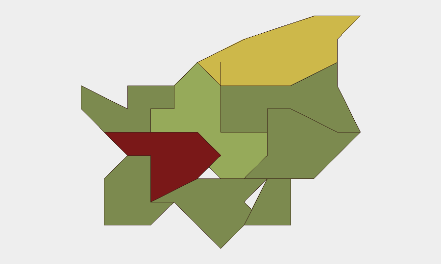
San Marino maintains a composite threat score of 1 with no tracked security events in the current window, reflecting its status as one of Europe's lowest-risk jurisdictions. The microstate's nine constituent municipalities show wide variance in risk, with Città di San Marino (the capital and tourism hub) significantly elevated above peripheral regions. No discrete security incidents, civil unrest, infrastructure disruptions, or travel-risk developments have been confirmed in the last 24–48 hours.
Key Developments
No specific security events have been identified in San Marino during the last 24–48 hours. GeoBit's event signal window remains empty for this reporting period. Organizations with personnel or assets in-country should monitor local media, official government channels, and transport operator announcements for any emerging incidents; however, no current alert is warranted based on available intelligence.
Highest-Risk Areas
Città di San Marino (risk 85) dominates the sub-national ranking, driven by its role as the administrative and tourism center, where transient populations, public gatherings, and infrastructure density create elevated baseline risk for petty crime, protest activity, or accident. Serravalle (risk 68), the most populous municipality and commercial hub, follows as secondary risk, reflecting urban density and economic activity. Borgo Maggiore (risk 52) ranks third. These three municipalities account for the majority of human and asset concentration in San Marino; peripheral municipalities (Acquaviva, Montegiardino, Chiesanuova) carry minimal recorded risk. Risk elevation in the capital and secondary urban centers is consistent with European small-state norms and does not signal acute instability.
How GeoBit Would Assist
AOI Monitoring & Early Warning would establish persistent watch over Città di San Marino and Serravalle, triggering alerts if security events (protest activity, accidents, infrastructure disruption, or crime clusters) emerge in real time. Multi-language OSINT (X/Twitter, local media, Telegram) combined with sentiment & temporal analysis would capture emerging civic or economic discontent before it manifests in street activity. Routing & Network Analysis would support duty-of-care teams in identifying alternative movement corridors for personnel if incidents block primary routes, and GIS & Spatial Analysis would enable rapid risk mapping of incidents relative to corporate facilities or personnel locations.
7-Day Outlook
No near-term security escalation is forecast for San Marino. The microstate's stable governance, low crime baseline, and tourism-dependent economy support the expectation of continued low threat environment. Organizations should maintain standard business-continuity and personnel-safety protocols; no elevated alert status is recommended at this time. Routine monitoring of local transport, weather, and official government notices remains standard practice for duty-of-care compliance.
Highest-Risk Areas — Ranked
| # | State / Region | Risk |
|---|---|---|
| 1 | Città di San Marino | 85 |
| 2 | Serravalle | 68 |
| 3 | Borgo Maggiore | 52 |
| 4 | Fiorentino | 32 |
| 5 | Domagnano | 28 |
| 6 | Faetano | 22 |
| 7 | Chiesanuova | 18 |
| 8 | Montegiardino | 16 |
| 9 | Acquaviva | 15 |
Previous Daily Briefs
A new San Marino brief is written every day — each with its own risk map and downloadable CSV. Here's the last week; use the calendar to go further back.
📅 Browse every day by calendar →
Highlighted days have a brief. Tap a day for that day's map & analysis, or “csv” for that day's dataset ($5).
Atlas — our AI intelligence desk — emails them this snapshot personally. Nothing else, no list.