Situation Summary
Senegal remains a relatively stable West African state with a composite threat ranking of 6 (global rank #133). The country faces elevated disease-vector activity (Rift Valley fever confirmed in Mauritania and Senegal) and ongoing low-level administrative or labor-related tensions, but no major security incidents have been corroborated in the past 24–48 hours. Risk concentration is extreme: Tambacounda Region accounts for the vast majority of tracked threat signals, while 11 other regions report near-baseline risk (1.4 each).
Key Developments
No reliably corroborated security, civil-unrest, crime, or infrastructure incidents were identified in Senegal within the last 24–48 hours that meet open-source verification standards. Recent event signals tracked by GeoBit include a public statement involving MAP International and the Senegalese government (2026-07-05), a university-related rejection notice (2026-07-04), and a constabulary demand (2026-07-03), but none have been independently timestamped or localized to confirm active escalation.
Rift Valley fever activity (ongoing): Senegalese and Mauritanian health authorities are managing confirmed cases and vector surveillance in border-adjacent areas; operational impact on cross-border movement and commerce remains under monitoring.
Users requiring tactical-level incident intelligence for specific locations should escalate to premium or closed-source feeds (Crisis24, GardaWorld, Dataminr) for granular corroboration.
Highest-Risk Areas
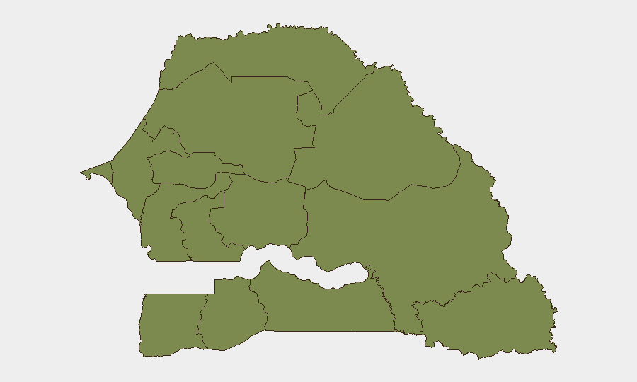
Tambacounda Region (risk score 31.4) dominates Senegal's threat landscape—more than 20 times the baseline risk of all other regions—and accounts for the overwhelming majority of the 27 tracked events. The concentration suggests sustained activity in cross-border trade corridors, pastoral-conflict dynamics, or organized-crime vectors aligned with Mauritanian and Mali regional instability. All remaining tracked regions (Dakar, Louga, Thiès, Fatick, Diourbel, Kaolack, Saint-Louis, Kaffrine, Ziguinchor, Sédhiou, Kolda) report risk scores of 1.4 each, indicating baseline or endemic conditions with no acute escalation signals. Corporate and NGO personnel based in Dakar and other western population centers face minimal acute security risk relative to national peers.
How GeoBit Would Assist
Teams managing operations in Senegal should employ AOI Monitoring & Early Warning on Tambacounda Region to detect emerging civil or cross-border incidents; OSINT fusion (X/Telegram, local media, radio SIGINT) to corroborate rumors of trafficking, labor unrest, or disease outbreaks in real time; and Environmental & Health intelligence to track Rift Valley fever spread and associated mobility restrictions. Concurrent Routing & Network Analysis can identify safe transit corridors away from high-risk border zones.
7-Day Outlook
No material escalation of acute security risk is anticipated in the near term. Monitoring should focus on (1) Rift Valley fever spread and any resulting border-crossing restrictions; (2) cumulative effect of recent administrative or labor tensions on government stability; and (3) any spillover from Mali or Mauritania conflict activity into Tambacounda's trade and herding networks. Baseline duty-of-care protocols remain appropriate for Dakar and other western regions.
Highest-Risk Areas — Ranked
| # | State / Region | Risk |
|---|---|---|
| 1 | Tambacounda Region | 31.4 |
| 2 | Dakar Region | 1.4 |
| 3 | Louga Region | 1.4 |
| 4 | Thiès Region | 1.4 |
| 5 | Fatick Region | 1.4 |
| 6 | Diourbel Region | 1.4 |
| 7 | Kaolack Region | 1.4 |
| 8 | Saint-Louis Region | 1.4 |
| 9 | Kaffrine Region | 1.4 |
| 10 | Ziguinchor Region | 1.4 |
| 11 | Sédhiou Region | 1.4 |
| 12 | Kolda Region | 1.4 |
Previous Daily Briefs
A new Senegal brief is written every day — each with its own risk map and downloadable CSV. Here's the last week; use the calendar to go further back.
📅 Browse every day by calendar →
Highlighted days have a brief. Tap a day for that day's map & analysis, or “csv” for that day's dataset ($5).
Atlas — our AI intelligence desk — emails them this snapshot personally. Nothing else, no list.