Situation Summary
Slovakia remains a low-to-moderate threat environment (global rank #88, composite score 13) with concentrated risk in the Bratislava metropolitan region. The past 48 hours have seen elevated operational tempo across emergency services—745 interventions nationally in the past week—driven by severe weather, transport accidents, and a significant industrial fire incident near Bratislava Airport. Localized security/arrest events flagged on July 16–19 and incoming severe weather through July 20 warrant close monitoring for travel and asset disruption, particularly in western and central zones.
Key Developments
- Bratislava (Ivanská cesta, near airport) – night of July 18–19, 2026: A large explosion of propane-butane cylinders during a fire at an auto service facility damaged at least six parked vehicles; firefighters contained the blaze with no reported injuries, but police opened a public-endangerment investigation. *Risk: hazardous materials incident, potential criminal cause, airside proximity.*
- Slovakia-wide – evening of July 19, 2026: National meteorological service issued thunderstorm warnings (18:00 onwards) for the entire territory, with forecasts of intense storms, strong winds, hail, and localized flooding affecting transport and outdoor operations, particularly in western and central regions. *Risk: infrastructure disruption, travel delay, flash-flood potential.*
- Pezinská Baba mountain pass (north of Bratislava) – July 19, 2026, late morning: Fatal single-vehicle motorcycle crash killed a 29-year-old; police attributed excessive speed as a likely factor and appealed to drivers to exercise caution on the route. *Risk: road safety escalation on a popular transport corridor.*
- Slovakia – week ending July 19, 2026: Fire and rescue services reported 745 interventions over seven days, including 157 traffic accidents and 17 hazardous-substance incidents, indicating sustained emergency-response load across multiple incident categories. *Risk: cumulative strain on emergency resources, baseline elevated.*
- Slovakia – July 16–19, 2026 (real-time flagging): Automated incident-mapping systems identified small-arms and arrest/detention events in the surveillance window; limited open-source detail available, but consistent with localized security-force or law-enforcement activity. *Risk: situational awareness only; operational context unclear.*
Highest-Risk Areas
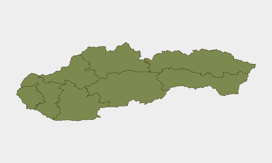
Bratislava Region dominates the sub-national risk profile at 31.8, more than double the second-ranked Banská Bystrica (14.3) and reflecting the capital's concentration of critical infrastructure, transport hubs, and population density. The recent airport-adjacent fire, thunderstorm risk to the metropolitan zone, and traffic fatality on the northern approach illustrate how Bratislava's position as the economic and administrative center amplifies exposure to industrial, weather, and transport incidents. All other regions cluster at risk scores ≤1.8, indicating that security and duty-of-care focus should remain concentrated on capital-region operations and travel corridors feeding it.
How GeoBit Would Assist
Security teams would deploy AOI Monitoring & Early Warning on Bratislava's critical zones (airport, logistics hubs, corporate districts) to detect recurrent hazmat or industrial incidents; GIS & Spatial Analysis to map thunderstorm impact on staff commute routes and supply chains; and Routing & Network Analysis to develop real-time alternative journey plans as weather and road conditions evolve. Integration with Intel Sweep (OSINT) on arrest/detention events and police investigations (propane incident cause, small-arms context) would sharpen operational risk posture within 6–12 hours.
7-Day Outlook
Severe weather will dominate the immediate 48-hour window (July 20–21), with flooding and transport delays likely in central and western Slovakia; impacts to Bratislava commutes and logistics should be anticipated. The propane-fire investigation and any emerging details on localized security events may provide clarification by July 22–23, but baseline threat level is unlikely to escalate beyond current moderate-risk profile absent major incident cascade.
Highest-Risk Areas — Ranked
| # | State / Region | Risk |
|---|---|---|
| 1 | Region of Bratislava | 31.8 |
| 2 | Region of Banská Bystrica | 14.3 |
| 3 | Region of Košice | 1.8 |
| 4 | Region of Žilina | 1.8 |
| 5 | Region of Trnava | 1.8 |
| 6 | Region of Trenčín | 1.8 |
| 7 | Region of Nitra | 1.8 |
| 8 | Region of Prešov | 1.8 |
Sources
Previous Daily Briefs
A new Slovakia brief is written every day — each with its own risk map and downloadable CSV. Here's the last week; use the calendar to go further back.
📅 Browse every day by calendar →
Highlighted days have a brief. Tap a day for that day's map & analysis, or “csv” for that day's dataset ($5).
Atlas — our AI intelligence desk — emails them this snapshot personally. Nothing else, no list.