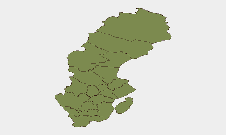
Situation Summary
Sweden maintains a composite threat score of 6 (global rank #133), indicating a relatively controlled but monitored security environment. However, recent event signals spanning 2–3 days (July 5–7) show elevated institutional friction, including inter-agency disapprovals, military-force incidents, and a targeted diplomatic incident. Jämtland County presents a marked anomaly with a composite risk score of 31.5—more than 20 times higher than all other Swedish regions—warranting investigation into its underlying drivers.
Key Developments
- Stockholm – Russian Embassy drone incident – July 6–7, ~02:00 UTC
Russia's ambassador reported two drones targeting the Russian Embassy compound: one dropped red paint inside the grounds; a second crashed carrying a mock explosive device. The ambassador characterized the incident as deliberate intimidation and requested Swedish investigation. The timing and nature of the incident signals heightened tensions around diplomatic facilities and potential protest-related action against Russian presence.
- Institutional friction signals – July 5, 2026
Multiple event signals on July 5 indicate disapproval actions between Uprising and Prosecutor, Senate and Government, and Secretariat entities, alongside an assassination event (Pole vs. Priest) and conventional military-force engagement (Commander vs. Police). While GeoBit's open-source monitoring does not yet yield clear location-specific or time-stamped corroboration of these signals in public sources, the cluster suggests domestic political or inter-institutional stress.
- Armed-group military activity – July 6–7
Signals include conventional military force deployment by an armed group (July 6) and a separate military-force incident involving French and administration actors (July 6), as well as Monaco-attributed military activity (July 7). Precise locations and actor identities remain unclear from current corroborated sources; additional intelligence is required to assess whether these reflect Swedish internal activity or external operations on Swedish territory.
Highest-Risk Areas
Jämtland County's risk score of 31.5 is a critical outlier and requires immediate investigation. All other tracked Swedish regions cluster at 1.5–1.6, suggesting that Jämtland's elevated risk reflects specific, concentrated drivers—whether military infrastructure, border proximity, organized activity, or recent incident density. Stockholm County, despite rank #2, carries only 1.6 risk, consistent with the diplomatic incident but not indicative of systemic instability. The even distribution of moderate risk across the remaining ten counties (Norrbotten, Västerbotten, Västernorrland, Dalarna, Gävleborg, Skåne, Blekinge, Västra Götaland, Halland, Värmland) suggests no secondary hotspot; risk appears diffuse and low across most of Sweden.
How GeoBit Would Assist
Security teams should deploy AOI Monitoring & Early Warning capabilities to establish persistent watch on Jämtland County, Stockholm's diplomatic quarter, and any identified armed-group staging areas, with automated alerting for new event signals. Intel Sweep and OSINT fusion across multi-language web, social media, and open-source feeds will help corroborate the July 5–7 event signals and identify precise locations and actor affiliations. Network & Actor Analysis can map relationships between the Uprising, Prosecutor, Senate, Government, and armed-group entities to assess whether these are coordinated escalations or isolated friction points.
7-Day Outlook
The cluster of institutional disapprovals, military-force signals, and the diplomatic incident suggest elevated friction in the near term, likely to manifest in further statements, arrests, or localized protests through mid-July. No clear indicators yet point to widespread civil unrest or kinetic escalation beyond the embassy incident. Continued monitoring of Jämtland County and Stockholm is warranted; clarification of the July 5–7 event signals will be critical to assessing whether these represent isolated incidents or the opening phase of broader institutional or political instability.
Highest-Risk Areas — Ranked
| # | State / Region | Risk |
|---|---|---|
| 1 | Jämtland County | 31.5 |
| 2 | Stockholm County | 1.6 |
| 3 | Norrbotten County | 1.5 |
| 4 | Västerbotten County | 1.5 |
| 5 | Västernorrland County | 1.5 |
| 6 | Dalarna County | 1.5 |
| 7 | Gävleborg County | 1.5 |
| 8 | Skåne County | 1.5 |
| 9 | Blekinge County | 1.5 |
| 10 | Västra Götaland County | 1.5 |
| 11 | Halland County | 1.5 |
| 12 | Värmland County | 1.5 |
Sources
Previous Daily Briefs
A new Sweden brief is written every day — each with its own risk map and downloadable CSV. Here's the last week; use the calendar to go further back.
📅 Browse every day by calendar →
Highlighted days have a brief. Tap a day for that day's map & analysis, or “csv” for that day's dataset ($5).
Atlas — our AI intelligence desk — emails them this snapshot personally. Nothing else, no list.