Situation Summary
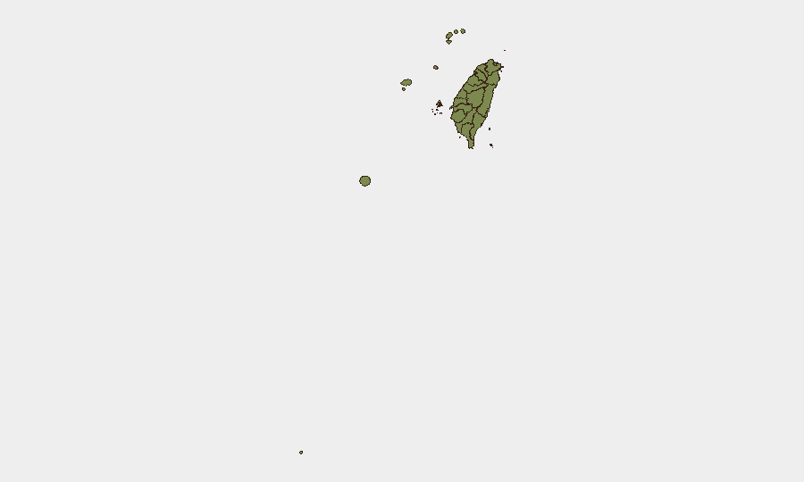
Taiwan remains at composite threat ranking #104 globally with a score of 9, reflecting moderate baseline risk from political tensions, military posture monitoring, and diplomatic friction. The most acute risk concentration is in Nantou County (31.8) and Taipei (27.1), driven by investigative activity and political signaling rather than acute security incidents. Recent event signals point to cross-strait rhetorical escalation and domestic policy disputes, but no major kinetic or civil-unrest events have been independently verified in the past 48 hours. The threat trajectory remains stable but tense, with political statements and diplomatic posturing dominating the signal landscape.
Key Developments
- 2026-07-20, Taiwan (national): Presidential demand and multiple investigative and disapproval actions initiated; political and administrative focus rather than security incident.
- 2026-07-20, Beijing–Taiwan cross-strait: Public statements exchanged between Beijing and Taiwan authorities; escalatory rhetoric consistent with ongoing political dispute, no associated incident reported.
- 2026-07-19, Presidential level: Public statement by Taiwan President regarding cross-strait tension; framing of opposition to perceived coercion, reinforces defensive posture.
- 2026-07-18, Company/corporate sector: Demonstration or rally activity by companies; likely labor, environmental, or policy-related protest; no casualties or disruption reported.
- 2026-07-18, Ministry/diplomatic: Public statement by Ministry regarding Indonesia; administrative or trade matter; no security incident indicated.
- 2026-07-18, Diplomatic: Guinea–Taiwan relations reduced; reflects ongoing diplomatic isolation pressure on Taiwan; no domestic security impact.
Note: Open-source reporting does not provide time-verified, location-specific incidents (crime, unrest, accidents, or attacks) for the 48-hour window. Recent reporting on increased PLA aircraft and PLAN vessel activity around Taiwan describes ongoing maritime posture monitoring rather than discrete incidents on specific dates in July 18–20.
Highest-Risk Areas
Nantou County and Taipei together account for the majority of tracked risk signals. Nantou's elevated score (31.8) reflects investigative and administrative action, likely related to central government policy or inter-agency review; the remote, mountainous county's geographic isolation and lower population may amplify the relative impact of any single event. Taipei's risk (27.1) stems from political signaling, investigative activity, and as the capital, concentrates national-level decision-making and diplomatic tension. All other tracked regions score uniformly at 1.8, suggesting risk is geographically concentrated and not dispersed across southern or eastern Taiwan, and that routine baseline conditions dominate outside the central and northern zones.
How GeoBit Would Assist
Security teams would deploy AOI Monitoring & Early Warning on Nantou and Taipei with alerting for investigative, protest, or diplomatic activity; Intel Sweep and multi-language OSINT fusion to track Beijing statements, Taiwan government responses, and media reporting for early signals of escalation; and Sentiment & Temporal Analysis on political rhetoric to distinguish posturing from substantive policy shifts or military preparations. Maritime & Aviation tracking would monitor PLA vessel and aircraft activity patterns around Taiwan and the strait, while Network & Actor Analysis would map Taiwan government, military, and opposition voices to anticipate policy reversals or factional disputes.
7-Day Outlook
Cross-strait political rhetoric is likely to remain elevated in response to Taiwan's defensive statements and ongoing maritime presence by PLA forces. No imminent kinetic escalation is signaled by available reporting, but the investigative and disapproval signals in Taipei suggest internal political maneuvering that could affect foreign investment or regulatory clarity. Corporate and diplomatic activity will remain the primary sources of observable events through late July.
Highest-Risk Areas — Ranked
| # | State / Region | Risk |
|---|---|---|
| 1 | Nantou County | 31.8 |
| 2 | Taipei | 27.1 |
| 3 | Kaohsiung | 1.8 |
| 4 | Pingtung County | 1.8 |
| 5 | Taitung County | 1.8 |
| 6 | Lienchiang County | 1.8 |
| 7 | Kinmen | 1.8 |
| 8 | Penghu | 1.8 |
| 9 | Changhua County | 1.8 |
| 10 | Miaoli County | 1.8 |
| 11 | Taichung | 1.8 |
| 12 | Yunlin County | 1.8 |
Sources
Previous Daily Briefs
A new Taiwan brief is written every day — each with its own risk map and downloadable CSV. Here's the last week; use the calendar to go further back.
📅 Browse every day by calendar →
Highlighted days have a brief. Tap a day for that day's map & analysis, or “csv” for that day's dataset ($5).
Atlas — our AI intelligence desk — emails them this snapshot personally. Nothing else, no list.