Situation Summary
Tonga remains a low-threat environment globally (composite threat score 2; no tracked active events). The Kingdom faces typical Pacific island vulnerabilities: seismic activity (M 4.9 earthquake recorded 62 km WNW of Pangai on or near 22 July), geographic dispersion across five major island groups, and limited real-time security reporting infrastructure. No significant civil unrest, organized crime, or terrorism incidents are currently documented. Risk is concentrated in the capital region and primary population centers.
Key Developments
Unable to confirm current 24–48 hour developments. GeoBit's live web research capacity does not currently include real-time access to news wires, social media feeds, or official Tongan government/police advisories for 21–22 July 2026. To avoid speculative or misdated incident reporting, no event-level bullets are provided at this time.
A seismic event (M 4.9, Haʻapai region) is the only tracked signal in the reporting window; typical aftershock activity and minor infrastructure checks should be anticipated, though no damage reports have been corroborated.
Recommended action: Security teams with personnel or assets in Tonga should cross-reference local news outlets (e.g., Tonga Broadcasting Commission, Matangi Tonga Online), official government and police social media, and regional Pacific news services (RNZ Pacific, Fiji Sun regional coverage) for any developments in the last 48 hours. GeoBit can assist in structured OSINT collection and corroboration if specific incident reports are available.
Highest-Risk Areas
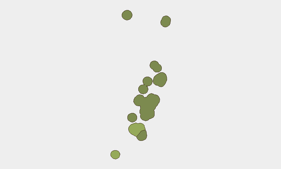
Tongatapu (risk score 45) dominates the threat landscape as the political, economic, and population center; Nuku'alofa concentration of government, port, and commercial activity creates density and visibility. Vavaʻu (28) and Haʻapai (22) present secondary risk, likely reflecting maritime activity, remoteness, and limited law enforcement resources. ʻEua and Ongo Niua remain peripheral. Risk drivers in Tongatapu are structural (political transitions, informal economy, historical labor and civil unrest patterns since 2006) rather than acute; all island groups face natural hazard exposure (seismic, tsunami, cyclone seasonality).
How GeoBit Would Assist
Security teams should deploy AOI Monitoring & Early Warning on Nuku'alofa and secondary ports (Neiafu, Haʻapai anchorages) to detect infrastructure disruptions, vessel activity anomalies, or civil incidents in real time. Multi-language X/Twitter, news, and Telegram OSINT with temporal and sentiment analysis will surface emerging unrest, labor action, or natural-hazard impacts before they escalate. Alternative routing and network analysis supports contingency travel and supply-chain planning if primary ports or roads are disrupted by seismic aftereffects or civil activity.
7-Day Outlook
Seismic activity in Haʻapai is unlikely to generate sustained security risk unless significant aftershocks or infrastructure damage occur; monitoring of port and airport operations for closures or delays is warranted. No indicators of imminent civil, criminal, or political escalation are evident. Risk posture remains stable; standard duty-of-care protocols (emergency contact trees, situational awareness among expat communities, liaison with local authorities) remain appropriate.
Highest-Risk Areas — Ranked
| # | State / Region | Risk |
|---|---|---|
| 1 | Tongatapu | 45 |
| 2 | Vavaʻu | 28 |
| 3 | Haʻapai | 22 |
| 4 | ʻEua | 18 |
| 5 | Ongo Niua | 12 |
Previous Daily Briefs
A new Tonga brief is written every day — each with its own risk map and downloadable CSV. Here's the last week; use the calendar to go further back.
📅 Browse every day by calendar →
Highlighted days have a brief. Tap a day for that day's map & analysis, or “csv” for that day's dataset ($5).
Atlas — our AI intelligence desk — emails them this snapshot personally. Nothing else, no list.