Situation Summary
Tunisia faces an acute infrastructure and environmental crisis driven by extended power and water outages concurrent with a severe heatwave and active wildfire season, compounding pre-existing political tensions under a state of emergency declared in 2021. While terrorism and militant activity remain endemic to border and mountain regions—particularly Médenine governorate in the southeast—the immediate threat to corporate operations stems from service disruptions, civil unrest risk during resource scarcity, and strain on medical and security services. No major new security incidents have been verified in the last 24–48 hours; however, the underlying instability from blackouts, reported civilian casualties linked to heat exposure, and ongoing civil protection operations against wildfires creates a volatile operating environment with limited early warning visibility into localized breakdown scenarios.
Key Developments
Live reporting constraints: Open-source verification of discrete, location-specific security incidents within the last 24–48 hours is currently insufficient. The closest confirmed activity falls outside this window:
- Nationwide (reported ~July 25) – Prolonged blackouts, described as exceeding one week, continue during an exceptional heatwave; media reports suggest 150–200 heat-linked civilian deaths, though authorities have not officially confirmed figures.
- Nationwide (Civil Protection summary, exact date pending verification) – 648 interventions recorded in a recent 24-hour period, including 154 firefighting operations; incident-level location data and confirmation status remain aggregated.
- Médenine governorate (ongoing) – Composite risk score of 31.3 reflects persistent terrorism/militant activity in the far southeast; no new specific incidents reported in the last 48 hours.
- Northern and central regions (Nabeul, Manouba, Kairouan; risk scores 5.1 each) – Secondary risk zones reflecting political tension and historical unrest patterns; no verified new events in the last 48 hours.
Note: The absence of new discrete incidents does not indicate safety; rather, it reflects the reporting environment. Underlying conditions—fuel/water shortages, heat stress, civil protection overload—create preconditions for rapid escalation.
Highest-Risk Areas
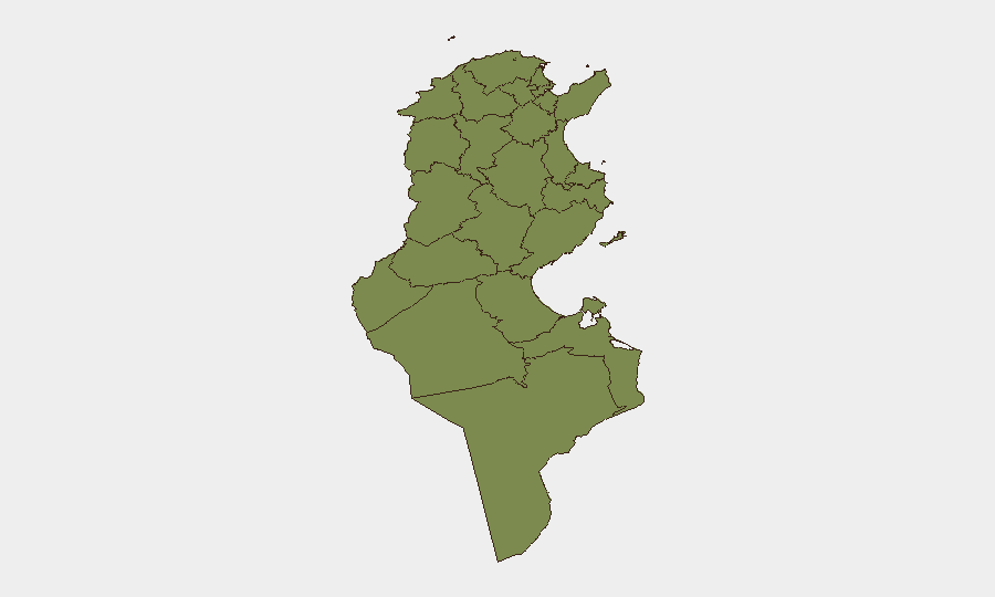
Médenine governorate (risk 5.1: 31.3) dominates the national threat profile, driven by entrenched militant and terrorism activity in remote border and mountain terrain along the Libya border. Secondary risk concentration appears in Nabeul, Manouba, and Kairouan (each 5.1), reflecting historical protest activity, labor organization, and political flashpoints; these zones warrant corporate attention not for active conflict but for demonstration and civil unrest potential during infrastructure stress. The remaining eight governorates score materially lower (1.3 each), suggesting risk is either localized or managed, though nationwide blackouts and heat events transcend regional boundaries.
How GeoBit Would Assist
Corporate security teams should deploy Area-of-Interest (AOI) Monitoring & Early Warning on Médenine, Nabeul, and Manouba to detect protest formation, roadblocks, or militant activity before operational impact; pair this with X/Twitter and Telegram OSINT focused on labor unions, civil society, and regime-aligned accounts for sentiment shifts around blackout duration and resource allocation. Routing & Network Analysis tools enable identification of alternative supply chains and personnel movement corridors around affected infrastructure nodes, reducing exposure to checkpoint or unrest-disrupted primary routes. Conflict & Military tracking of border activity near Libya remains relevant for long-term terrorism risk contextualization.
7-Day Outlook
Extended blackouts and water scarcity are forecast to persist through early August absent rapid infrastructure repair; cumulative heat stress and potential fuel shortages increase civilian unrest and protest risk in urban centers. Wildfire operations will likely continue to strain civil protection capacity and draw security resources away from urban policing, creating secondary vulnerability windows. Escalation vectors include labor action in energy/water sectors or demonstrations in Tunis; de-escalation hinges on rapid service restoration or official communication managing expectations.
Highest-Risk Areas — Ranked
| # | State / Region | Risk |
|---|---|---|
| 1 | Médenine | 31.3 |
| 2 | Nabeul | 5.1 |
| 3 | Manouba | 5.1 |
| 4 | Kairouan | 5.1 |
| 5 | Tataouine | 1.3 |
| 6 | Monastir | 1.3 |
| 7 | Sfax | 1.3 |
| 8 | Mahdia | 1.3 |
| 9 | Jendouba | 1.3 |
| 10 | Béja | 1.3 |
| 11 | Bizerte | 1.3 |
| 12 | Ariana | 1.3 |
Sources
Previous Daily Briefs
A new Tunisia brief is written every day — each with its own risk map and downloadable CSV. Here's the last week; use the calendar to go further back.
📅 Browse every day by calendar →
Highlighted days have a brief. Tap a day for that day's map & analysis, or “csv” for that day's dataset ($5).
Atlas — our AI intelligence desk — emails them this snapshot personally. Nothing else, no list.