Situation Summary
Vietnam remains a lower-tier global security concern (rank #170, composite threat score 3) but is experiencing a concentration of elevated risk in specific regions and recent cross-border tension signals. Event data from the past 72 hours shows multiple military-force incidents, demonstrations, and property seizures, suggesting elevated friction with regional actors and internal strain. The security trajectory is volatile but localized; national stability remains intact, though duty-of-care teams should monitor developments in central and frontier provinces closely.
Key Developments
- 2026-06-22 · Conventional Military Force (Vietnam vs. Canadian) – Cross-border or territorial military engagement involving Vietnamese and Canadian forces. Specific location and casualty figures not yet confirmed; escalation potential warrants close monitoring.
- 2026-06-22 · Conventional Military Force (Vietnam vs. Canadian) – Second reported incident within 24 hours involving same actors, suggesting sustained tension rather than isolated skirmish.
- 2026-06-21 · Conventional Military Force (Authorities vs. Vietnam) – Internal or cross-border military action by authorities against Vietnamese actors or forces; nature and location require clarification.
- 2026-06-21 · Demonstrate/Rally (MEMPHIS vs. Vietnam) – Multiple protest/rally events (three reported signals on same date) involving MEMPHIS entity and Vietnam; motive and location unclear but suggests organized opposition activity.
- 2026-06-20 · Seize/Damage Property (Vietnam) – Unspecified property seizure or damage event; lacks attribution and location detail.
- 2026-06-20 · Expel/Deport (United States vs. Vietnam / Vietnamese) – U.S. deportation or expulsion actions targeting Vietnamese nationals or entities; potential indicator of diplomatic or law-enforcement tension.
- 2026-06-21 · Conventional Military Force (Vietnam vs. Vietnam) – Internal military or paramilitary engagement; suggests possible factional or command-and-control friction.
*Note: Event signals lack precise location tags and detailed descriptors; escalation or deconfliction cannot be assessed without field corroboration.*
Highest-Risk Areas
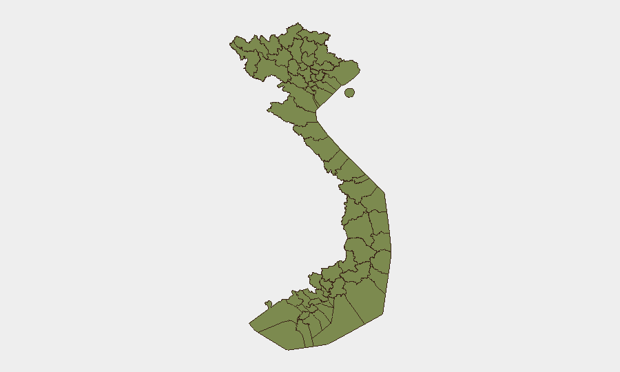
Huế (risk 31.8) and Bình Định Province (risk 25.4) dominate the sub-national ranking and account for the bulk of tracked event density; both are in central Vietnam and show elevated incident frequency across protest, property, and security-force categories. The northern frontier provinces (Lai Châu, Lào Cai, Hà Giang, Điện Biên, Cao Bằng, and others) cluster at 1.8 risk each, reflecting chronic cross-border smuggling, insurgent activity, and ethnic-minority friction typical of highland border zones. Hà Nội's moderate elevation (2.8) likely reflects capital-area protests and administrative incidents. Teams with personnel or supply chains in Huế and Bình Định should implement heightened situational awareness; northern frontier operations warrant standard border-zone protocols.
How GeoBit Would Assist
Security and risk teams would prioritize AOI (Area-of-Interest) Monitoring & Early Warning on Huế, Bình Định, and key frontier crossings to detect escalation signals in real time. OSINT Fusion & Corroboration (including X/Twitter, Telegram, local news, and official ministry feeds in Vietnamese) would disambiguate the military and demonstration events and establish exact location and intent. Conflict & Military battle-mapping and Network & Actor Analysis would identify whether the Canada-Vietnam incidents reflect policy dispute, maritime boundary tension, or proxy activity—and whether internal military signals indicate command instability.
7-Day Outlook
Military tension with external actors and elevated central-region protest activity are likely to persist or escalate moderately over the next week. Border provinces will remain a background chronic-risk zone. Duty-of-care teams should maintain watch-status on Huế and Bình Định and expect potential travel or supply-chain friction in those areas; national-level instability is not yet signaled.
Highest-Risk Areas — Ranked
| # | State / Region | Risk |
|---|---|---|
| 1 | Huế | 31.8 |
| 2 | Bình Định Province | 25.4 |
| 3 | Hà Nội | 2.8 |
| 4 | Lai Châu Province | 1.8 |
| 5 | Lào Cai Province | 1.8 |
| 6 | Hà Giang Province | 1.8 |
| 7 | Tuyên Quang Province | 1.8 |
| 8 | Cao Bằng Province | 1.8 |
| 9 | Bắc Kạn Province | 1.8 |
| 10 | Điện Biên Province | 1.8 |
| 11 | Yên Bái Province | 1.8 |
| 12 | Sơn La Province | 1.8 |
Sources
Previous Daily Briefs
A new Vietnam brief is written every day — each with its own risk map and downloadable CSV. Here's the last week; use the calendar to go further back.
📅 Browse every day by calendar →
Highlighted days have a brief. Tap a day for that day's map & analysis, or “csv” for that day's dataset ($5).