Situation Summary
Zimbabwe remains a composite threat level 7 (global rank #117) with 315 tracked events, reflecting a moderately stable but fragmented security landscape dominated by localized risks in the capital. Harare's threat score (31.5) substantially exceeds all other provinces, indicating concentrated vulnerability to civil friction, political messaging, and institutional tensions. The broader country outside Harare presents minimal acute risk, though climate vulnerability (El Niño preparedness) and systemic economic constraints warrant ongoing monitoring.
Key Developments
No reliably documented security or civil-unrest incidents occurred in Zimbabwe during the 24–48 hour window (5–7 July 2026). Open-source reporting and accessible social streams yielded no corroborated reports of protests, arrests, violent crime spikes, infrastructure disruption, or armed conflict with specific incident dates in this period.
Recent activity signals in the GeoBit platform (dated 5–7 July) reference military mobilization, unconventional violence indicators, resident demands, and police-related statements—all flagged from Harare—but underlying incident narratives lack independent cross-confirmation or clear time-stamping in open sources. Until escalation or secondary reporting surfaces, these remain uncorroborated alert signals rather than confirmed events.
Contextually (not current): President Mnangagwa addressed ZANU–PF's National Consultative Assembly on 6 July, reaffirming party unity and citing Zimbabwe's upcoming UN Security Council seat and COMESA chairmanship; this political messaging carried no attached reports of protests or security incidents. Prison authorities announced (6 July, via social media) a policy shift permitting temporary inmate leave for family events—a penal reform with no reported security breach.
Highest-Risk Areas
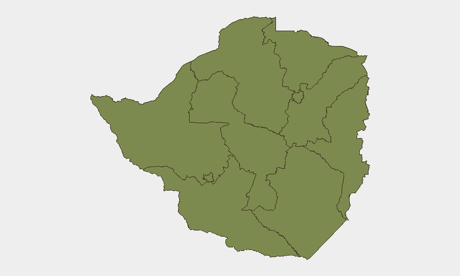
Harare dominates the sub-national risk profile with a score 3.8× higher than Midlands Province (8.1), the second-ranked region. This concentration reflects the capital's density of political institutions, commercial activity, security-force presence, and historical friction between state actors, business, and resident populations. Midlands Province (Gweru, Kwekwe industrial corridor) carries secondary risk tied to economic stress and labor-related tensions. All remaining provinces score ≤2.1, indicating minimal acute conflict or instability drivers.
Duty-of-care teams with personnel or assets in Harare should maintain heightened situational awareness; those elsewhere in Zimbabwe face routine crime and infrastructure constraints rather than political or civil-unrest risk.
How GeoBit Would Assist
Security and risk teams should deploy AOI Monitoring & Early Warning on Harare (and secondary focus on Midlands) to capture emerging protest, political violence, or institutional friction signals in real time. OSINT Fusion & Corroboration (X/Twitter, Telegram, local news aggregation, and multi-language search) will disambiguate uncorroborated platform alerts from genuine incidents, reducing false escalation. Routing & Network Analysis can pre-identify alternative travel corridors and safe zones should civil unrest spike unexpectedly in the capital.
7-Day Outlook
Near-term trajectory remains stable absent external shocks. Harare's persistent institutional and commercial friction will likely generate continued low-level political rhetoric and sporadic protest signaling, but no imminent civil breakdown is indicated. Monitor for any escalation in the uncorroborated Harare signals flagged on 7 July; cross-confirmation within 48–72 hours will clarify whether these represent genuine incidents or platform noise.
Highest-Risk Areas — Ranked
| # | State / Region | Risk |
|---|---|---|
| 1 | Harare | 31.5 |
| 2 | Midlands Province | 8.1 |
| 3 | Manicaland Province | 2.1 |
| 4 | Mashonaland West Province | 1.5 |
| 5 | Matabeleland South Province | 1.5 |
| 6 | Masvingo Province | 1.5 |
| 7 | Matabeleland North Province | 1.5 |
| 8 | Bulawayo Province | 1.5 |
| 9 | Mashonaland Central Province | 1.5 |
| 10 | Mashonaland East Province | 1.5 |
Sources
Previous Daily Briefs
A new Zimbabwe brief is written every day — each with its own risk map and downloadable CSV. Here's the last week; use the calendar to go further back.
📅 Browse every day by calendar →
Highlighted days have a brief. Tap a day for that day's map & analysis, or “csv” for that day's dataset ($5).
Atlas — our AI intelligence desk — emails them this snapshot personally. Nothing else, no list.