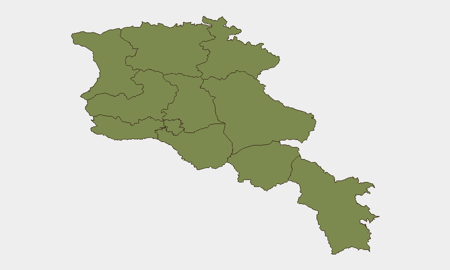
Situation Summary
Armenia remains at moderate composite threat level (28/100) with concentrated risk in Yerevan, where political tensions, detention-related friction, and violent crime are intersecting. Provincial areas show uniformly low baseline risk (1.3 each), but recent incidents—including a wolf attack in Syunik and food-safety concerns in Armavir—reflect localized physical-safety and public-health vulnerabilities. The security environment is characterized by political strain over proposed transit corridors, ongoing detention controversies, and sporadic violent crime rather than large-scale conflict or systematic instability.
Key Developments
- Yerevan, 20–22 July (ongoing investigation as of 24 July): Armed shooting and grenade attack in central Yerevan resulted in one fatality and one serious injury; one suspect detained. Investigation remains active and risk of copycat incidents or related violence persists in downtown zones.
- Yerevan, 23–24 July: Detained opposition figure Andranik Tevanyan experienced acute health deterioration during medical examination, triggering concern among opposition networks and raising protest-mobilization risk in the capital.
- Yerevan, 21–24 July: Armenia's Justice Ministry publicly criticized the proposed U.S.-led transit corridor to Azerbaijan as violating Armenian law, intensifying sovereignty-centered political debate and protest risk around government/diplomatic facilities.
- Syunik Province (southern village), 23–24 July: Wolf attack injured six people, including a child; video documentation and medical treatment required. Reflects rural security and wildlife-management gaps in remote areas.
- Armavir Province, 23–24 July: Nine residents sought medical care for suspected food poisoning from donuts and lahmajo; Armenia's Food Safety Inspectorate opened investigation. Local public-health infrastructure strain evident.
- Yerevan and border zones, updated 23–24 July: Current advisories flag ongoing protest activity risk near government and embassy zones; Armenia–Azerbaijan border checkpoints remain volatile with potential for rapid closures and cross-border disruptions, though no new large-scale clashes reported.
- Yerevan, 24 July: Amnesty International and Azerbaijan each issued detention-related statements; U.S. issued public statement regarding Armenia. Elevated diplomatic messaging around rule-of-law and detention practices.
Highest-Risk Areas
Yerevan dominates the risk profile (31.3) due to concentration of violent crime, political tension, and detention-related friction. All other provinces cluster at 1.3, indicating that security variance is primarily urban (capital) rather than geographical. The gap between Yerevan and provincial areas reflects the city's role as the center of political mobilization, law enforcement activity, and opposition discourse; rural areas face discrete public-health and wildlife incidents but lack the systemic protest or crime-driven volatility of the capital.
How GeoBit Would Assist
Security teams would employ Intel Sweep and multi-language OSINT (X/Telegram) to monitor opposition statements and detention-related messaging for signs of escalating protest organization. AOI Monitoring with alerting on Yerevan government and diplomatic zones would provide early warning of gatherings or civil unrest. Conflict and regime-stability search, combined with entity and sentiment analysis, would track judicial, political, and border-control friction points that could accelerate into travel disruption or security incidents.
7-Day Outlook
Political and legal tensions around detention practices and transit-corridor sovereignty are likely to sustain low-level protest activity and diplomatic friction through early August. Yerevan remains the primary risk concentration; provincial incidents appear isolated rather than coordinated. No imminent large-scale conflict is signaled, but rapid escalation around border checkpoints or opposition mobilization remains possible if detention conditions worsen or sovereignty disputes sharpen.
Highest-Risk Areas — Ranked
| # | State / Region | Risk |
|---|---|---|
| 1 | Yerevan | 31.3 |
| 2 | Lori Province | 1.3 |
| 3 | Tavush Province | 1.3 |
| 4 | Kotayk Province | 1.3 |
| 5 | Ararat Province | 1.3 |
| 6 | Gegharkunik Province | 1.3 |
| 7 | Vayots Dzor Province | 1.3 |
| 8 | Syunik Province | 1.3 |
| 9 | Shirak Province | 1.3 |
| 10 | Aragatsotn Province | 1.3 |
| 11 | Armavir Province | 1.3 |
Sources
Previous Daily Briefs
A new Armenia brief is written every day — each with its own risk map and downloadable CSV. Here's the last week; use the calendar to go further back.
📅 Browse every day by calendar →
Highlighted days have a brief. Tap a day for that day's map & analysis, or “csv” for that day's dataset ($5).
Atlas — our AI intelligence desk — emails them this snapshot personally. Nothing else, no list.