Situation Summary
Bahrain faces an acute and active security emergency following Iranian ballistic missile and armed-drone attacks on 7–8 July 2026, the latest in a series of strikes since earlier in the year. Air-raid warnings were activated kingdom-wide; residential structures sustained damage, though Bahrain's Defense Force reported interception of multiple threats and no confirmed casualties. The attacks occur within a wider U.S.–Iran confrontation, with Iran claiming to have targeted U.S. military installations in Bahrain and Kuwait; the formal UN Security Council session convened on 8 July underscores the escalatory trajectory and international dimensions of the risk.
Key Developments
- Kingdom-wide, 7–8 July 2026: Bahrain's Ministry of Interior activated air-raid warnings and emergency shelter procedures across all governorates following confirmation of incoming Iranian missile and drone attacks on civilian and critical-infrastructure targets.
- Manama (residential), overnight 7–8 July 2026: A residential building sustained damage from Iranian aerial threats; Bahrain Defense Force reported successful interception of multiple ballistic missiles and armed drones with no casualties recorded.
- Manama, morning 8 July 2026: Bahrain formally requested an emergency UN Security Council meeting and tabled a draft resolution condemning Iranian attacks on Bahrain and six other Arab states; the Council convened to address the ongoing Iran–U.S. confrontation and regional security.
- U.S. military installations, night 7–8 July 2026: Iran claimed strikes on U.S. military sites in Bahrain and Kuwait; U.S. officials reported no casualties or damage to U.S. installations in Bahrain from the latest Iranian attacks.
- UN briefing, 7–8 July 2026: Civil-defense measures remain activated kingdom-wide; international assessments indicate the U.S.–Iran ceasefire framework is under significant pressure due to recent missile and drone activity in the Gulf.
Highest-Risk Areas
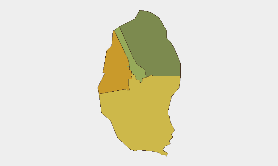
The Northern Governorate (risk 72) and Southern Governorate (risk 68) present substantially elevated threat profiles, likely driven by proximity to contested maritime zones, historical protest activity, and infrastructure concentration. The Capital Governorate (risk 45), encompassing Manama, faces direct exposure to ongoing Iranian aerial threats and hosts critical government, diplomatic, and U.S. military assets. Muharraq Governorate (risk 38) remains elevated given port infrastructure and civilian density. Current events indicate that air-based threats transcend sub-national boundaries; all population centers require active monitoring.
How GeoBit Would Assist
Security teams should deploy AOI Monitoring & Early Warning on critical infrastructure, residential clusters, and U.S. installations across all four governorates to detect incoming missile/drone activity and shelter-activation events in real time. Conflict & Military capabilities—including force structure, weapons-capability tracking, and battle-mapping—enable tracking of Iranian and Bahraini Defense Force operational patterns and threat vectors. OSINT fusion and multi-language search across X/Twitter, Telegram, and local broadcast feeds provide early signals of escalation or civil-protection directives before official announcements, allowing duty-of-care teams to brief personnel and adjust movement protocols.
7-Day Outlook
Absent a negotiated de-escalation or U.S.–Iran ceasefire restoration, repeat Iranian strikes on Bahrain remain probable within the next 7 days. Shelter-in-place and movement restrictions should be anticipated; U.S. military installations and government facilities will likely remain primary target sets. Corporate teams with personnel in Manama and the Capital Governorate should maintain heightened readiness for rapid shelter procedures and potential evacuation activation.
Highest-Risk Areas — Ranked
| # | State / Region | Risk |
|---|---|---|
| 1 | Northern Governorate | 72 |
| 2 | Southern Governorate | 68 |
| 3 | Capital Governorate | 45 |
| 4 | Muharraq Governorate | 38 |
Sources
Previous Daily Briefs
A new Bahrain brief is written every day — each with its own risk map and downloadable CSV. Here's the last week; use the calendar to go further back.
📅 Browse every day by calendar →
Highlighted days have a brief. Tap a day for that day's map & analysis, or “csv” for that day's dataset ($5).
Atlas — our AI intelligence desk — emails them this snapshot personally. Nothing else, no list.