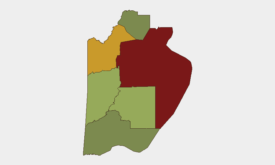
Situation Summary
Belize remains a moderate-risk environment with composite threat score 14, concentrated in urban centers and gang-affected districts. A nationwide internet outage affecting multiple regions was reported on 2026-07-25, indicating potential infrastructure vulnerability but with no confirmed malicious cause. Ongoing gang violence and crime patterns, particularly in Belize City and Orange Walk District, continue to drive risk; no major new security incidents or policy shifts were verified in the last 24–48 hours beyond the communications disruption.
Key Developments
- Nationwide · 2026-07-25: Intermittent internet outages reported across multiple regions of Belize; cause unconfirmed. Impact on business continuity and emergency communications warrants monitoring.
- Belize City · Pre-2026-07-24: Gang-related violence and state of emergency operations remain active but no new incidents timestamped in the last 48 hours; broader context of elevated violence in mid-July prompted intensified crackdown operations.
- Multiple Government Agencies · 2026-07-25 to 2026-07-26: Series of public statements from Belize Ministry, Immigration Ministry, and related agencies recorded but substantive content/subject matter not yet detailed in available open-source reporting.
Highest-Risk Areas
Belize District (risk 95) and Orange Walk District (risk 72) dominate the threat landscape, driven by gang competition, drug trafficking, and street-level violence concentrated in Belize City and northern urban corridors. Cayo District (risk 58) poses secondary risk, primarily due to drug-trafficking activity and border proximity. Stann Creek, Toledo, and Corozal districts carry substantially lower risk profiles. Corporate and operational presence in Belize City, Belmopan, and Orange Walk Town should assume elevated baseline threat posture and maintain contingency protocols.
How GeoBit Would Assist
Teams with personnel or assets in Belize should deploy AOI Monitoring & Early Warning on high-risk districts (Belize City, Orange Walk) to receive real-time alerts on violence, gang activity, or infrastructure disruptions. Intel Sweep and global event feeds provide continuous monitoring of gang operations, cartel activity, and government enforcement responses; multi-language OSINT and Telegram/X intelligence capture local threat narratives and emerging incidents before mainstream reporting. Routing & Network Analysis enables identification of secure transit corridors in Belize City and alternative supply-chain routes around gang-controlled zones during periods of heightened unrest.
7-Day Outlook
Internet infrastructure stability should be monitored; if outages recur or expand, contingency communications systems (satellite phones, offline data) may be necessary for critical operations. Gang violence risk in Belize City and Orange Walk remains elevated but stable absent new triggers; government crackdown operations are ongoing. No significant policy, political, or cross-border developments are forecast to materially alter the security baseline in the next seven days, though localized incidents remain probable in high-risk districts.
Highest-Risk Areas — Ranked
| # | State / Region | Risk |
|---|---|---|
| 1 | Belize District | 95 |
| 2 | Orange Walk District | 72 |
| 3 | Cayo District | 58 |
| 4 | Stann Creek District | 48 |
| 5 | Toledo District | 35 |
| 6 | Corozal District | 22 |
Sources
Previous Daily Briefs
A new Belize brief is written every day — each with its own risk map and downloadable CSV. Here's the last week; use the calendar to go further back.
📅 Browse every day by calendar →
Highlighted days have a brief. Tap a day for that day's map & analysis, or “csv” for that day's dataset ($5).
Atlas — our AI intelligence desk — emails them this snapshot personally. Nothing else, no list.