Situation Summary
Canada maintains a composite threat score of 6 (rank #100 globally) with 442 tracked events, reflecting a moderate and fragmented security environment dominated by localized law-enforcement incidents rather than systemic national crisis. Ontario's disproportionate risk score (31.6) is being driven by active violent crime, institutional security breaches, and cross-border enforcement activity concentrated in the Greater Toronto Area and Detroit–Windsor corridor. The security posture is characterized by reactive institutional responses to contraband interdiction and armed-crime investigations rather than proactive strategic threats, though cyber-fraud exposure via third-party financial-data breaches is expanding the risk surface for civilian and corporate entities.
Key Developments
- North York, Toronto, Ontario – June 16, 2026: Toronto Police Emergency Task Force officer fatally shot during execution of search warrants at a high-rise related to March U.S. Consulate shooting investigation; second armed suspect remains at large and designated dangerous, triggering active manhunt and sustained police presence in residential/commercial zones.
- Detroit–Windsor Border Crossing – June 16, 2026: U.S. Customs and Border Protection and Homeland Security Investigations confirmed cross-border incident under active investigation, signaling elevated scrutiny at the corridor and potential delays or enhanced screening for commercial and personnel transit.
- Saskatchewan Penitentiary, Prince Albert – June 16, 2026: Correctional Service Canada reported multi-item contraband seizure (drugs, weapons) in enforcement action; no escapes or injuries reported but underscores institutional security vulnerabilities across federal corrections system.
- TransUnion Data Breach – June 16, 2026: Major third-party application vulnerability exposed consumer financial data; Canadians confirmed among affected parties, elevating identity-theft and cyber-fraud risk for individuals and institutions dependent on credit-reporting and financial-services infrastructure.
- Federal Facility Enforcement Actions – June 16, 2026: Government of Canada issued updated advisories on ongoing security operations across federal institutions, reflecting continued focus on contraband and unauthorized items in correctional and administrative facilities.
- Russia Sanctions Update – June 16, 2026: Global Affairs Canada reaffirmed restrictive measures under Special Economic Measures Act; relevant to entities with Russia-linked supply chains, financial exposure, or personnel in sanctions-affected sectors.
Highest-Risk Areas
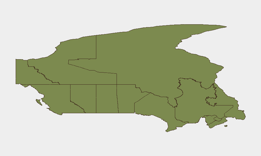
Ontario accounts for 75% of the country's tracked threat events, with Toronto–York and Ottawa corridors serving as epicenters for violent crime, institutional security incidents, and cross-border law-enforcement operations. British Columbia (16.7) and Nunavut (12.5) follow distantly but persistently, with BC linked to ongoing border and transnational crime activity. Risk is concentrated in major urban centers and federal infrastructure rather than distributed across rural or remote regions, making corporate presence in Ontario and southern BC the primary exposure vector for Canadian operations.
How GeoBit Would Assist
Corporate security teams should deploy AOI Monitoring & Early Warning on Toronto-York precincts and the Detroit–Windsor corridor to receive real-time alerting on police operations, armed-suspect activity, and border-crossing incidents affecting personnel and supply chains. OSINT Fusion & Corroboration (X, Telegram, police scanner intelligence, and local news feeds) will disambiguate enforcement actions from operational threats and flag emerging manhunts or institutional breaches. Routing & Network Analysis should be applied to personnel and logistics transiting Ontario and BC to identify dynamic alternative routes during active incidents.
7-Day Outlook
The Toronto manhunt and border-crossing investigation are likely to remain active and disruptive through the near term, with sustained police presence affecting downtown and midtown accessibility. Institutional security incidents (prisons, federal facilities) will continue as routine enforcement actions; no escalation to systemic failure is indicated. Cross-border trade and personnel movement should expect elevated friction at Detroit–Windsor; alternative crossings may see temporary demand spikes.
Highest-Risk Areas — Ranked
| # | State / Region | Risk |
|---|---|---|
| 1 | Ontario | 31.6 |
| 2 | British Columbia | 16.7 |
| 3 | Nunavut | 12.5 |
| 4 | Quebec | 8.4 |
| 5 | Alberta | 4.3 |
| 6 | Manitoba | 3.8 |
| 7 | New Brunswick | 2.7 |
| 8 | Prince Edward Island | 2.5 |
| 9 | Saskatchewan | 2.1 |
| 10 | Newfoundland and Labrador | 1.9 |
| 11 | Northwest Territories | 1.8 |
| 12 | Yukon | 1.6 |
Sources
Previous Daily Briefs
A new Canada brief is written every day — each with its own risk map and downloadable CSV. Here's the last week; use the calendar to go further back.
📅 Browse every day by calendar →
Highlighted days have a brief. Tap a day for that day's map & analysis, or “csv” for that day's dataset ($5).