Situation Summary
Cyprus remains a low-to-moderate threat environment (global rank #79, composite score 16) with no credible security incidents, civil unrest, infrastructure failures, or official travel warnings reported in the last 48 hours. The security picture is dominated by routine diplomatic friction—primarily Cyprus–Turkey maritime and airspace disputes spanning March–May 2026—and baseline geopolitical tension rather than acute on-ground risk. Nicosia carries significantly elevated risk (31.8) relative to other districts, though the drivers remain political rather than active violence.
Key Developments
- No verified security incidents reported in Cyprus in the last 24–48 hours. Web research confirms absence of credible reports of criminal activity, accidents, strikes, infrastructure failures, or new travel advisories.
- Cyprus–Turkey maritime/airspace tensions (March–May 2026, ongoing context). Cyprus filed UN protest over repeated Turkish airspace and maritime-zone incursions; no new incidents in this dispute logged in the last two days, but file remains a diplomatic flashpoint.
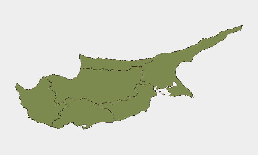
- Nicosia remains the focal point of elevated risk. District risk score of 31.8 significantly outpaces all other regions (Paphos 8.4; Larnaca, Limassol 2.9 each; Kyrenia, Famagusta 1.8 each). Risk drivers are political/diplomatic rather than criminal or kinetic.
- UNFICYP operations and routine UN activity continue. No change to UN peacekeeping posture or incident reporting from the buffer zone in the last 48 hours.
- RAF Akrotiri baseline activity nominal. Unconfirmed social media reference to sirens at the base (source, date, and corroboration unclear) does not meet incident threshold; no official UK or Cyprus military alert issued.
Highest-Risk Areas
Nicosia's risk score (31.8) is nearly four times higher than Paphos (8.4) and substantially exceeds all other districts. Risk is driven by political concentration—the capital hosts government, media, diplomatic activity, and the UN buffer-zone administration—rather than active criminal networks or violence. Paphos and the southern coastal cities (Larnaca, Limassol) carry minimal residual risk. Northern districts (Kyrenia, Famagusta) remain lowest-risk, though they remain under Turkish-occupied administration and fall outside Cyprus government control. For corporate teams, Nicosia warrants elevated situational awareness and liaison with local authorities and diplomatic networks; southern coastal zones are suitable for routine operations.
How GeoBit Would Assist
Security teams monitoring Cyprus should deploy AOI Monitoring & Early Warning on Nicosia and border/buffer-zone crossings to detect shifts in political activity, protest mobilization, or unauthorized military movement. Intel Sweep and multi-language OSINT (X/Twitter, Telegram, local media, Greek and Turkish sources) provide real-time detection of diplomatic escalation, rhetoric shifts, or civil unrest before mainstream reporting. Routing & Network Analysis can model safe travel corridors and alternative routes in and out of Nicosia and identify chokepoints during potential political disruption.
7-Day Outlook
No significant change to the current risk profile is anticipated. Cyprus–Turkey maritime tensions will likely remain diplomatic in character absent a triggering incident. Nicosia will continue to carry elevated political-risk weighting; corporate activity in the capital should maintain standard due-diligence protocols and local liaison. Southern and coastal zones remain suitable for normal operations.
Highest-Risk Areas — Ranked
| # | State / Region | Risk |
|---|---|---|
| 1 | Nicosia | 31.8 |
| 2 | Paphos | 8.4 |
| 3 | Larnaca | 2.9 |
| 4 | Limassol | 2.9 |
| 5 | Kyrenia | 1.8 |
| 6 | Famagusta | 1.8 |
Sources
Previous Daily Briefs
A new Cyprus brief is written every day — each with its own risk map and downloadable CSV. Here's the last week; use the calendar to go further back.
📅 Browse every day by calendar →
Highlighted days have a brief. Tap a day for that day's map & analysis, or “csv” for that day's dataset ($5).