Situation Summary
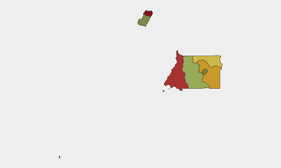
Equatorial Guinea remains stable with no credible security incidents reported in the last 24–48 hours. The country ranks #147 globally on GeoBit's composite threat index (score 5), reflecting low-to-moderate baseline risk. Sub-national variation is pronounced: Bioko Norte and Litoral Province carry elevated risk profiles (85 and 78 respectively), while southern and island provinces remain substantially lower-risk. The overall security environment shows no signs of acute deterioration.
Key Developments
No discrete security, civil-unrest, conflict, crime, or infrastructure incidents have been corroborated for Equatorial Guinea in the 24–48 hour window of 11–13 July 2026. Indexed web research across international news outlets, regional security feeds, and open-source social platforms returned no time-stamped reports meeting analytical thresholds for inclusion in this brief. Shipping and energy-sector commentary occasionally references Equatorial Guinea in sanctions or commodity-market contexts, but does not indicate in-country security events.
Highest-Risk Areas
Bioko Norte and Litoral Province are the primary drivers of sub-national risk, with composite scores of 85 and 72 respectively. Both regions carry historical vulnerabilities related to maritime activity, port operations, and border proximity to Cameroon; smuggling, organized crime, and occasional cross-border tensions remain baseline concerns in these zones. Wele-Nzas Province (risk 72) shares similar border-security dynamics with Cameroon and Gabon. By contrast, Bioko Sur, Djibloho, and Annobón Province present substantially lower operational risk and are suitable for standard duty-of-care protocols.
How GeoBit Would Assist
AOI Monitoring & Early Warning would provide persistent watch on Bioko Norte and Litoral Province, alerting security teams to emerging civil unrest, port disruptions, or criminal activity before they escalate. OSINT Fusion & Corroboration (multi-language search, X/Telegram intelligence, and event-feed analysis) ensures rapid detection of any new incidents while filtering noise and false reports. Routing & Network Analysis supports alternative journey planning and supply-chain resilience planning for teams or assets operating in higher-risk northern provinces. For maritime and energy assets, Maritime Tracking paired with Economic & Trade intelligence enables real-time visibility into shipping, sanctions compliance, and port-state control risk.
7-Day Outlook
No acute destabilizers are evident on the near-term horizon. The security posture is expected to remain stable, with baseline risk concentrated in northern maritime and border zones. Teams should maintain standard duty-of-care monitoring of Bioko Norte and Litoral Province and remain alert to any cross-border dynamics with Cameroon, but no escalation is anticipated within the next seven days absent major external shocks.
Highest-Risk Areas — Ranked
| # | State / Region | Risk |
|---|---|---|
| 1 | Bioko Norte | 85 |
| 2 | Litoral Province | 78 |
| 3 | Wele-Nzas Province | 72 |
| 4 | Kié-Ntem Province | 68 |
| 5 | Centro Sur Province | 45 |
| 6 | Bioko Sur | 38 |
| 7 | Djibloho | 15 |
| 8 | Annobón Province | 8 |
Sources
Previous Daily Briefs
A new Equatorial Guinea brief is written every day — each with its own risk map and downloadable CSV. Here's the last week; use the calendar to go further back.
📅 Browse every day by calendar →
Highlighted days have a brief. Tap a day for that day's map & analysis, or “csv” for that day's dataset ($5).
Atlas — our AI intelligence desk — emails them this snapshot personally. Nothing else, no list.