Situation Summary
Guatemala remains a mid-tier security concern globally (rank #55, composite threat score 35) with 74 tracked events in the current monitoring window. Recent activity signals institutional strain—including high-court disapproval, presidential public statements, military investigations, and school-related disputes—alongside isolated incidents of small-arms combat and police gang enforcement. The security environment is fragmented by region, with Alta Verapaz presenting significantly elevated risk compared to other departments, suggesting localized rather than nationwide instability.
Key Developments
- 2026-07-02 · Presidential Public Statement: Government issued a public statement; no geographic specificity available from current data. Timing and subject matter require clarification via direct source verification.
- 2026-07-02 · Government vs. Japan Statement: Public diplomatic communication issued; context and location unclear from available signals.
- 2026-07-01 · Military Investigation: President initiated investigation against military; indicates internal institutional tension but no immediate operational impact confirmed.
- 2026-07-01 · Ministry Blockade: Ministry-level blockade action reported; specific location and scope require confirmation.
- 2026-07-01 · Guatemala vs. Banking Sector: Public dispute between government and financial institution; economic impact potential but no imminent disruption to operations reported.
- 2026-06-30 · Small-Arms Combat (Indigenous vs. State): Armed engagement reported between indigenous groups and Guatemalan state forces; location not specified but consistent with historical Alta Verapaz tensions.
- 2026-06-30 · Police Gang Enforcement: Police conducted arrest/detention operation against gang actors; part of routine law-enforcement activity.
Note: Live web research did not yield independently verifiable incident reporting in the last 24–48 hours. Event signals above derive from GeoBit's tracked event feed; independent confirmation is advised before operational response.
Highest-Risk Areas
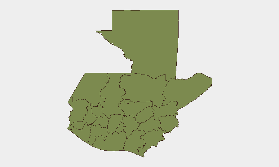
Alta Verapaz dominates the risk landscape with a composite score of 31.5—more than 80% higher than the next-tier departments (Chimaltenango and Guatemala Department, each 17.2). This disparity reflects a pattern of armed group activity, indigenous-state tensions, and localized conflict that persists in that region. Chimaltenango and Guatemala Department (which includes Guatemala City) carry secondary but meaningful risk, likely driven by urban gang presence, organized-crime activity, and periodic protest action. All other departments fall to minimal risk (1.5–2.8), suggesting risk concentration rather than nationwide instability.
How GeoBit Would Assist
Security teams should employ AOI Monitoring & Early Warning focused on Alta Verapaz, with persistent watch on Chimaltenango and Guatemala Department urban corridors to detect escalation in real time. Network & Actor Analysis paired with Intel Sweep (X/Twitter, Telegram, multi-language OSINT) would disambiguate the institutional disputes (court, military, government) now showing in event signals and clarify links to operational risk. Conflict & Military force-structure tracking and GIS & Spatial Analysis would enable route-planning and facility-risk assessment, particularly for personnel transit through or near Alta Verapaz.
7-Day Outlook
Institutional friction (presidential-military investigation, government-banking dispute, court disapproval) is unlikely to produce acute security events in the next 7 days but signals political volatility that may affect regulatory or operational conditions. Regional risk in Alta Verapaz remains elevated and static; no triggering events have been detected that would suggest imminent escalation or de-escalation. Security posture should remain steady with heightened awareness for shifts in indigenous-state dynamics or organized-crime enforcement activity.
Highest-Risk Areas — Ranked
| # | State / Region | Risk |
|---|---|---|
| 1 | Alta Verapaz | 31.5 |
| 2 | Chimaltenango | 17.2 |
| 3 | Guatemala Department | 17.2 |
| 4 | San Marcos | 2.8 |
| 5 | Petén | 1.5 |
| 6 | Huehuetenango | 1.5 |
| 7 | Quetzaltenango | 1.5 |
| 8 | Retalhuleu | 1.5 |
| 9 | Quiché | 1.5 |
| 10 | Totonicapán | 1.5 |
| 11 | Sololá | 1.5 |
| 12 | Suchitepéquez | 1.5 |
Sources
Previous Daily Briefs
A new Guatemala brief is written every day — each with its own risk map and downloadable CSV. Here's the last week; use the calendar to go further back.
📅 Browse every day by calendar →
Highlighted days have a brief. Tap a day for that day's map & analysis, or “csv” for that day's dataset ($5).