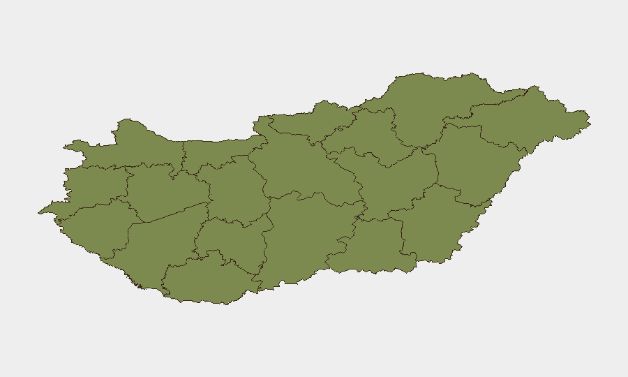
Situation Summary
Hungary remains a low-threat environment with a composite threat score of 6 (rank #126 globally) and no verified high-impact security, civil unrest, infrastructure, or travel-risk incidents in the last 24–48 hours. Recent event signals reflect political and diplomatic activity (statements by President, Attorney General, and Government; Hungary–Ukraine diplomatic rejection on 2026-07-18) rather than public disorder or organized violence. Routine crime enforcement continues across multiple counties, consistent with baseline policing activity in a stable jurisdiction.
Key Developments
- Gödöllő, Pest County (mid-July 2026, last 24–48h window): Gödöllő Police arrested a man for targeted violent assault—allegedly following an acquaintance by car, ramming her vehicle, and firing a rubber-bullet weapon. The suspect was charged and brought before court; no indication of broader unrest or random attacks.
- Budapest, Zugló XIV district (mid-July 2026): Police arrested two individuals suspected of dealing crystal methamphetamine from a flat on Tatai Street; typical urban drug-enforcement activity.
- Budapest, Zugló XIV district (mid-July 2026): Zugló police recovered a stolen vehicle and arrested the suspect (a Budapest man accused of taking his girlfriend's car from her workplace) within two days of the theft.
- Salgótarján, Nógrád County (mid-July 2026, case closure): Police quickly identified and apprehended a 36-year-old suspect in a local criminal case; routine investigation closure with no public-safety implications.
- Püspökladány, Hajdú-Bihar County (mid-July 2026): Court ordered pre-trial detention of a 27-year-old man following a multi-month criminal investigation; no links to organized violence or terrorism.
- Kiskunmajsa & Kiskunhalas, Bács-Kiskun County (mid-July 2026, case outcome): Police concluded a months-long investigation into a series of thefts, with two detained suspects facing charges related to 15 separate crimes; property-crime matter now mitigated.
- National scope (consolidated last 24–48h): Open-source and social-media monitoring confirm absence of protest, civil unrest, infrastructure failure, terror alerts, or large-scale violence across Hungary.
Highest-Risk Areas
Pest County (composite risk 31.9) and Budapest (10.3) account for the overwhelming majority of tracked risk, reflecting their status as Hungary's most densely populated and economically active regions. The concentration of police activity, routine crime enforcement, and administrative functions in these areas naturally elevates their event frequency. All other tracked counties (Zala, Komárom-Esztergom, Fejér, Nógrád, Szabolcs-Szatmár-Bereg, Vas, Győr-Moson-Sopron, Veszprém, Somogy, Baranya) register composite risk scores of 3.3 or below, indicating dispersed, low-level criminal activity with no systemic instability drivers. Risk distribution reflects standard urban–rural policing patterns rather than emerging conflict or unrest.
How GeoBit Would Assist
Security teams protecting personnel or assets in Hungary should deploy AOI (Area-of-Interest) Monitoring & Early Warning on Budapest and Pest County to detect emerging civil unrest, protests, or infrastructure disruptions in real time. OSINT Fusion & Corroboration (Twitter/Telegram, news feeds, multi-language search) provides continuous baseline assessment of political rhetoric and public sentiment, flagging any escalation in Hungary–Ukraine diplomatic tensions or domestic political instability. Risk & Threat Assessment combined with Routing & Network Analysis enables secure journey planning for personnel traveling between Budapest and regional sites, accounting for localized crime hotspots and enforcement activity.
7-Day Outlook
No significant security deterioration is anticipated over the next seven days. Political statements and diplomatic friction (Hungary–Ukraine rejection signals) remain within normal state-level discourse and carry negligible risk to corporate operations. Routine criminal enforcement will continue; organizations with personnel in Budapest and Pest should maintain standard duty-of-care protocols and situational awareness, but heightened alert postures are not warranted.
Highest-Risk Areas — Ranked
| # | State / Region | Risk |
|---|---|---|
| 1 | Pest | 31.9 |
| 2 | Budapest | 10.3 |
| 3 | Zala | 3.3 |
| 4 | Komárom-Esztergom | 1.9 |
| 5 | Fejér | 1.9 |
| 6 | Nógrád | 1.9 |
| 7 | Szabolcs-Szatmár-Bereg | 1.9 |
| 8 | Vas | 1.9 |
| 9 | Győr-Moson-Sopron | 1.9 |
| 10 | Veszprém | 1.9 |
| 11 | Somogy | 1.9 |
| 12 | Baranya | 1.9 |
Previous Daily Briefs
A new Hungary brief is written every day — each with its own risk map and downloadable CSV. Here's the last week; use the calendar to go further back.
📅 Browse every day by calendar →
Highlighted days have a brief. Tap a day for that day's map & analysis, or “csv” for that day's dataset ($5).
Atlas — our AI intelligence desk — emails them this snapshot personally. Nothing else, no list.