Situation Summary
Indonesia remains a moderate-tier global security risk (rank #47, composite score 40) with acute volatility concentrated in Papua and select urban centers. The security environment has deteriorated sharply over the past 48 hours following a fatal separatist attack on an American pilot in Papua's Yahukimo Regency, which has triggered intensified military operations and a reported displacement of approximately 122,000 civilians. Concurrent volcanic hazards across six regions (Sinabung, Marapi, Semeru, Lewotobi Laki-Laki, Ruang, Ibu) compound movement and infrastructure risks. The trajectory is worsening, with government statements confirming violence "has accelerated over the last month" and law-enforcement activity spiking across multiple domains.
Key Developments
- Papua – Yahukimo Regency, 6 July 2026. West Papua Liberation Army (TPNPB) militants attacked and burned a PT AMA aircraft at Ipdeheik airstrip (Balinggama village), fatally shooting American pilot Nicholas F. Goselin shortly after landing; seven Papuan passengers survived. Separatist channels claimed responsibility the same day; Indonesian military and civil aviation confirmed the incident.
- Papua – Yahukimo Regency, 7 July 2026. Indonesian security forces recovered the pilot's body from the attack site during follow-on military operations on Friday, signaling intensified security sweeps and potential for further clashes in the region.
- Papua Region – Multiple Regencies, 6–7 July 2026. Indonesian government reported approximately 122,000 Papuan civilians now displaced due to clashes between security forces and armed separatist groups; officials attributed displacement surge to worsened violence over the past month and at least three recent civilian deaths.
- Papua Region, 6 July 2026 (current). UK FCDO reiterated heightened security advisories against all travel to high-risk Papua areas, citing ongoing armed conflict, sporadic violence, and movement restrictions; advisory remains in force.
- East Java – Lumajang Regency (Mount Semeru), 6 July 2026 (current). Volcanic hazard zone expanded: authorities advise against travel within 5 km of crater and within 500 m of Besuk Kobokan riverbanks for 13 km downstream due to lahar and pyroclastic-flow risk.
- North Sumatra – Karo Regency (Mount Sinabung) & West Sumatra (Mount Marapi), 6 July 2026 (current). No-travel zones enforced within 5 km and 3 km respectively; ongoing instability poses eruption, ashfall, and pyroclastic-flow hazard.
- North Sulawesi (Mount Ruang), North Maluku (Mount Ibu), East Nusa Tenggara (Mount Lewotobi Laki-Laki), 6 July 2026 (current). Multi-region volcanic advisories restrict travel within 7 km of craters; enduring eruption risk and potential for rapid evacuation or air-traffic disruption.
Highest-Risk Areas
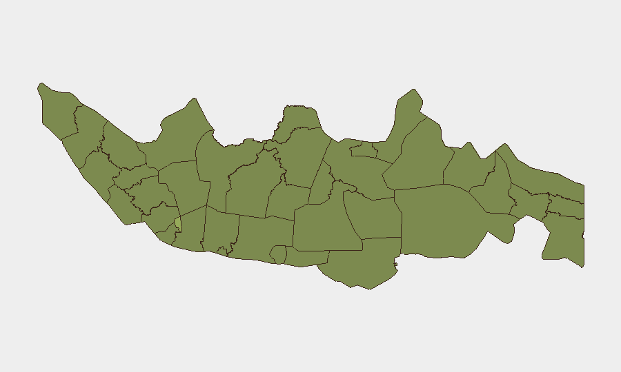
Jakarta dominates national risk (57.7), reflecting its status as the capital and primary hub for protest, political activity, and security-force concentration. Papua (34.7) has surged to critical threat level following the 6 July pilot killing and the reported 122,000-person displacement; North Sumatra (37.5) ranks second, driven by separatist activity and volcanic hazard. East Java and South Sulawesi follow, with East Java pressured by Mount Semeru and ongoing law-enforcement operations. West Java and the volcanic zones (East Nusa Tenggara, South Kalimantan) sustain elevated risk from both civil unrest and natural hazards. Together, these top-ranked regions account for the majority of recorded incidents and displacement figures.
How GeoBit Would Assist
Teams with people or assets in Indonesia should deploy AOI Monitoring & Early Warning to watch Papua (Yahukimo, Dogiyai, surrounding regencies) and volcanic zones for military operations, displacement flows, and eruption triggers. Network & Actor Analysis and OSINT fusion (X/Telegram scrapes, SIGINT) provide real-time visibility into TPNPB activity, security-force posture, and civilian-movement corridors. Routing & Network Analysis supports contingency travel planning around volcanic exclusion zones and active conflict areas, while Conflict & Military battle-mapping clarifies safe transit corridors and identifies checkpoints.
7-Day Outlook
Separatist activity in Papua is likely to intensify over the next 7 days as security forces pursue perpetrators of the 6 July attack; further clashes and displacement are probable. Volcanic activity across Sinabung, Marapi, Semeru, Ruang, and Ibu will remain elevated, with lahar and ashfall hazards restricting overland and air routes. Jakarta and major urban centers should expect continued law-enforcement sweeps and political activity, with routine security cordons around government sites.
Highest-Risk Areas — Ranked
| # | State / Region | Risk |
|---|---|---|
| 1 | Special capital Region of Jakarta | 57.7 |
| 2 | North Sumatra | 37.5 |
| 3 | Papua | 34.7 |
| 4 | East Java | 34.5 |
| 5 | South Sulawesi | 32.5 |
| 6 | West Java | 31.2 |
| 7 | East Nusa Tenggara | 30.7 |
| 8 | South Kalimantan | 30.7 |
| 9 | Lampung | 30.5 |
| 10 | Central Java | 30 |
| 11 | Riau | 28.7 |
| 12 | South Papua | 28.5 |
Sources
Previous Daily Briefs
A new Indonesia brief is written every day — each with its own risk map and downloadable CSV. Here's the last week; use the calendar to go further back.
📅 Browse every day by calendar →
Highlighted days have a brief. Tap a day for that day's map & analysis, or “csv” for that day's dataset ($5).
Atlas — our AI intelligence desk — emails them this snapshot personally. Nothing else, no list.