Situation Summary
Ireland remains a low-threat environment globally (rank #117, composite score 8), with 47 tracked security events in the current monitoring cycle. However, risk is heavily concentrated in County Dublin, which accounts for a disproportionate share of the national threat profile. No major civil unrest, terrorism, or infrastructure crises are currently reported, but recent airline-related diplomatic signals warrant monitoring for potential travel or business disruption.
Key Developments
Data Limitation Note: GeoBit's web-research tools have not returned verified, geolocated incident reports for Ireland dated 2026-06-24 to 2026-06-26. The event signals listed in the platform (airline disapprovals on 2026-06-26 and 2026-06-23, Nigeria-vs-airline public statement on 2026-06-26, Alaska-vs-airline disapproval on 2026-06-26) appear to reflect diplomatic or regulatory signals rather than on-ground security incidents in Ireland. No confirmed civil unrest, crime spikes, infrastructure failures, or transport disruptions in Ireland have been validated from open sources in the last 48 hours.
To obtain current incident-level detail, security teams should:
- Monitor RTÉ News, Irish Times, Irish Independent, and local outlets (Dublin Live, Belfast Live, Cork Beo) in real time.
- Check Garda Síochána press releases and official X/Twitter feeds.
- Track Transport Infrastructure Ireland, Dublin Airport, Irish Rail, and local council statements for travel disruption.
- Use time-bounded social-media searches (Twitter/X "since:2026-06-24 until:2026-06-26" + geography/keyword filters) and require cross-source confirmation before treating unverified posts as incident reports.
Highest-Risk Areas
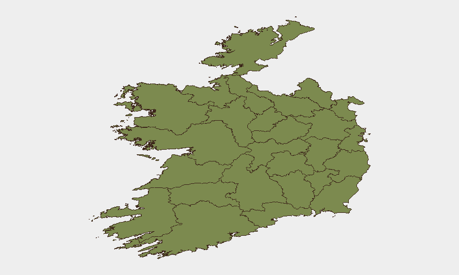
Dublin dominates the national risk profile (score 31.9), roughly 2.8× higher than Tipperary (11.2) and 11× higher than Kildare/Cork. This concentration reflects Dublin's role as the capital, primary transport hub, and seat of government and financial services. Tipperary's secondary ranking is noteworthy but remains an order of magnitude lower. All other counties score below 3.0, indicating dispersed, low-level risk. For corporate teams, Dublin—particularly its airport, port, CBD, and critical infrastructure corridors (M50, M1, M4)—warrants baseline situational awareness; other regions present minimal duty-of-care concern under normal circumstances.
How GeoBit Would Assist
AOI Monitoring & Early Warning with persistent watch on Dublin's airport, port, and CBD would trigger alerts on unrest, protests, or security incidents before they escalate or disrupt travel/business. OSINT Fusion & Corroboration across RTÉ, Garda feeds, and social media would rapidly validate or rule out unconfirmed incident reports, reducing false alarms. Routing & Network Analysis would enable security teams to model alternative transport routes (air, road, rail) in the event of M50, M1, or Dublin-area disruptions, ensuring continuity of operations and duty-of-care compliance.
7-Day Outlook
No significant deterioration in Ireland's security posture is forecast. The airline-related signals (diplomatic disapprovals) do not yet indicate imminent travel restrictions or port/airport closures, but continued monitoring of Nigeria–Ireland and US–Ireland aviation relations is prudent. Corporate teams should maintain baseline alert protocols for Dublin and remain ready to execute contingency routing if diplomatic friction escalates to operational impact.
Highest-Risk Areas — Ranked
| # | State / Region | Risk |
|---|---|---|
| 1 | County Dublin | 31.9 |
| 2 | County Tipperary | 11.2 |
| 3 | County Kildare | 2.7 |
| 4 | County Cork | 2.7 |
| 5 | County Mayo | 2.5 |
| 6 | County Sligo | 1.9 |
| 7 | County Galway | 1.9 |
| 8 | County Clare | 1.9 |
| 9 | County Limerick | 1.9 |
| 10 | County Donegal | 1.9 |
| 11 | County Leitrim | 1.9 |
| 12 | County Roscommon | 1.9 |
Sources
Previous Daily Briefs
A new Ireland brief is written every day — each with its own risk map and downloadable CSV. Here's the last week; use the calendar to go further back.
📅 Browse every day by calendar →
Highlighted days have a brief. Tap a day for that day's map & analysis, or “csv” for that day's dataset ($5).