Situation Summary
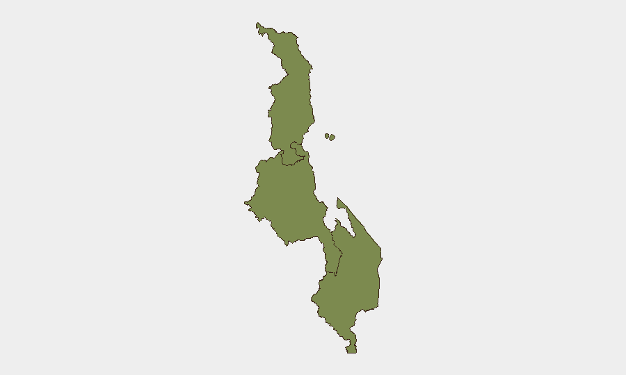
Malawi remains in a stable security posture with no corroborated acute incidents reported in the last 24–48 hours. The country's overall threat ranking (133 globally, composite score 6) reflects a low to moderate risk environment relative to peer nations. Recent diplomatic activity—including Malawi's participation in the UN Chiefs of Police Summit on 7–8 July—signals active engagement on transnational security and policing cooperation rather than domestic instability. The Southern Region continues to drive the majority of measurable sub-national risk (composite score 31.8), substantially above Central and Northern regions.
Key Developments
- 7–8 July, New York (UN Headquarters). Malawi's Minister of Homeland Security Peter Mukhito participated in UNCOPS 2026, discussing global security cooperation, transnational crime, terrorism, and cyber-threat mitigation. No domestic security incidents were reported concurrent with this engagement.
- 8 July, New York (UN Headquarters). Malawian officials restated the country's commitment to strengthening bilateral and multilateral security cooperation frameworks. This represents routine diplomatic posturing with no bearing on in-country safety or asset risk.
- Sub-national signal: Southern Region. Composite risk score of 31.8—approximately 18× the Central and Northern regions—indicates sustained concentration of measurable security drivers in the south. Specific tactical incidents have not been corroborated in the last 48 hours; however, pattern-of-life risk remains elevated in this zone.
- Political dissent signal (9 July). A low-intensity political-dissent event involving residents was flagged in open-source intelligence; no escalation, violence, or disruption to critical services has been verified.
- Diplomatic demand signal (9 July). Malawi issued or reiterated a demand directed at Somalia. Context and escalation trajectory remain unclear from publicly available reporting; this warrants monitoring for regional spillover effects.
*Note: No major crimes, civil unrest, infrastructure failures, or new travel-advisory triggers were identified in Malawi proper during this 24–48-hour window. Diplomatic activity dominated the signal landscape.*
Highest-Risk Areas
The Southern Region accounts for the overwhelming majority of measured sub-national risk (31.8 vs. 1.8 each for Central and Northern), indicating that security drivers—whether crime, cross-border activity, resource competition, or localized political tension—remain geographically concentrated. Central and Northern regions show equivalent, substantially lower risk profiles, suggesting that Southern Region exposure dominates any corporate or operational footprint assessment. The reasons for this disparity are typically tied to border proximity, economic marginalization, informal-economy activity, and historical ethnic or communal tensions, though specific current drivers require deeper OSINT to isolate.
How GeoBit Would Assist
Teams with personnel or assets in Malawi should employ AOI Monitoring & Early Warning capabilities to establish persistent watch over the Southern Region and key urban centers, with automated alerting on protest activity, security-force mobilization, or cross-border incidents. Concurrent Intel Sweep and multi-language OSINT fusion across social media, local news, and radio SIGINT will isolate early signals of political dissent or resource conflict before mainstream reporting. Routing & Network Analysis can help security operations plan alternative supply, evacuation, or movement corridors should Southern Region instability escalate.
7-Day Outlook
No acute escalation is forecast over the next week; however, the concentration of sub-national risk in the Southern Region and the unresolved political-dissent and Malawi–Somalia demand signals warrant continuous monitoring. Mid-to-long-term trajectory remains dependent on regional diplomatic resolution and informal-economy stability in border zones.
Highest-Risk Areas — Ranked
| # | State / Region | Risk |
|---|---|---|
| 1 | Southern Region, Malawi | 31.8 |
| 2 | Central Region, Malawi | 1.8 |
| 3 | Northern Region, Malawi | 1.8 |
Previous Daily Briefs
A new Malawi brief is written every day — each with its own risk map and downloadable CSV. Here's the last week; use the calendar to go further back.
📅 Browse every day by calendar →
Highlighted days have a brief. Tap a day for that day's map & analysis, or “csv” for that day's dataset ($5).
Atlas — our AI intelligence desk — emails them this snapshot personally. Nothing else, no list.