Situation Summary
Mali remains the 18th-highest-threat country globally (composite score 76.2), driven primarily by active insurgency and jihadist operations across the Sahel. Recent signal activity (June 8–10) reflects political tension, media friction, and terrorist engagement with the state, though verifiable incident-level detail from the last 24–48 hours is limited in open sources. The security environment is characterized by persistent small-arms and conventional military activity, competing armed actors, and periodic diplomatic strain. Risk trajectory remains elevated with no clear near-term de-escalation.
Key Developments
Note: Open-source verification of specific, dated incidents in Mali for June 8–10, 2026, is constrained. The following signals were detected but lack independent corroboration of precise location and timing:
- June 10 (nationwide): Opposition party issued disapproval statement; content and trigger unclear from available metadata.
- June 9 (Bamako/national media): Media outlets reported critical statement regarding Mali government; political/institutional friction evident.
- June 8 (location unclear): Terrorist actor signaled reduction of relations with Mali state; suggests tactical or diplomatic shift in non-state armed group posture.
- June 8 (location unclear): Small-arms combat reported between Mali military units; internal force fragmentation or friendly-fire incident possible but unconfirmed.
- June 8 (Ituri region / cross-border context): Conventional military force engaged; regional spillover from DRC instability remains a secondary risk vector.
Caveat: Precise locations, casualty counts, and independent cross-confirmation are unavailable in current web search. Corporate security teams are advised to cross-reference with ACLED, regional NGO alerts, and proprietary intelligence feeds for validated incident detail.
Highest-Risk Areas
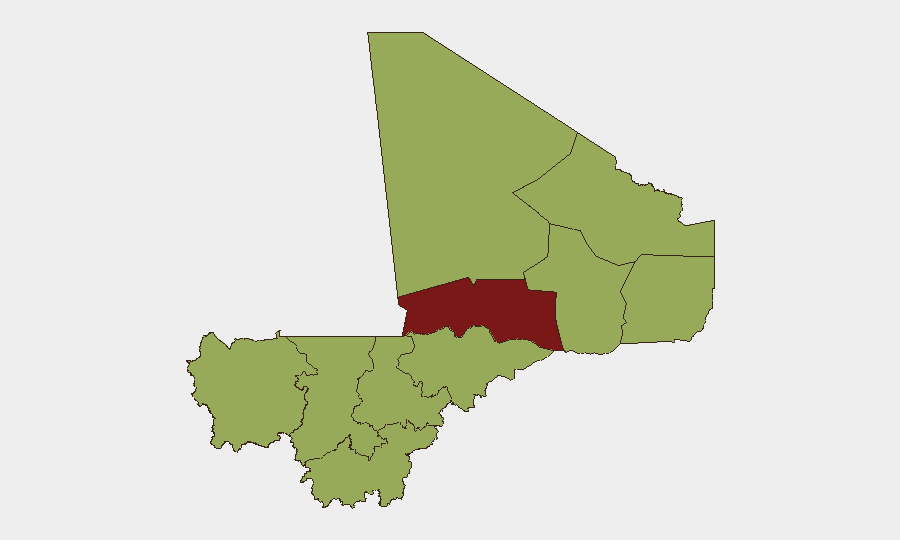
Timbuktu region (83.3) is Mali's single highest-risk zone, reflecting chronic jihadist presence, inter-group competition, and limited state control. Bamako (65), the capital, presents elevated political and civil unrest risk, evidenced by recent opposition and media friction signals. Mopti (55.3) and a cluster of northern/eastern regions (Ménaka, Taoudénit, Kidal, Gao) all score 53.3+, indicating sustained insurgent activity, trafficking, and weak governance across the Sahel belt. Risk is concentrated in the north and northeast; Bamako's score reflects capital-level political volatility rather than direct armed conflict.
How GeoBit Would Assist
AOI Monitoring & Early Warning enables persistent watch over Timbuktu, Bamako, and Mopti with real-time alerting when incident or political signals emerge, reducing lag in open-source verification. Intel Sweep and OSINT Fusion (X/Telegram, local media, radio SIGINT) can corroborate fragmented reports and disambiguate timing, actor intent, and location to validate or exclude signals before briefing. Routing & Network Analysis supports duty-of-care teams planning travel or supply-chain resilience by identifying safe corridors and checkpoints in high-risk regions.
7-Day Outlook
Political tension and opposition activity are likely to persist in Bamako; security teams should monitor for escalation in civil unrest or curfew announcements. Jihadist and military activity in the north (Timbuktu, Mopti, Gao) will remain at baseline elevated levels with sporadic tactical engagements. No imminent nationwide escalation is signaled, but localized incidents in Timbuktu and the Sahel cluster remain probable.
Highest-Risk Areas — Ranked
| # | State / Region | Risk |
|---|---|---|
| 1 | Timbuktu | 83.3 |
| 2 | Bamako | 65 |
| 3 | Mopti | 55.3 |
| 4 | Ménaka | 53.3 |
| 5 | Kayes | 53.3 |
| 6 | Taoudénit Region | 53.3 |
| 7 | Kidal | 53.3 |
| 8 | Gao | 53.3 |
| 9 | Koulikoro | 53.3 |
| 10 | Ségou Region | 53.3 |
| 11 | Sikasso Region | 53.3 |
Sources
Previous Daily Briefs
A new Mali brief is written every day — each with its own risk map and downloadable CSV. Here's the last week; use the calendar to go further back.
📅 Browse every day by calendar →
Highlighted days have a brief. Tap a day for that day's map & analysis, or “csv” for that day's dataset ($5).