Situation Summary
Malta's security environment remains relatively stable overall (composite threat score 7), but two significant incidents in the past 48 hours have elevated short-term operational risk: an armed standoff with police casualties in St Julian's on 24 July, and widespread power-grid disruptions across multiple localities since 20–21 July. The armed incident was contained through negotiation and arrest, but the infrastructure failures affecting electricity supply pose a secondary risk to service continuity and vulnerable populations. No credible evidence of organized civil unrest or political instability has been documented beyond these two concurrent events.
Key Developments
- St Julian's / Ta' Ġiorni (San Ġwann) – 24 July 2026, morning/afternoon
Armed suspect fired on police at a construction site on Joseph Carbone Street following a dispute over construction noise and a fire under a crane. One officer sustained serious facial/neck injuries; a second officer received minor injuries. Police deployed snipers and negotiated for several hours before the suspect surrendered; a second individual was also detained.
- St Julian's – 24 July 2026, ongoing operations
Armed standoff continued as suspect remained barricaded in a building after the initial shoot-out. One officer reported shot in the head area and underwent emergency surgery. Extended police negotiation preceded the suspect's surrender and arrest.
- Nationwide power disruptions – Night of 20–21 July, continuing into 24–25 July
Enemalta's electricity distribution network experienced widespread faults causing multi-hour blackouts across entire neighbourhoods. Energy Ministry attributed failures to extreme temperatures and record demand during an ongoing heatwave. Repeated outages reported in multiple localities (Valletta area, Gozo, Munxar) within the past 48 hours, affecting residents and essential services.
- Infrastructure resilience strain – 24–25 July
Rolling blackouts continuing to impact air conditioning, refrigeration, transport, and emergency-response capability, particularly affecting vulnerable populations and visitors dependent on climate control during extreme heat conditions.
Highest-Risk Areas
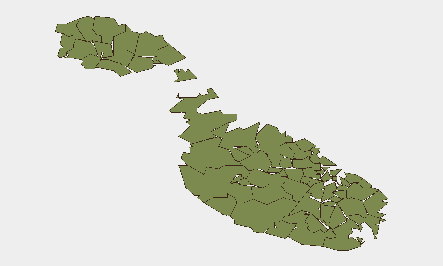
Valletta dominates the sub-national ranking (risk score 31.3), significantly above all other localities (which cluster at 1.3). This elevation reflects the concentration of government, commercial, and transport infrastructure in the capital, combined with the documented armed incident in the proximate St Julian's area and the wider grid instability affecting the urban core. Secondary localities show uniform baseline risk; no second-order geographic concentration of threat is evident in current data. The power-grid vulnerability is nationwide but has greater operational impact in high-density urban zones where service interdependencies are greatest.
How GeoBit Would Assist
Security teams with personnel or assets in Malta should employ AOI Monitoring & Early Warning (persistent watch on Valletta and St Julian's for emerging incidents) paired with Intel Sweep and multi-language OSINT (real-time tracking of social-media reports, local news, and infrastructure-status alerts) to detect resumption of violence or service degradation before impact reaches downstream operations. Routing & Network Analysis would support alternative-route planning for staff commuting and supply chains during continued grid instability. Sentiment & temporal analysis of public feeds can flag early signs of civil unrest or secondary incidents linked to heat-stress and service failures.
7-Day Outlook
The armed incident appears contained and criminal rather than indicative of broader instability; however, the underlying infrastructure vulnerability (power grid) is likely to persist through the heatwave cycle, creating cumulative friction and potential secondary incidents (accidents, medical-response delays, supply disruption). Monitoring should focus on whether grid-restoration efforts accelerate and whether the police-involved shooting triggers public backlash or further armed incidents.
Highest-Risk Areas — Ranked
| # | State / Region | Risk |
|---|---|---|
| 1 | Valletta | 31.3 |
| 2 | Santa Venera | 1.3 |
| 3 | Birkirkara | 1.3 |
| 4 | Għarb | 1.3 |
| 5 | Saint Lawrence | 1.3 |
| 6 | Kerċem | 1.3 |
| 7 | Għasri | 1.3 |
| 8 | Fontana | 1.3 |
| 9 | Żebbuġ | 1.3 |
| 10 | Victoria | 1.3 |
| 11 | Xagħra | 1.3 |
| 12 | Xewkija | 1.3 |
Sources
Previous Daily Briefs
A new Malta brief is written every day — each with its own risk map and downloadable CSV. Here's the last week; use the calendar to go further back.
📅 Browse every day by calendar →
Highlighted days have a brief. Tap a day for that day's map & analysis, or “csv” for that day's dataset ($5).
Atlas — our AI intelligence desk — emails them this snapshot personally. Nothing else, no list.