Situation Summary
Oman remains a low-threat country globally (rank #181, composite score 3), but faces a sharp localized maritime security spike driven by the Iran–U.S. escalation in the Strait of Hormuz. Two confirmed maritime incidents off Omani waters in the past 48 hours—a drone strike on a Singapore-flagged vessel (June 25) and a projectile strike on a tanker (June 27)—have elevated risk to shipping and triggered a U.S. Embassy Level 3 advisory authorizing departure of non-emergency personnel. Terrestrial security in Muscat and other populated governorates remains stable; risk is concentrated in maritime zones and Al Wusta Governorate (score 31.8).
Key Developments
- Off Dahit, Oman; June 25 — A Singapore-flagged cargo ship sustained a drone attack approximately 8 nautical miles southeast of Dahit in the Strait of Hormuz. Multiple sources attribute the strike to ongoing Iran–U.S. maritime hostilities.
- Off Oman coast; June 27 — UKMTO reported an unspecified projectile striking a tanker off Oman's coast, confirming active weapons employment in Omani waters within the past 24 hours.
- Strait of Hormuz; June 27 — JMIC (U.S.-led maritime coordination center) assessed the threat to shipping as "substantial," citing presence of mines and ongoing naval clearance operations near Omani territorial waters.
- U.S. Embassy advisory; June 27 — The U.S. Embassy updated its Level 3 (Reconsider Travel) advisory for Oman and authorized evacuation of non-emergency U.S. government personnel and families due to safety risks tied to regional hostilities.
- Maritime threat environment — The two incidents in 48 hours suggest sustained drone and/or missile capability employment by non-state or Iranian-aligned actors, with no de-escalation signal evident.
Highest-Risk Areas
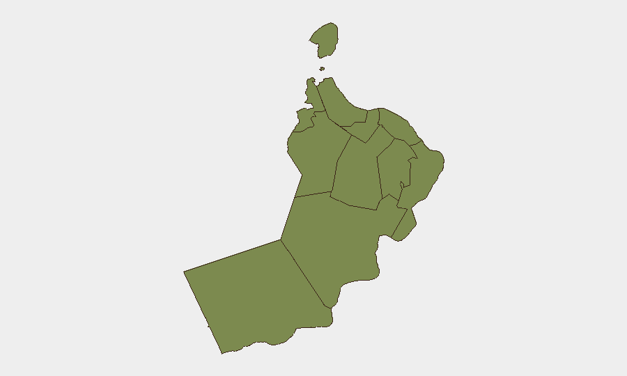
Al Wusta Governorate (score 31.8) dominates the risk profile and reflects maritime activity in and near the Strait of Hormuz and Arabian Sea approaches; Dahit and surrounding coastal zones are now actively contested. Musandam Governorate (score 5.8) also faces elevated maritime risk due to its proximity to the Strait. All other governorates—including Muscat (1.8)—show minimal threat and are suitable for normal operations. Risk is maritime-centric and geographically confined; terrestrial, aviation, and urban security in the capital and northern population centers remains low.
How GeoBit Would Assist
Corporate security teams should immediately activate Maritime & Aviation tracking and AOI Monitoring & Early Warning functions to establish persistent watch on vessel movements and drone/missile activity in the Strait and waters off Muscat, Musandam, and Al Wusta. Intel Sweep and multi-language OSINT fusion (X/Twitter, Telegram, maritime databases, UKMTO alerts) will provide real-time incident corroboration and pattern detection. Routing & Network Analysis capabilities enable identification of alternative shipping corridors and supply-chain rerouting to avoid high-threat maritime zones while maintaining duty-of-care compliance.
7-Day Outlook
The maritime threat is expected to remain elevated through early July given the absence of diplomatic off-ramps and continued drone/missile strikes. Shipping delays, insurance premium spikes, and potential further U.S. or regional military responses are probable. Terrestrial security in Oman is unlikely to deteriorate, but maritime-dependent logistics, energy supply chains, and personnel transit by sea should be treated as high-consequence risk vectors requiring active mitigation and contingency planning.
Highest-Risk Areas — Ranked
| # | State / Region | Risk |
|---|---|---|
| 1 | Al Wusta Governorate | 31.8 |
| 2 | Musandam Governorate | 5.8 |
| 3 | Muscat Governorate | 1.8 |
| 4 | Al Buraymi Governorate | 1.8 |
| 5 | Ad Dhahirah Governorate | 1.8 |
| 6 | Al Batinah North Governorate | 1.8 |
| 7 | Al Batinah South Governorate | 1.8 |
| 8 | Ad Dakhiliyah Governorate | 1.8 |
| 9 | Ash Sharqiyah North Governorate | 1.8 |
| 10 | Ash Sharqiyah South Governorate | 1.8 |
| 11 | Dhofar Governorate | 1.8 |
Sources
Previous Daily Briefs
A new Oman brief is written every day — each with its own risk map and downloadable CSV. Here's the last week; use the calendar to go further back.
📅 Browse every day by calendar →
Highlighted days have a brief. Tap a day for that day's map & analysis, or “csv” for that day's dataset ($5).