Situation Summary
The Philippines remains a moderate, composite-threat environment (global rank #59, score 34) with 115 tracked threat events. Recent signal activity (17–18 June) points to elevated governance and international-relations tension, including military/police posturing, arrest/detention actions, and statements referencing Russia and international legal proceedings. The threat profile is geographically concentrated in Mimaropa and Davao Region, with secondary elevation across Metro Manila and Cordillera.
Key Developments
- 2026-06-18 · Governance & International Tension: Philippine government issued public statements and counter-statements amid references to Russia and Victoria; simultaneous military/police "power show" activity recorded. Specific locations and operational details remain opaque in available signal; suggests high-level political or diplomatic friction rather than immediate ground-level security event.
- 2026-06-18 · Arrest/Detention Cascade: Multiple arrest/detention events recorded involving a senator, prosecutor, and international legal actor (The Hague reference). Signals point to potential ICC-related or anti-corruption enforcement action; no casualty or immediate public-order breakdown reported.
- 2026-06-18 · Unconventional Violence Signal: ICC vs. Philippine incident flagged; context suggests legal/investigative action rather than kinetic violence. Warrant service or compliance issue likely.
- 2026-06-17 · Legislative & Executive Friction: Public statement involving Senate President signals domestic political strain; no violence or imminent institutional breakdown detected.
- 2026-06-18 · Military/Police Display: Dual power-show events (domestic and international component) suggest deterrence posturing, possibly linked to governance disputes or external pressure. No active conflict or mobilization detected.
Note: Available signals do not yet yield confirmed incident locations, casualty counts, or ground-truth details. Field verification via Philippine police (PNP), local disaster agencies, and real-time news feeds recommended to establish specifics.
Highest-Risk Areas
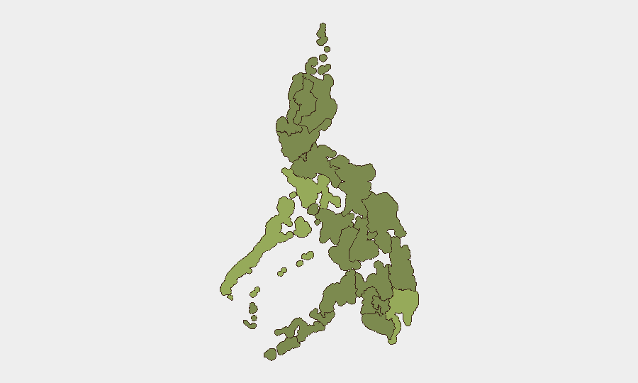
Mimaropa (53.7) and Davao Region (43.7) drive the majority of composite risk, reflecting persistent criminality, maritime/trafficking exposure, and historical armed-group activity. Metro Manila (34.2) elevation is consistent with political concentration and infrastructure density; Cordillera (33.1) and Calabarzon (30.9) flag secondary hotspots tied to resource-competition and labor-sector volatility. Northern island and Mindanao regions show lower but sustained risk profiles (23–24), reflecting residual militant presence and cross-border trafficking. The current governance-signal uptick may amplify Metro Manila and national-level institutional risk; field-asset teams should monitor detention and legal-action developments.
How GeoBit Would Assist
Intel Sweep & OSINT Fusion on Philippine governance actors, legislative players, and ICC-related entities would clarify the 17–18 June statement and arrest cascade in real time. AOI Monitoring & Early Warning on Mimaropa and Davao would provide persistent alerting on trafficking, armed-group, and criminal incidents affecting corporate personnel or supply-chain assets. Conflict & Military tracking combined with Network & Actor Analysis would flag military posturing, command-and-control shifts, or factional friction before operational impact. Routing & Network Analysis can identify safe corridors and alternative logistics during governance instability.
7-Day Outlook
Governance tension and legal actions are likely to persist or escalate modestly over the next 7 days as detention and ICC-related processes unfold; no immediate kinetic escalation is signaled. Ground-level criminal and trafficking activity in Mimaropa and Davao should remain elevated and seasonal. Corporate teams with personnel or assets in Metro Manila should maintain heightened situational awareness on legislative and judicial developments; Mindanao-based operations should assume baseline armed-group and trafficking risk unchanged.
Highest-Risk Areas — Ranked
| # | State / Region | Risk |
|---|---|---|
| 1 | Mimaropa | 53.7 |
| 2 | Davao Region | 43.7 |
| 3 | Metro Manila | 34.2 |
| 4 | Cordillera Administrative Region | 33.1 |
| 5 | Calabarzon | 30.9 |
| 6 | Ilocos Region | 24.2 |
| 7 | Zamboanga Peninsula | 24.2 |
| 8 | Bangsamoro | 23.7 |
| 9 | Caraga | 23.7 |
| 10 | Northern Mindanao | 23.7 |
| 11 | Soccsksargen | 23.7 |
| 12 | Cagayan Valley | 23.7 |
Sources
Previous Daily Briefs
A new Philippines brief is written every day — each with its own risk map and downloadable CSV. Here's the last week; use the calendar to go further back.
📅 Browse every day by calendar →
Highlighted days have a brief. Tap a day for that day's map & analysis, or “csv” for that day's dataset ($5).