Situation Summary
Saint Kitts and Nevis remains a low-threat jurisdiction (global rank #202, composite score 3) with no verified security incidents, civil unrest, or crime events reported in the last 24–48 hours. Sub-national risk concentration in Saint Kitts (risk score 72) significantly exceeds Nevis (28), driven primarily by urban crime patterns in Basseterre rather than active instability. Recent maritime emergencies (June 29 capsized inter-island ferry) highlight ongoing migrant-smuggling and sea-state risks, but pose no immediate threat to the terrestrial security environment.
Key Developments
- No verified security, crime, conflict, or civil-unrest incidents in Saint Kitts and Nevis within the last 24–48 hours. Open-source monitoring and social media search detected no current events meeting recency and verification thresholds as of July 4, 2026.
- Recent maritime incidents (June 29, outside 48h window) signal persistent inter-island ferry safety and migrant-smuggling concerns. A capsized inter-island ferry off Saint Kitts resulted in multiple rescues and ongoing search operations; a separate vessel incident off Nevis has been reported but lacks verified timestamp. These patterns indicate vulnerability in regional maritime corridors rather than current acute threat.
- St Kitts Music Festival ongoing (promotional activity noted). Large gathering event in operation; no security incidents or civil unrest tied to the festival have been reported in available 24–48h data. Standard crowd-management and event-security awareness recommended for corporate operations in or near venue areas.
- Three public statements flagged by signal monitoring (July 3): Prime Minister, Rastafarian community, and Basseterre school-related statement. Content and context of statements not yet clarified in available open-source results; sentiment and operational significance require follow-up via deeper OSINT fusion to determine relevance to corporate duty-of-care obligations.
Highest-Risk Areas
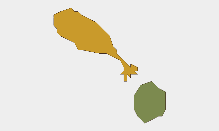
Saint Kitts dominates the sub-national risk profile, with a composite score of 72 compared to Nevis's 28—a 2.6× differential. Urban crime concentration in Basseterre (the capital and commercial hub) drives this disparity, reflecting higher petty theft, robbery, and gang-related activity typical of Caribbean port cities. Nevis's significantly lower score reflects its smaller population, limited urbanization, and lower incident density. For corporate teams, Saint Kitts—particularly the downtown and waterfront zones—warrants heightened personnel security and asset-protection protocols, while Nevis-based operations face lower baseline risk.
How GeoBit Would Assist
GeoBit's AOI Monitoring & Early Warning capability with persistent geographic alerts would provide real-time notification of emerging security, crime, or civil-unrest events in Saint Kitts and Nevis, closing the recency gap evident in current open-source lag. OSINT fusion and corroboration across X/Twitter, Telegram, Facebook, and local media feeds would validate and timestamp maritime incidents, political statements, and large-event security posture more rapidly than manual research. GIS & Spatial Analysis layered with crime and incident density mapping would enable security teams to refine high-risk zone boundaries in Basseterre and route personnel accordingly.
7-Day Outlook
No acute security deterioration is anticipated over the next seven days. Continued monitoring of inter-island maritime corridors and the St Kitts Music Festival is warranted as precaution. Clarification of the July 3 public statements and any underlying grievances should be prioritized via targeted OSINT to assess whether they signal emerging civil tension or remain routine political discourse.
Highest-Risk Areas — Ranked
| # | State / Region | Risk |
|---|---|---|
| 1 | Saint Kitts | 72 |
| 2 | Nevis | 28 |
Sources
Previous Daily Briefs
A new Saint Kitts and Nevis brief is written every day — each with its own risk map and downloadable CSV. Here's the last week; use the calendar to go further back.
📅 Browse every day by calendar →
Highlighted days have a brief. Tap a day for that day's map & analysis, or “csv” for that day's dataset ($5).
Atlas — our AI intelligence desk — emails them this snapshot personally. Nothing else, no list.