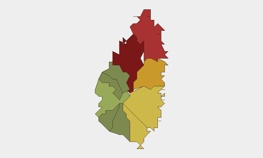
Situation Summary
Saint Lucia remains a low-threat environment globally (rank #81, composite score 14) with no tracked discrete security events in the current analysis window. The sub-national risk profile is heavily concentrated in the capital and northwest corridor—Castries, Gros Islet, and Dennery account for the majority of documented threat activity. A homicide near George Charles Airport on July 9 has prompted government attention to airport perimeter security, though the incident does not signal a shift in the national threat trajectory.
Key Developments
- Vigie, Castries (George Charles Airport perimeter) — July 9, 2026 — One homicide reported near the airport fence; Office of the Prime Minister flagged the incident as a concern to airport security and national security posture. No additional incidents confirmed in the 24–48 hours following the statement.
- No other verified security, crime, civil-unrest, or infrastructure incidents recorded in Saint Lucia within the last 24–48 hours.
- Historical context (not current): Since February 2026, a missing-persons case involving individuals lost at sea has remained unresolved; government confirmed no bodies recovered and characterized handling as responsible. This is background only and does not represent active 24–48 hour developments.
Highest-Risk Areas
Castries (risk 95) dominates the national threat profile and accounts for the plurality of documented incidents, including the July 9 airport-adjacent homicide. The northwest corridor—Gros Islet (78), Dennery (72), and Vieux Fort (68)—forms a secondary band of elevated risk, likely reflecting concentration of economic activity, tourism, and population density. By contrast, rural and southern districts (Canaries, Choiseul, Anse La Raye) register minimal risk. The geographic concentration suggests that corporate and diplomatic presence in Castries and the northwest should remain the focus of duty-of-care monitoring, while personnel in southern and rural areas face substantially lower baseline threat.
How GeoBit Would Assist
Intel Sweep and OSINT Fusion would enable continuous monitoring of Castries and Gros Islet for emerging crime, gang activity, or infrastructure disruption signals across open sources, social media, and local government channels. AOI Monitoring & Early Warning would support persistent watch of high-risk zones (airport perimeter, central Castries commercial districts, port facilities) with automated alerting if threat indicators escalate. Routing & Network Analysis would assist security teams in identifying safer transit corridors and alternative routes for personnel and asset movement, particularly in Castries and surrounding districts.
7-Day Outlook
No indicators of significant escalation are present. The airport homicide appears isolated and has elicited government response; routine crime patterns are expected to persist at current levels in Castries and the northwest corridor. Personnel and asset security posture should remain unchanged, with standard due diligence in high-risk districts and heightened awareness near transportation hubs.
Highest-Risk Areas — Ranked
| # | State / Region | Risk |
|---|---|---|
| 1 | Castries | 95 |
| 2 | Gros Islet | 78 |
| 3 | Dennery | 72 |
| 4 | Vieux Fort | 68 |
| 5 | Micoud | 65 |
| 6 | Soufrière | 42 |
| 7 | Laborie | 38 |
| 8 | Choiseul | 35 |
| 9 | Anse La Raye | 28 |
| 10 | Canaries | 12 |
Sources
Previous Daily Briefs
A new Saint Lucia brief is written every day — each with its own risk map and downloadable CSV. Here's the last week; use the calendar to go further back.
📅 Browse every day by calendar →
Highlighted days have a brief. Tap a day for that day's map & analysis, or “csv” for that day's dataset ($5).
Atlas — our AI intelligence desk — emails them this snapshot personally. Nothing else, no list.