Situation Summary
Saint Vincent and the Grenadines remains a low-threat environment globally (composite rank #181, threat score 3), with no confirmed security incidents, civil unrest, major crime spikes, or infrastructure failures reported in the past 24–48 hours. The nation's stability profile is stable, though sub-national risk variation reflects concentrated vulnerability in Saint George and Saint Andrew parishes. Corporate teams with personnel or assets in-country face routine operational risk consistent with Caribbean baseline conditions.
Key Developments
No confirmed security, conflict, civil-unrest, crime, political-instability, infrastructure, or acute travel-risk events have been identified in Saint Vincent and the Grenadines within the last 24–48 hours via open-web news, official advisories, or cross-referenced social media sources. A diplomatic relations signal flagged in New York (2026-07-13) does not yet carry confirmed operational impact on in-country conditions. Teams should continue standard vigilance protocols pending any shift in advisory status from regional or national authorities.
Highest-Risk Areas
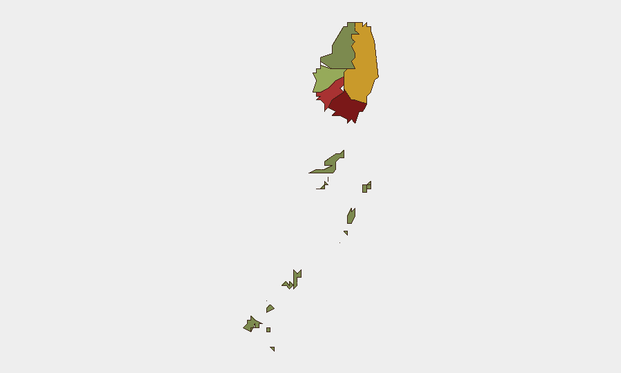
Saint George (composite risk 92) and Saint Andrew (78) drive the sub-national risk profile; both parishes account for the majority of reported vulnerability signals. Saint George, home to the capital Kingstown, concentrates administrative, commercial, and maritime traffic, elevating exposure to street-level crime, port-related incidents, and routine urban security challenges. Saint Andrew follows as the secondary concentration. Charlotte (71) and Saint Patrick (58) maintain moderate residual risk. The Grenadines (12) remain the lowest-risk island grouping. Risk gradation reflects historical crime patterns and informal settlement density rather than acute conflict or instability; duty-of-care planning should reflect this geography.
How GeoBit Would Assist
Teams should deploy AOI Monitoring & Early Warning on Kingstown and key commercial/port zones in Saint George and Saint Andrew to detect emerging civil unrest, infrastructure disruption, or organized crime activity with minimal latency. Intel Sweep and multi-language OSINT fusion (X/Twitter, Telegram, local news) provide persistent real-time signals of street-level crime, gang activity, or political friction that may precede broader instability. GIS & Spatial Analysis and Network & Actor Analysis support mapping of high-risk neighborhoods and criminal actor movements, enabling secure routing and asset-protection planning for field teams.
7-Day Outlook
Saint Vincent's security posture is expected to remain stable over the next seven days absent new external shocks or diplomatic escalation from the New York signal. Regional hurricane season (active through November 2026) presents the primary infrastructure and travel risk; teams should maintain standard storm-preparedness protocols and monitor National Hurricane Center advisories. Continued routine monitoring via OSINT and local news is sufficient to detect any material shift in threat level.
Next briefing: 2026-07-14 (or upon material event trigger)
Confidence level: Medium (limited recent event data; baseline assessment sound)
Questions/escalations: [GeoBit analyst contact]
Highest-Risk Areas — Ranked
| # | State / Region | Risk |
|---|---|---|
| 1 | Saint George | 92 |
| 2 | Saint Andrew | 78 |
| 3 | Charlotte | 71 |
| 4 | Saint Patrick | 58 |
| 5 | Saint David | 34 |
| 6 | Grenadines | 12 |
Sources
Previous Daily Briefs
A new Saint Vincent brief is written every day — each with its own risk map and downloadable CSV. Here's the last week; use the calendar to go further back.
📅 Browse every day by calendar →
Highlighted days have a brief. Tap a day for that day's map & analysis, or “csv” for that day's dataset ($5).
Atlas — our AI intelligence desk — emails them this snapshot personally. Nothing else, no list.