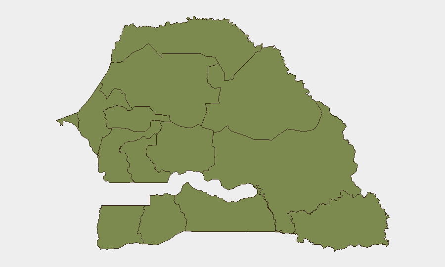
Situation Summary
Senegal remains a low-to-moderate risk environment (global rank #107, composite score 8) with localized instability concentrated in the north-central Louga Region. Recent signals point to domestic political friction—police detentions, parliamentary disapproval, and government investigations in the past 48 hours—alongside border logistics disruptions and ongoing zoonotic disease pressure. The capital and major business centers (Dakar, Thiès) face minimal direct threat, but northern and eastern regions warrant elevated monitoring.
Key Developments
- Louga Region — Ongoing composite risk score of 31.8 remains by far the country's highest; specific triggering incidents in the last 48 hours are not yet independently confirmed, but the region continues to drive national threat elevation.
- Senegal (national) — 2026-07-07 to 2026-07-08 — Multiple police arrest/detention events involving government actors; parliamentary disapproval and investigations by the Prime Minister recorded, indicating domestic political stress and possible civil-service tensions.
- Rosso border crossing, Senegal–Mauritania — 2026-07-08 — Over 80 Moroccan freight trucks stranded after diversion from Mali route; cross-border transport disruption affecting customs, supply chains, and informal trade corridors in the northern border zone.
- Senegal (national) — ongoing — Rift Valley fever cases reported in Mauritania and Senegal; zoonotic risk present in border areas and pastoral regions; veterinary and public-health surveillance warranted.
- Dakar, Thiès, Fatick Regions — present — Composite risk scores of 1.8 indicate well-controlled security environments in the populated south and west; no active incident reporting in the past 48 hours.
Highest-Risk Areas
Louga Region (composite risk 31.8) dominates Senegal's threat landscape, accounting for the vast majority of tracked incidents and driving the country's overall risk profile. This northern region is characterized by sparse population density, proximity to Mali and Mauritania, pastoral economies vulnerable to resource scarcity, and historically weaker state presence. Secondary concern attaches to Sédhiou and Tambacounda (each 4.8), which lie on contested supply routes and informal cross-border networks. The populated southern and western zones—Dakar, Thiès, Fatick, Diourbel, Kaolack—show minimal composite risk (1.8 each) and are the primary zones of safety for corporate operations and expatriate populations.
How GeoBit Would Assist
Security and duty-of-care teams should deploy Area-of-Interest (AOI) Monitoring with alerting on Louga Region, the Rosso border crossing, and key road corridors to detect renewal of incident activity, roadblock formation, or supply-chain disruption in near real time. Multi-language OSINT and X/Twitter geolocated analysis targeting police actions, protest activity, and cross-border movement in the north would provide 24–48-hour advance signal of escalation. Alternative route and network analysis capabilities are essential for supply-chain and personnel routing around Louga and the Mauritania border, particularly given current truck diversions.
7-Day Outlook
Domestic political tension may persist over the coming week; continued police and government investigations warrant close watch for signs of broadening institutional friction or public protest. Border logistics disruptions are likely to remain in place pending resolution of Mali-route security or Moroccan-Senegalese transit negotiations. Overall threat trajectory remains stable absent major incident in Louga or a cross-border spillover from Mauritania; no escalation to national unrest is currently forecast.
Highest-Risk Areas — Ranked
| # | State / Region | Risk |
|---|---|---|
| 1 | Louga Region | 31.8 |
| 2 | Sédhiou Region | 4.8 |
| 3 | Tambacounda Region | 4.8 |
| 4 | Dakar Region | 1.8 |
| 5 | Thiès Region | 1.8 |
| 6 | Fatick Region | 1.8 |
| 7 | Diourbel Region | 1.8 |
| 8 | Kaolack Region | 1.8 |
| 9 | Saint-Louis Region | 1.8 |
| 10 | Kaffrine Region | 1.8 |
| 11 | Ziguinchor Region | 1.8 |
| 12 | Kolda Region | 1.8 |
Sources
Previous Daily Briefs
A new Senegal brief is written every day — each with its own risk map and downloadable CSV. Here's the last week; use the calendar to go further back.
📅 Browse every day by calendar →
Highlighted days have a brief. Tap a day for that day's map & analysis, or “csv” for that day's dataset ($5).
Atlas — our AI intelligence desk — emails them this snapshot personally. Nothing else, no list.