Situation Summary
Tonga remains a low-threat environment with a composite global threat score of 2 and no verified reports of protests, armed conflict, civil unrest, or major crime spikes in the past 24–48 hours. The primary security event is an ongoing police manhunt in Nuku'alofa (Tongatapu) for one high-risk escapee following a Sunday jailbreak at Central Police Station; two of three detainees have been recaptured. Moderate seismic activity (M 4.3–5.1) has been recorded in waters surrounding Tonga over the past week, but no new quakes or tsunami warnings have been issued in the last 24–48 hours, and no infrastructure or travel disruption has been reported.
Key Developments
- Nuku'alofa, Tongatapu (23–24 July 2026) – Police Commissioner Geoff Turner held a public press conference reiterating the active search for fugitive Liuaki Fungalei Kokohu Vi (35, New Zealand/Tongan national), wanted for serious passport fraud. Turner classified Vi as "dangerous," warned the public not to approach him, and confirmed he remains at large in Tonga as of 24 July.
- Nuku'alofa, Tongatapu (23–24 July 2026) – Tonga Police renewed a reward offer of up to TOP 5,000 for information directly leading to Vi's arrest. Authorities emphasized that the reward is contingent on actionable intelligence that results in recapture and reiterated the public should not attempt to detain him.
- Nuku'alofa/Mataika, Tongatapu (20–23 July 2026) – Two of three escapees from the 21 July incident have been recaptured: a 16-year-old Tongan national apprehended in Mataika early on 23 July and a 35-year-old Fijian national subsequently returned to custody. This reduces the immediate scale of the escape incident.
- Nuku'alofa, Tongatapu (23–24 July 2026) – Police Commissioner Turner warned that harbouring or assisting the fugitive carries penalties of up to 10 years' imprisonment under Tongan law, signalling heightened enforcement of obstruction offences.
- Nationwide, Tonga (past 48 hours) – Composite monitoring of news wires, regional Pacific media, and social media feeds confirms no major security incidents, infrastructure failures, or travel-advisory changes across Tonga.
Highest-Risk Areas
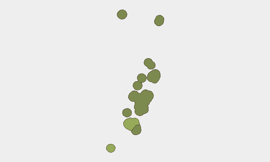
Tongatapu (risk score 45) accounts for the bulk of measured risk, driven by the ongoing police operation in Nuku'alofa and the presence of one dangerous fugitive at large. Vavaʻu (risk 28) and Haʻapai (risk 22) register elevated but significantly lower scores; neither region has reported new incidents in the past 24–48 hours. ʻEua (risk 18) and Ongo Niua (risk 12) remain peripheral to current threat dynamics. The concentration of risk in Tongatapu reflects the localized nature of the jailbreak and manhunt rather than a broader territorial instability.
How GeoBit Would Assist
Security teams with personnel or assets in Tongatapu would benefit from AOI Monitoring & Early Warning to track real-time police activity and updates in Nuku'alofa, combined with multi-language news and social media OSINT to detect any emergence of Vi or related incidents across Pacific outlets and local channels. Network & Actor Analysis could map connections to the escapee and identify networks that might harbour him, while Routing & Network Analysis could support movement planning for personnel in Nuku'alofa to avoid areas of active police operations if needed.
7-Day Outlook
The manhunt is expected to remain the dominant security focus in Tongatapu over the next week. Unless Vi is apprehended or new civil incidents emerge, Tonga's overall risk profile will remain stable and low-threat. Seismic monitoring will continue; no immediate tsunami or major quake risk is signalled for the period.
Highest-Risk Areas — Ranked
| # | State / Region | Risk |
|---|---|---|
| 1 | Tongatapu | 45 |
| 2 | Vavaʻu | 28 |
| 3 | Haʻapai | 22 |
| 4 | ʻEua | 18 |
| 5 | Ongo Niua | 12 |
Sources
Previous Daily Briefs
A new Tonga brief is written every day — each with its own risk map and downloadable CSV. Here's the last week; use the calendar to go further back.
📅 Browse every day by calendar →
Highlighted days have a brief. Tap a day for that day's map & analysis, or “csv” for that day's dataset ($5).
Atlas — our AI intelligence desk — emails them this snapshot personally. Nothing else, no list.