Situation Summary
The United Kingdom remains at low overall threat (rank #137 globally, composite score 6), with no credible indicators of coordinated terrorism, civil unrest, or nationwide instability as of 25 June 2026. However, a cluster of localised violent-crime incidents—knife attacks, street disorder, and hate-motivated vandalism—has emerged across England and Scotland over the past 48 hours, concentrated in major urban centres. Transport disruption at the Port of Dover reflects enhanced border screening rather than security deterioration. The trajectory is contained but warrants continued monitoring of street-level violence patterns.
Key Developments
- Brixton, London – 23 June 2026 (evening): Knife attack near Brixton Underground Station left at least one person seriously injured; armed police detained a suspect with no terrorism indicators reported.
- Glasgow, Scotland – 23 June 2026 (late evening): Large youth street fight in Buchanan Street area prompted public-order response; multiple arrests made on suspicion of breach of the peace and assault.
- Birmingham, England – 22 June 2026 (early hours): Late-night disorder on Broad Street and Hurst Street involved bottles thrown and serious assault outside nightclub; several arrests for violent disorder and offensive weapons possession.
- Leicester, England – 22–23 June 2026 (night): Targeted vandalism and minor arson against vehicles and takeaway in Spinney Hills area investigated as hate-motivated; police ordered increased patrols.
- Southwark, London – 22 June 2026 (evening): Stabbing on Old Kent Road resulted in non-life-threatening injury; investigation open with no immediate arrests reported at time of filing.
- Port of Dover, Kent – 22–23 June 2026: Multi-hour delays for outbound traffic attributed to enhanced French border checks and UK security screening rather than security incident.
Highest-Risk Areas
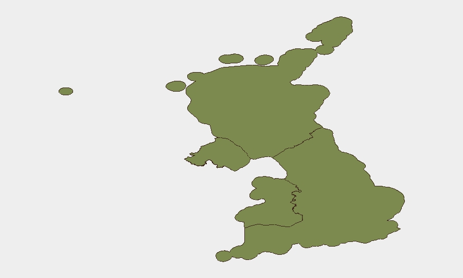
England dominates the sub-national risk profile (score 32), driven by concentration of violent-crime incidents in London (Brixton, Southwark) and Midlands (Birmingham, Leicester) urban corridors. Scotland (5.9) registers secondary concern following the Glasgow street-disorder event. Northern Ireland (4.9) and Wales (2.2) show lower near-term event density, though the Cardiff drug-crime operation reflects ongoing enforcement activity across all regions. Urban nightlife districts and transport hubs in England's major cities present the highest immediate-incident clustering.
How GeoBit Would Assist
Corporate security teams protecting people or assets in UK cities would deploy AOI Monitoring & Early Warning to track persistent hotspots—Brixton, Broad Street (Birmingham), Buchanan Street (Glasgow)—with real-time alerting on police incidents and disorder clustering. Routing & Network Analysis would allow duty-of-care teams to identify alternative routes avoiding Port of Dover congestion and violent-crime zones during travel planning. OSINT fusion and sentiment analysis across X/Twitter, local news feeds, and police-community channels would provide early detection of emerging street-violence trends or organised group activity before escalation.
7-Day Outlook
Street-level violence and petty-crime incidents are expected to remain sporadic across English cities without indication of coordinated escalation. Police enforcement activity (visible in Leicester, Cardiff, Glasgow) suggests adequate public-order response. Transport congestion at Dover is likely to persist through weekend travel peaks unless French–UK border protocols are adjusted; no security deterioration is anticipated.
Highest-Risk Areas — Ranked
| # | State / Region | Risk |
|---|---|---|
| 1 | England | 32 |
| 2 | Scotland | 5.9 |
| 3 | Northern Ireland | 4.9 |
| 4 | Wales | 2.2 |
Sources
Previous Daily Briefs
A new United Kingdom brief is written every day — each with its own risk map and downloadable CSV. Here's the last week; use the calendar to go further back.
📅 Browse every day by calendar →
Highlighted days have a brief. Tap a day for that day's map & analysis, or “csv” for that day's dataset ($5).