Situation Summary
Vanuatu remains in a low-threat security environment with no verified incidents, civil unrest, crime spikes, or infrastructure disruptions reported in the last 24–48 hours. Recent political disagreements between the government, opposition, and France have generated official statements and diplomatic disapproval but have not translated into street-level instability or public unrest. Transport, ports, airports, and essential services continue to operate normally. The near-term outlook is stable, with no indicators of imminent deterioration in public order or security conditions.
Key Developments
- Nationwide, 2026-07-18: Government and opposition issued formal statements and disapprovals; France also issued a disapproval statement targeting the opposition. No public protests, riots, or political violence have materialized in response.
- Port-Olry area (Torba Province), recent date: A magnitude 4.8 earthquake was recorded 51 km north-northeast of Port-Olry; no damage reports or disruptions to critical infrastructure have been confirmed.
- Nationwide, last 24–48 hours: Security and infrastructure monitoring confirms all major ports, airports, power systems, and telecommunications remain operational with no closures or service interruptions.
- Nationwide, last 24–48 hours: Dedicated security monitoring detected no organized protests, public assemblies, armed robbery, homicide, or major crime incidents within the current 48-hour window.
- Travel advisories, last 24–48 hours: Foreign governments maintain standing advice to "exercise normal safety precautions"; no new security warnings or travel restrictions have been issued for Vanuatu.
Highest-Risk Areas
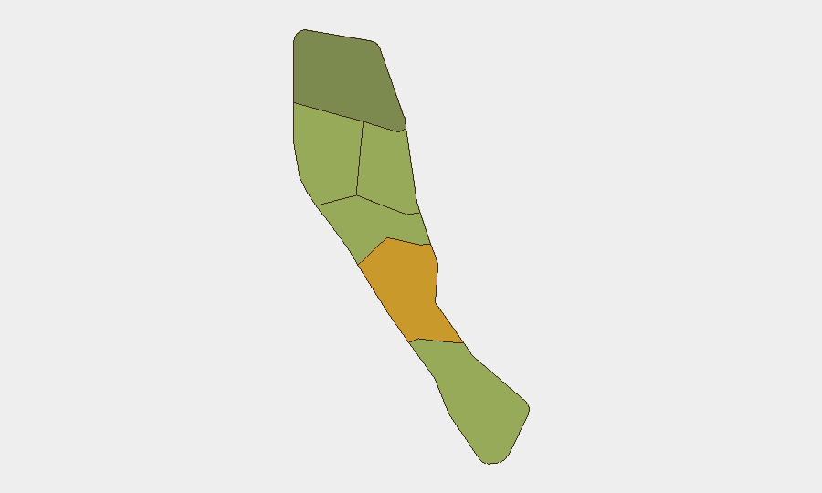
Shefa Province (composite risk 72) is the primary risk driver and merits prioritized monitoring; it encompasses the capital Port Vila and concentrates economic activity, government functions, and urban density. Penama (58) and Sanma (52) present secondary concerns, though baseline threat levels across all provinces remain low. Risk scores in Vanuatu reflect structural vulnerabilities—limited law enforcement capacity, geographic isolation, and dependence on maritime transport—rather than active, current incidents. Northern and remote provinces (Torba, 35) carry lower composite risk, consistent with smaller populations and less operational activity.
How GeoBit Would Assist
Security teams managing personnel or assets in Vanuatu should deploy AOI Monitoring & Early Warning on Shefa Province (particularly Port Vila) to detect emerging civil unrest, protest activity, or infrastructure disruptions in near-real time. Intel Sweep and multi-language OSINT (including regional media, government announcements, and opposition statements) would provide early signals of escalating political friction or public sentiment shifts. Ports and infrastructure monitoring—via satellite, shipping feeds, and utilities intelligence—would confirm continuity of supply chains and operational access, critical for duty-of-care planning in this geographically isolated jurisdiction.
7-Day Outlook
No imminent security deterioration is forecast over the coming week. Political rhetoric and diplomatic friction are unlikely to ignite street-level violence given historical patterns and current absence of mobilization signals. Standard precautions and routine monitoring should suffice; escalation indicators would include organized public assembly, strike calls, or official statements explicitly calling for disruption.
GEOBIT GLOBAL RANKING: Vanuatu #190 (composite threat 3/100) | CONFIDENCE: High (corroborated open-source feeds and absence of contrary signals)
Highest-Risk Areas — Ranked
| # | State / Region | Risk |
|---|---|---|
| 1 | Shefa Province | 72 |
| 2 | Penama | 58 |
| 3 | Sanma | 52 |
| 4 | Malampa | 48 |
| 5 | Tafea | 45 |
| 6 | Torba | 35 |
Sources
Previous Daily Briefs
A new Vanuatu brief is written every day — each with its own risk map and downloadable CSV. Here's the last week; use the calendar to go further back.
📅 Browse every day by calendar →
Highlighted days have a brief. Tap a day for that day's map & analysis, or “csv” for that day's dataset ($5).
Atlas — our AI intelligence desk — emails them this snapshot personally. Nothing else, no list.