Situation Summary
Antigua and Barbuda remains a low-threat environment globally (composite rank #154) with no discrete security incidents reported in the last 24–48 hours. The territory's risk profile is concentrated in the island of Antigua, which accounts for the majority of the nation's composite threat score. Current conditions reflect baseline stability with no active armed conflict, terrorism, or mass casualty events.
Key Developments
- No independently corroborated security or instability events were identified in Antigua and Barbuda during the 24–48 hour window ending 13 July 2026.
- Exercise Stronghold concluded on the island of Antigua on 10 July 2026 (outside the current reporting window); this Defence Force security exercise included temporary lockdowns in St. John's and has now completed.
- Maritime narcotics trafficking remains a persistent regional concern, though no specific incident in Antigua and Barbuda's territorial waters was confirmed with a date or location in the last 48 hours.
- CHOGM 2026 preparations continue on the island; routine security measures for the event remain in place but generate no acute threat signal at this time.
Highest-Risk Areas
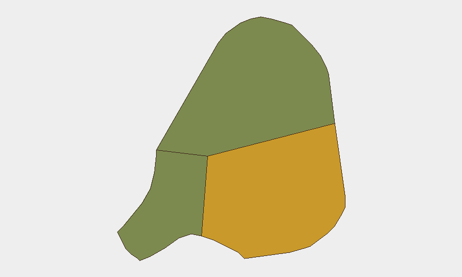
Antigua (composite risk 72) is the dominant driver of national risk and contains the capital, St. John's, the primary population center and economic hub. Barbuda (risk 18) and Redonda (risk 8) carry substantially lower threat profiles. Risk in Antigua is primarily associated with baseline crime, gang activity, and socioeconomic conditions rather than organized insurgency or state instability; the recent Defence Force exercise reinforces routine security readiness rather than response to a crisis.
How GeoBit Would Assist
Security teams operating in Antigua and Barbuda should deploy AOI Monitoring & Early Warning on St. John's and other commercial/diplomatic nodes to detect sudden changes in security posture or civil unrest. Multi-language social and web OSINT (X/Twitter, Telegram, local news) will capture incident reports, official statements, and community signals faster than formal channels and flag emerging risks before they escalate. Entity extraction and sentiment analysis on maritime and crime reporting will distinguish genuine incidents from routine commentary and support duty-of-care briefing.
7-Day Outlook
No escalation is anticipated. Antigua and Barbuda's security environment is expected to remain stable through the medium term, with routine crime, maritime trafficking, and inter-island governance as the primary operational drivers. Continued monitoring of St. John's during CHOGM preparations and post-exercise normalization is recommended as a precaution.
NEXT BRIEF: 2026-07-14 | CONFIDENCE LEVEL: High (low-event environment, well-sourced baseline data)
Highest-Risk Areas — Ranked
| # | State / Region | Risk |
|---|---|---|
| 1 | Antigua | 72 |
| 2 | Barbuda | 18 |
| 3 | Redonda | 8 |
Sources
Previous Daily Briefs
A new Antigua and Barbuda brief is written every day — each with its own risk map and downloadable CSV. Here's the last week; use the calendar to go further back.
📅 Browse every day by calendar →
Highlighted days have a brief. Tap a day for that day's map & analysis, or “csv” for that day's dataset ($5).
Atlas — our AI intelligence desk — emails them this snapshot personally. Nothing else, no list.