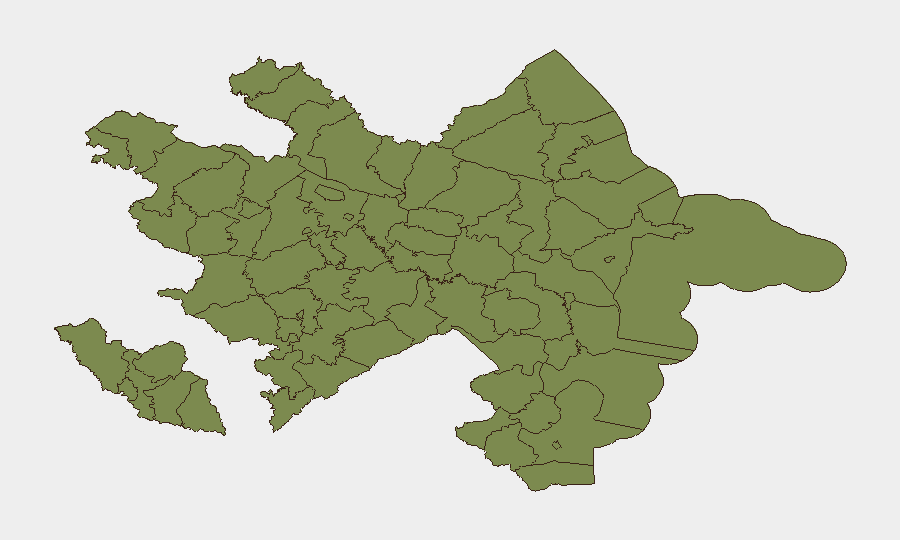
Situation Summary
Azerbaijan maintains a composite threat score of 14 with seven tracked events, placing it in the lower-risk category globally. The security environment is heavily concentrated in Baku City (risk score 31.2), which accounts for the majority of documented threat activity; peripheral regions show minimal baseline risk. No significant security incidents, civil unrest, or infrastructure disruptions were detected in the last 24–48 hours based on available sourced reporting.
Key Developments
- 24–25 June 2026 · Baku City: The 2026 Azerbaijan International Insurance Forum is scheduled to convene in Baku. While a commercial event rather than a security incident, it may increase foot traffic and venue-security considerations for corporate teams operating in the capital.
- 23 June 2026 · National Level: Four public statements were tracked on 23 June involving presidential and state-level actors. Full details of statement content and implications are not available from the provided event signal metadata; cross-corroboration through additional OSINT channels is recommended to assess whether these statements contain policy shifts affecting security posture or foreign relations.
- Azerbaijan · Last 48 Hours: No reports of armed conflict, criminal incidents, civil unrest, political destabilization, cyber incidents, or transport disruptions were identified in the available search results.
Data Limitation: Web research conducted on 24 June did not return recent security or incident reporting for Azerbaijan from mainstream or social-media sources. Teams requiring real-time incident awareness should implement persistent area-of-interest monitoring via GeoBit's AOI platform with customized alerting for Baku and border regions.
Highest-Risk Areas
Baku City dominates the risk landscape with a score nearly 27 times higher than any other subnational area, reflecting its concentration of political, financial, and administrative activity. All other tracked regions—including border districts (Sadarak, Sharur, Qazakh, Tovuz) and Nakhchivan Autonomous Republic—register at 1.2, indicating minimal tracked threat activity. The risk gradient suggests that corporate and personnel security in Azerbaijan should be calibrated to Baku's urban-center profile (large gatherings, transit nodes, commercial districts) rather than conflict-driven provincial concerns. Border regions warrant routine monitoring given historical tensions, though current threat signals do not indicate active escalation.
How GeoBit Would Assist
Security teams should deploy AOI Monitoring & Early Warning on Baku City and key border districts to detect emerging incidents or political developments in real time, with alert thresholds set for civil unrest, transport disruptions, or regime-stability signals. Intel Sweep and multi-language OSINT (including X/Twitter, Telegram, and local news sources) would close the 24–48-hour intelligence gap identified in this brief, enabling duty-of-care teams to track presidential statements and policy changes before they cascade into operational risk. Routing & Network Analysis supports contingency planning for personnel evacuation or movement restrictions in Baku should the threat trajectory shift.
7-Day Outlook
No imminent escalation is forecast over the next seven days based on current signal data. Baku will remain the primary risk node; continued monitoring of presidential communications and border activity is prudent. Corporate teams should maintain standard security postures and expect routine operations to proceed without major disruptions.
Highest-Risk Areas — Ranked
| # | State / Region | Risk |
|---|---|---|
| 1 | Baku City | 31.2 |
| 2 | Sadarak District | 1.2 |
| 3 | Qazakh District | 1.2 |
| 4 | Sharur District | 1.2 |
| 5 | Yevlakh District | 1.2 |
| 6 | Kangarli District | 1.2 |
| 7 | Nakhchivan Autonomous Republic | 1.2 |
| 8 | Aghstafa District | 1.2 |
| 9 | Tovuz District | 1.2 |
| 10 | Qakh District | 1.2 |
| 11 | Shaki | 1.2 |
| 12 | Sheki District | 1.2 |
Previous Daily Briefs
A new Azerbaijan brief is written every day — each with its own risk map and downloadable CSV. Here's the last week; use the calendar to go further back.
📅 Browse every day by calendar →
Highlighted days have a brief. Tap a day for that day's map & analysis, or “csv” for that day's dataset ($5).