Situation Summary
Bahrain experienced a significant security escalation on 9 July 2026 when Iranian missile and drone strikes targeted U.S. military facilities and nearby civilian infrastructure in and around Manama. Bahraini air defenses responded, and authorities issued an "all clear" after the immediate threat ended; a residential building was damaged but no casualties were reported in available coverage. The attack is part of a broader Iran–U.S. escalation affecting the wider Gulf region, including simultaneous strikes on Kuwait, and has triggered emergency diplomatic activity and a UN Security Council meeting. Threat conditions remain elevated across the Northern and Southern Governorates, where militant activity and regional tensions have sustained high risk scores.
Key Developments
- Manama / Naval Support Activity Bahrain (9 July) — Iranian state media and multiple open sources reported missile and drone strikes targeting the U.S. Fifth Fleet base; interceptor fire and explosions were observed over Manama, though independent damage assessment remains incomplete.
- Manama / residential area (9 July) — A residential building adjacent to or near the military impact zone sustained damage during the Iranian attack; Bahraini officials confirmed the incident but reported no fatalities in cited coverage.
- Bahrain national airspace (9 July) — Bahraini air defense responded to incoming threats and authorities declared an "all clear," signaling the immediate kinetic phase had concluded by evening local time.
- Bahrain–Kuwait attack cluster (9 July) — Both Bahrain and Kuwait came under coordinated missile/drone attack the same day, consistent with broader Iran–U.S. Gulf escalation; Bahrain's strike is linked to regional maritime and U.S. military posture tensions.
- Manama / diplomatic surge (9–10 July) — Bahrain's Foreign Ministry engaged in multiple emergency calls and meetings with regional counterparts; the government formally raised the attack in an emergency UN Security Council session, framing it as an assault on civilian and critical infrastructure.
- Strait of Hormuz / shipping spillover (9–10 July) — Bahraini diplomatic statements condemned parallel attacks on commercial shipping in the Strait, indicating supply-chain and maritime-transit risk implications extending beyond direct military targets.
Highest-Risk Areas
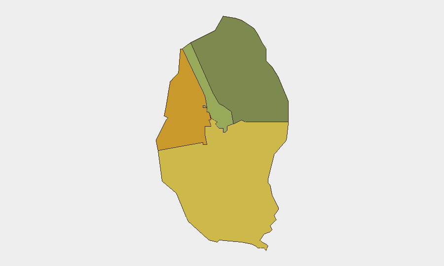
The Northern Governorate (risk 72) and Southern Governorate (risk 68) remain the primary drivers of Bahrain's overall threat profile, reflecting sustained militant activity, cross-border tensions, and proximity to disputed maritime zones. The Capital Governorate (risk 45), which includes Manama and the U.S. Fifth Fleet area, has moved into the threat spotlight following the 9 July strikes; civilian infrastructure damage and regional escalation now intersect with diplomatic and military concentration in this zone. Muharraq Governorate (risk 38) represents lower but non-negligible exposure. The spatial clustering of risk in the north and south reflects longer-standing sectarian and Iran-linked activism; the Capital's elevated status on 10 July reflects acute incident impact and ongoing regional military posturing.
How GeoBit Would Assist
Security teams should deploy AOI Monitoring & Early Warning on high-risk governorates and critical sites (ports, airports, government districts) to detect precursor activity and emerging threats. Conflict & Military tracking (force posture, weapons systems, base activity) combined with Maritime & Aviation tracking will provide real-time visibility into U.S. and regional military movements and shipping patterns in the Strait. Intelligence & OSINT fusion (social media sentiment, entity networks, multi-language media) and Routing & Network Analysis will enable duty-of-care teams to assess travel safety and identify alternative routes or operational centers outside high-risk zones.
7-Day Outlook
Regional de-escalation signals remain absent; Iranian and U.S. rhetoric is expected to harden over the near term, sustaining elevated alert status across Bahrain's military and civilian infrastructure. Expect continued diplomatic activity and possible secondary incidents or rhetoric escalation within 7 days. Personnel and asset security teams should maintain heightened posture in the Capital and Northern Governorates and prepare contingency protocols for staff movement and facility hardening.
Highest-Risk Areas — Ranked
| # | State / Region | Risk |
|---|---|---|
| 1 | Northern Governorate | 72 |
| 2 | Southern Governorate | 68 |
| 3 | Capital Governorate | 45 |
| 4 | Muharraq Governorate | 38 |
Sources
Previous Daily Briefs
A new Bahrain brief is written every day — each with its own risk map and downloadable CSV. Here's the last week; use the calendar to go further back.
📅 Browse every day by calendar →
Highlighted days have a brief. Tap a day for that day's map & analysis, or “csv” for that day's dataset ($5).
Atlas — our AI intelligence desk — emails them this snapshot personally. Nothing else, no list.